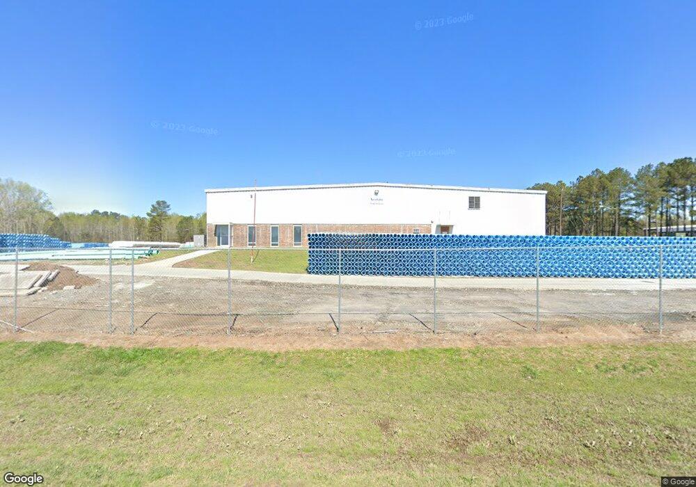
1390 Airport Rd Greensboro, GA 30642
Estimated Value: $1,005,613
--
Bed
--
Bath
42,000
Sq Ft
$24/Sq Ft
Est. Value
About This Home
This home is located at 1390 Airport Rd, Greensboro, GA 30642 and is currently estimated at $1,005,613, approximately $23 per square foot. 1390 Airport Rd is a home located in Greene County with nearby schools including Greene County High School.
Ownership History
Date
Name
Owned For
Owner Type
Purchase Details
Closed on
Sep 14, 2016
Sold by
165 Group Llc
Bought by
North American Pipe Corp
Current Estimated Value
Purchase Details
Closed on
Jul 31, 2007
Sold by
Sarah Cant Sing Llc
Bought by
165 Grp Llc
Purchase Details
Closed on
Jul 25, 2003
Sold by
Sarah Can'T Sing Llc
Bought by
Sarah Can'T Sing-Re Recording
Purchase Details
Closed on
Jul 16, 2003
Sold by
Spartech Plastics Inc
Bought by
Sarah Can'T Sing Llc
Purchase Details
Closed on
Sep 2, 1997
Sold by
Preferred Technical Group Inc
Bought by
Spartech Plastics Inc
Purchase Details
Closed on
Sep 30, 1992
Sold by
United Technologies Automotive
Bought by
Preferred Technical Group Inc
Purchase Details
Closed on
Sep 28, 1992
Bought by
United Technologies Automotive
Create a Home Valuation Report for This Property
The Home Valuation Report is an in-depth analysis detailing your home's value as well as a comparison with similar homes in the area
Home Values in the Area
Average Home Value in this Area
Purchase History
| Date | Buyer | Sale Price | Title Company |
|---|---|---|---|
| North American Pipe Corp | $468,000 | -- | |
| 165 Grp Llc | $745,000 | -- | |
| Sarah Can'T Sing-Re Recording | -- | -- | |
| Sarah Can'T Sing Llc | $250,000 | -- | |
| Spartech Plastics Inc | $1,700,000 | -- | |
| Preferred Technical Group Inc | $329,400 | -- | |
| United Technologies Automotive | -- | -- |
Source: Public Records
Tax History Compared to Growth
Tax History
| Year | Tax Paid | Tax Assessment Tax Assessment Total Assessment is a certain percentage of the fair market value that is determined by local assessors to be the total taxable value of land and additions on the property. | Land | Improvement |
|---|---|---|---|---|
| 2024 | $3,226 | $210,920 | $26,080 | $184,840 |
| 2023 | $3,330 | $217,760 | $26,080 | $191,680 |
| 2022 | $3,299 | $190,600 | $26,080 | $164,520 |
| 2021 | $3,543 | $190,600 | $26,080 | $164,520 |
| 2020 | $3,493 | $169,960 | $22,080 | $147,880 |
| 2019 | $3,603 | $169,960 | $22,080 | $147,880 |
| 2018 | $3,610 | $169,960 | $22,080 | $147,880 |
| 2016 | $3,546 | $178,943 | $22,100 | $156,843 |
| 2015 | $3,531 | $178,942 | $22,100 | $156,843 |
| 2014 | $3,827 | $188,927 | $22,100 | $166,827 |
Source: Public Records
Map
Nearby Homes
- 0 Union Point Hwy Unit 69532
- 0 Union Point Hwy Unit 7607786
- 0 Union Point Hwy Unit 10555176
- 0 Cunningham Rd
- 2260 Cunningham Rd
- 1141 Planing Mill Rd
- 1131 Planing Mill Rd
- 0 Shady Side Ln
- LOT 1 Penfield
- 1641 Bowden Pond Rd
- 1531 E Broad St
- 0 Railroad St Unit 218854
- 0 Railroad St Unit 10578007
- 0 Railroad St Unit 531919
- 0 Old Union Point Rd Unit 1 10557753
- 1020 Horton Dr
- 1251 Brickhouse Rd
- 1251 Brick House Rd
- 3021 Penfield Rd
- 1060 Twin Pines Cir
- Tract 2 Airport Rd
- 11 Airport Rd
- 1498 Airport Rd
- 1050 Price Ln
- 2340 Union Point Hwy
- 1850 Old Union Point Rd
- 1550 Airport Rd
- 1560 Airport Rd
- 2450 Union Point Hwy
- 1071 Ball Field Rd
- 1570 Airport Rd
- 2350 Union Point Hwy
- 1580 Airport Rd
- 2330 Union Point Hwy
- 1590 Airport Rd
- 2351 Union Point Hwy
- 1600 Old Union Point Rd
- 1630 Airport Rd
- 2331 Union Point Hwy
- 0 Airport Rd Unit 8260315