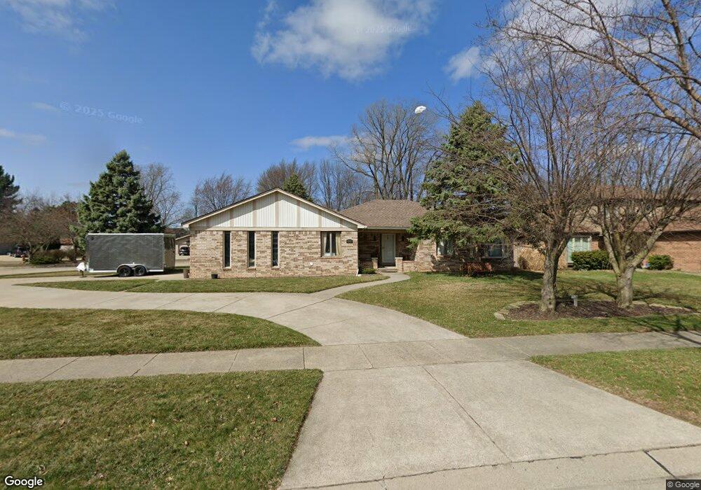
13907 Amanda Dr Sterling Heights, MI 48313
Estimated Value: $350,973 - $387,000
--
Bed
--
Bath
1,593
Sq Ft
$230/Sq Ft
Est. Value
About This Home
This home is located at 13907 Amanda Dr, Sterling Heights, MI 48313 and is currently estimated at $366,743, approximately $230 per square foot. 13907 Amanda Dr is a home located in Macomb County with nearby schools including Graebner Elementary School, Bemis Junior High School, and Henry Ford II High School.
Ownership History
Date
Name
Owned For
Owner Type
Purchase Details
Closed on
Oct 29, 2020
Sold by
Sinishtaj Anton and Sinishtaj Kristina
Bought by
Greco Nino A Del
Current Estimated Value
Home Financials for this Owner
Home Financials are based on the most recent Mortgage that was taken out on this home.
Original Mortgage
$212,000
Outstanding Balance
$188,988
Interest Rate
2.9%
Mortgage Type
New Conventional
Estimated Equity
$177,755
Purchase Details
Closed on
Jul 23, 2019
Sold by
Lulgjuraj P Jeter P and Lulgjuraj Lula
Bought by
Sinishtaj Anton and Sinishtaj Kristina
Purchase Details
Closed on
Oct 13, 2006
Sold by
Bullis Donald L and Bullis Sandra A
Bought by
Lulgjuraj Pjeter
Home Financials for this Owner
Home Financials are based on the most recent Mortgage that was taken out on this home.
Original Mortgage
$168,000
Interest Rate
6.5%
Mortgage Type
New Conventional
Create a Home Valuation Report for This Property
The Home Valuation Report is an in-depth analysis detailing your home's value as well as a comparison with similar homes in the area
Home Values in the Area
Average Home Value in this Area
Purchase History
| Date | Buyer | Sale Price | Title Company |
|---|---|---|---|
| Greco Nino A Del | $265,000 | Core Title Llc | |
| Sinishtaj Anton | -- | None Available | |
| Lulgjuraj Pjeter | $210,000 | Great Lakes Title Of Mi |
Source: Public Records
Mortgage History
| Date | Status | Borrower | Loan Amount |
|---|---|---|---|
| Open | Greco Nino A Del | $212,000 | |
| Previous Owner | Lulgjuraj Pjeter | $168,000 |
Source: Public Records
Tax History Compared to Growth
Tax History
| Year | Tax Paid | Tax Assessment Tax Assessment Total Assessment is a certain percentage of the fair market value that is determined by local assessors to be the total taxable value of land and additions on the property. | Land | Improvement |
|---|---|---|---|---|
| 2025 | $5,299 | $168,600 | $0 | $0 |
| 2024 | $4,734 | $159,500 | $0 | $0 |
| 2023 | $4,394 | $145,300 | $0 | $0 |
| 2022 | $4,616 | $130,000 | $0 | $0 |
| 2021 | $4,486 | $116,300 | $0 | $0 |
| 2020 | $3,581 | $110,300 | $0 | $0 |
| 2019 | $2,847 | $109,400 | $0 | $0 |
| 2018 | $2,980 | $102,600 | $0 | $0 |
| 2017 | $2,847 | $96,900 | $18,300 | $78,600 |
| 2016 | $2,751 | $96,900 | $0 | $0 |
| 2015 | -- | $88,100 | $0 | $0 |
| 2014 | -- | $75,800 | $0 | $0 |
Source: Public Records
Map
Nearby Homes
- 13980 Amanda Dr
- 14289 Hope Dr
- 13374 Wessel Ct
- 13431 Melanie Dr
- 14160 Alpena Dr
- 14239 Alpena Dr
- 13689 Ridgepoint Dr
- 14554 Alma Dr
- 42917 Freeport Dr
- 41222 Paign Dr
- 42640 Park Cresent Dr
- 42633 Park Cresent Dr Unit 35
- 13299 Jennilynn Ln
- 43216 Pendleton Cir Unit 63
- 42708 Wilmington Dr
- 14548 Holborn Dr Unit 24
- 14941 Loyola Dr
- 43103 Strand Dr Unit 34
- 40779 Cascade Dr
- 42811 Wilmington Dr
- 13919 Amanda Dr
- 13871 Gale Ct
- 13931 Amanda Dr
- 41741 Balfour Dr
- 13755 Amanda Dr
- 41742 Balfour Dr
- 13859 Gale Ct
- 13943 Amanda Dr
- 13847 Gale Ct
- 41729 Balfour Dr
- 13766 Amanda Dr
- 13811 Gale Ct
- 13743 Amanda Dr
- 41730 Balfour Dr
- 13754 Amanda Dr
- 41979 Duxbury Dr
- 13835 Gale Ct
- 13823 Gale Ct
- 41717 Balfour Dr
- 13944 Amanda Dr