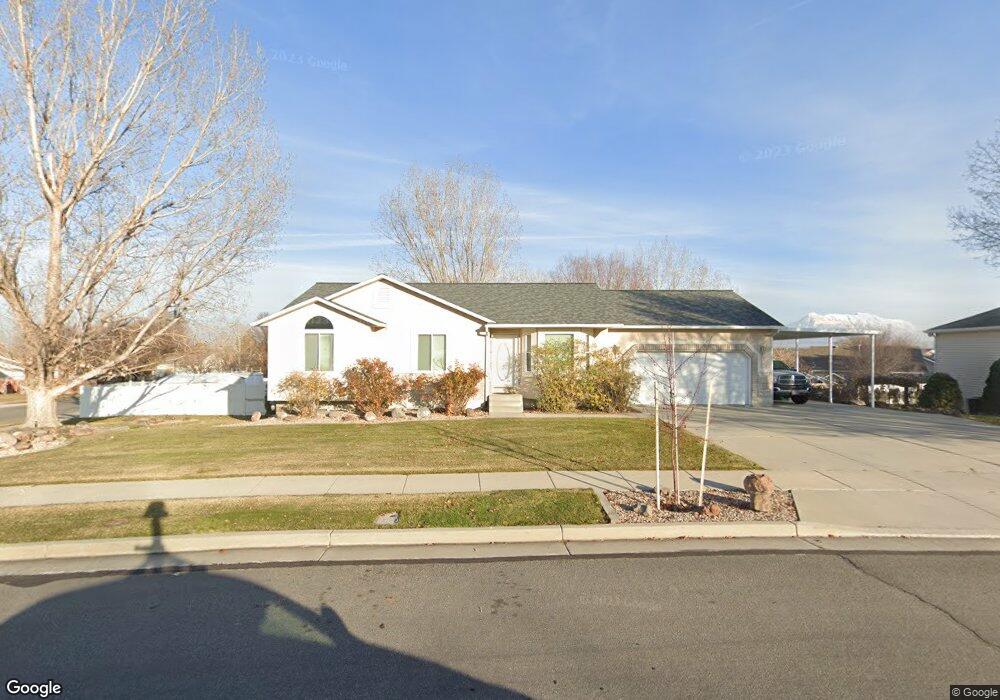
13907 Kessler Peak Cir Riverton, UT 84096
Estimated Value: $596,000 - $630,106
3
Beds
2
Baths
1,421
Sq Ft
$427/Sq Ft
Est. Value
About This Home
This home is located at 13907 Kessler Peak Cir, Riverton, UT 84096 and is currently estimated at $606,277, approximately $426 per square foot. 13907 Kessler Peak Cir is a home located in Salt Lake County with nearby schools including Foothills School, South Hills Middle School, and Mountain Ridge High School.
Ownership History
Date
Name
Owned For
Owner Type
Purchase Details
Closed on
Nov 25, 1997
Sold by
Ross Bill
Bought by
Johnson Robert Scott and Johnson Sandra A
Current Estimated Value
Home Financials for this Owner
Home Financials are based on the most recent Mortgage that was taken out on this home.
Original Mortgage
$44,750
Interest Rate
7.33%
Purchase Details
Closed on
May 2, 1997
Sold by
Ross William I and Ross Sherrie J
Bought by
Ross Bill
Home Financials for this Owner
Home Financials are based on the most recent Mortgage that was taken out on this home.
Original Mortgage
$88,334
Interest Rate
7.96%
Mortgage Type
Construction
Purchase Details
Closed on
Apr 9, 1997
Sold by
Development Associates Inc
Bought by
Ross William I and Ross Sherrie J
Home Financials for this Owner
Home Financials are based on the most recent Mortgage that was taken out on this home.
Original Mortgage
$88,334
Interest Rate
7.96%
Mortgage Type
Construction
Create a Home Valuation Report for This Property
The Home Valuation Report is an in-depth analysis detailing your home's value as well as a comparison with similar homes in the area
Home Values in the Area
Average Home Value in this Area
Purchase History
| Date | Buyer | Sale Price | Title Company |
|---|---|---|---|
| Johnson Robert Scott | -- | -- | |
| Ross Bill | -- | -- | |
| Ross William I | -- | -- |
Source: Public Records
Mortgage History
| Date | Status | Borrower | Loan Amount |
|---|---|---|---|
| Closed | Johnson Robert Scott | $44,750 | |
| Previous Owner | Ross Bill | $88,334 |
Source: Public Records
Tax History Compared to Growth
Tax History
| Year | Tax Paid | Tax Assessment Tax Assessment Total Assessment is a certain percentage of the fair market value that is determined by local assessors to be the total taxable value of land and additions on the property. | Land | Improvement |
|---|---|---|---|---|
| 2025 | -- | $598,100 | $267,600 | $330,500 |
| 2024 | -- | $547,700 | $245,800 | $301,900 |
| 2023 | -- | $548,700 | $227,600 | $321,100 |
| 2022 | $0 | $553,800 | $223,100 | $330,700 |
| 2021 | $96 | $409,900 | $172,100 | $237,800 |
| 2020 | $2,778 | $369,100 | $133,900 | $235,200 |
| 2019 | $82 | $337,300 | $127,500 | $209,800 |
| 2018 | $0 | $315,300 | $117,800 | $197,500 |
| 2017 | $107 | $292,300 | $117,800 | $174,500 |
| 2016 | $33 | $267,300 | $117,800 | $149,500 |
| 2015 | $2,193 | $255,700 | $117,900 | $137,800 |
| 2014 | -- | $241,300 | $112,400 | $128,900 |
Source: Public Records
Map
Nearby Homes
- 13863 S Kessler Peak Dr
- 5036 W Cedar Point Peak Dr
- 5030 Little Water Peak Dr
- 14049 S van Cott Peak Cir
- 4722 W Cillian Ln Unit 2411
- 14048 van Cott Peak Cir
- 4714 W Cillian Ln Unit 2410
- 4698 W Cillian Ln Unit 2409
- 4688 W Cillian Ln Unit 2408
- 13878 S Shaggy Peak Dr
- 14054 Elk Horn Peak Dr
- 4682 W Cillian Ln Unit 2407
- 4676 W Cillian Ln Unit 2406
- 4662 W Cillian Ln Unit 2405
- 14121 Elk Horn Peak Dr
- 4638 W Cillian Ln Unit 2403
- 13908 S 5180 W
- 4629 W Hiddleston Dr Unit 2111
- 4569 W Ruple Ridge Ln
- 13597 S Firetip Ct
- 13907 S Kessler Peak Cir
- 13923 Kessler Peak Cir
- 4891 Kessler Peak Dr
- 4891 W Kessler Peak Dr
- 4880 Lookout Peak Cir
- 4872 Lookout Peak Cir
- 4916 W Kessler Peak Dr
- 4916 Kessler Peak Dr
- 13920 Kessler Peak Cir
- 4872 W Lookout Peak Cir
- 4900 W Kessler Peak Dr
- 4900 Kessler Peak Dr
- 4924 Kessler Peak Dr
- 4924 W Kessler Peak Dr
- 13937 S Kessler Peak Cir
- 13937 Kessler Peak Cir
- 13885 S Kessler Peak Dr
- 13885 Kessler Peak Dr
- 14063 Grand View Peak Cir
- 4879 Lookout Peak Cir