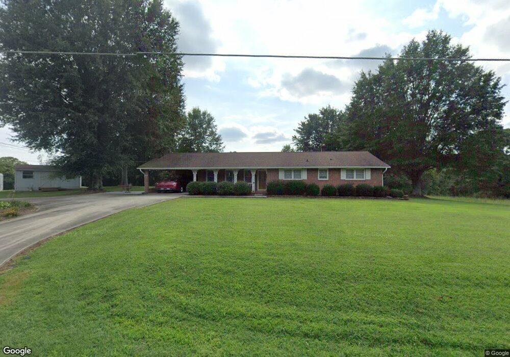
1391 Saw Mill Rd Conover, NC 28613
Estimated Value: $250,000 - $376,241
4
Beds
2
Baths
1,952
Sq Ft
$163/Sq Ft
Est. Value
About This Home
This home is located at 1391 Saw Mill Rd, Conover, NC 28613 and is currently estimated at $318,810, approximately $163 per square foot. 1391 Saw Mill Rd is a home located in Catawba County with nearby schools including Lyle Creek Elementary School, River Bend Middle School, and Bunker Hill High School.
Ownership History
Date
Name
Owned For
Owner Type
Purchase Details
Closed on
Jul 11, 2014
Current Estimated Value
Purchase Details
Closed on
Jun 25, 2014
Sold by
Dellinger Dennis and Dellinger Sherel Annette
Bought by
Beck Annissa
Purchase Details
Closed on
Jan 27, 2005
Sold by
Dellinger Paul J and Dellinger Shirley H
Bought by
Earls Pandora and Dellinger Dennis
Purchase Details
Closed on
Mar 14, 1990
Purchase Details
Closed on
Oct 21, 1966
Bought by
Dellinger Paul Junior and Dellinger Shirle
Create a Home Valuation Report for This Property
The Home Valuation Report is an in-depth analysis detailing your home's value as well as a comparison with similar homes in the area
Home Values in the Area
Average Home Value in this Area
Purchase History
| Date | Buyer | Sale Price | Title Company |
|---|---|---|---|
| -- | $25,000 | -- | |
| Beck Annissa | -- | None Available | |
| Earls Pandora | -- | None Available | |
| -- | -- | -- | |
| Dellinger Paul Junior | -- | -- |
Source: Public Records
Tax History Compared to Growth
Tax History
| Year | Tax Paid | Tax Assessment Tax Assessment Total Assessment is a certain percentage of the fair market value that is determined by local assessors to be the total taxable value of land and additions on the property. | Land | Improvement |
|---|---|---|---|---|
| 2025 | $1,355 | $304,400 | $39,700 | $264,700 |
| 2024 | $1,355 | $304,400 | $39,700 | $264,700 |
| 2023 | $1,303 | $184,700 | $39,700 | $145,000 |
| 2022 | $971 | $184,700 | $39,700 | $145,000 |
| 2021 | $971 | $184,700 | $39,700 | $145,000 |
| 2020 | $971 | $184,700 | $39,700 | $145,000 |
| 2019 | $971 | $139,700 | $0 | $0 |
| 2018 | $769 | $155,700 | $39,400 | $116,300 |
| 2017 | $769 | $0 | $0 | $0 |
| 2016 | $769 | $0 | $0 | $0 |
| 2015 | $863 | $155,720 | $39,400 | $116,320 |
| 2014 | $863 | $188,800 | $42,500 | $146,300 |
Source: Public Records
Map
Nearby Homes
- 5826 St Peters Church Rd
- 5101 Mill Pond Dr
- 28.8 Acres +/- Carver House Rd
- 25 Acres+/- Carver House Rd
- 1371 Millrace Dr
- 4932 Sandstone Dr
- 5079 Archdale Dr
- 4874 Stone Dr Unit 125
- 5413 Dusty Rd
- 5605 Creek Point Dr
- 5309 Hall St
- 4793 Panama Dr
- 4965 Elmhurst Dr NE
- 6256 Monford Dr
- 4921 Elmhurst Dr NE
- 6301 Lynchburg Rd
- 6289 Lynchburg Rd
- 2270 Houston Mill Rd
- 6311 St Peters Church Rd
- 4645 Rifle Range Rd
- 1422 Saw Mill Rd
- 1371 Saw Mill Rd
- 1308 Saw Mill Rd
- 5387 Coons Dr
- 1363 Saw Mill Rd
- 1443 Saw Mill Rd
- 1355 Saw Mill Rd
- 5398 Coons Dr
- 5380 Coons Dr
- 1458 Saw Mill Rd
- 1345 Saw Mill Rd
- 5587 Lee Cline Rd
- 1333 Saw Mill Rd
- 5535 Lee Cline Rd
- 5360 Coons Dr
- 1284 Saw Mill Rd
- 5467 Lee Cline Rd
- 1477 Saw Mill Rd
- 1484 Saw Mill Rd
- 5350 Coons Dr