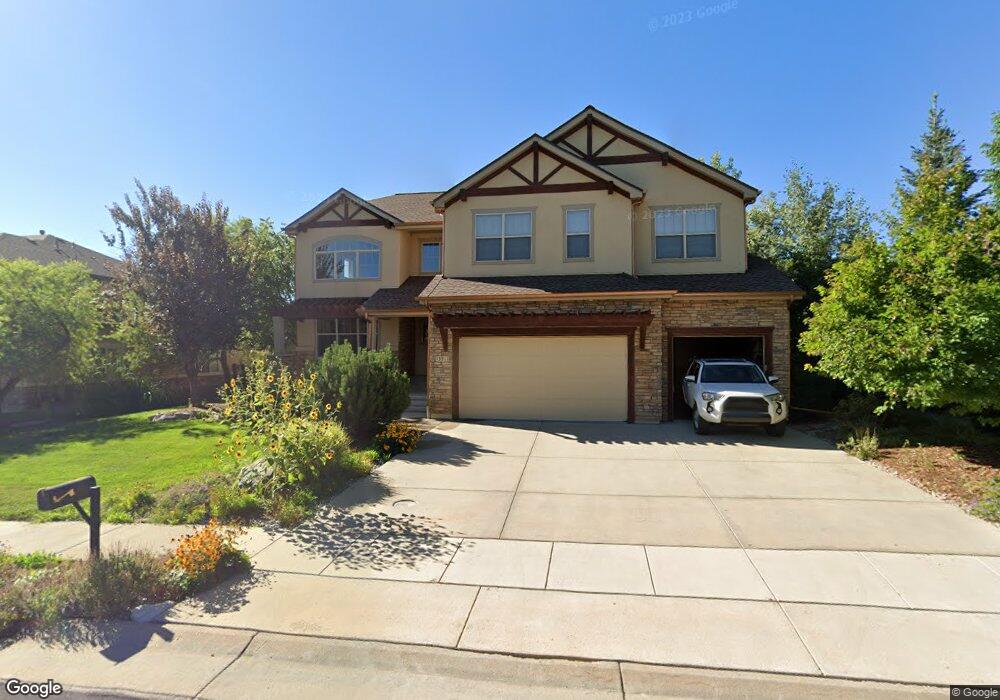
13911 Gunnison Way Broomfield, CO 80020
Country Estates NeighborhoodEstimated Value: $1,125,004 - $1,374,000
5
Beds
4
Baths
3,452
Sq Ft
$366/Sq Ft
Est. Value
About This Home
This home is located at 13911 Gunnison Way, Broomfield, CO 80020 and is currently estimated at $1,263,251, approximately $365 per square foot. 13911 Gunnison Way is a home located in Broomfield County with nearby schools including Aspen Creek K-8 School, Broomfield High School, and Nativity: Faith and Reason.
Ownership History
Date
Name
Owned For
Owner Type
Purchase Details
Closed on
Feb 15, 2010
Sold by
Gallery Homes Inc
Bought by
Winston Scott W and Winston Leslie A
Current Estimated Value
Home Financials for this Owner
Home Financials are based on the most recent Mortgage that was taken out on this home.
Original Mortgage
$417,000
Outstanding Balance
$277,086
Interest Rate
5.11%
Mortgage Type
New Conventional
Estimated Equity
$986,165
Purchase Details
Closed on
Jun 3, 1998
Create a Home Valuation Report for This Property
The Home Valuation Report is an in-depth analysis detailing your home's value as well as a comparison with similar homes in the area
Home Values in the Area
Average Home Value in this Area
Purchase History
| Date | Buyer | Sale Price | Title Company |
|---|---|---|---|
| Winston Scott W | $612,000 | Land Title Guarantee Company | |
| -- | -- | -- |
Source: Public Records
Mortgage History
| Date | Status | Borrower | Loan Amount |
|---|---|---|---|
| Open | Winston Scott W | $417,000 |
Source: Public Records
Tax History Compared to Growth
Tax History
| Year | Tax Paid | Tax Assessment Tax Assessment Total Assessment is a certain percentage of the fair market value that is determined by local assessors to be the total taxable value of land and additions on the property. | Land | Improvement |
|---|---|---|---|---|
| 2025 | $5,305 | $74,260 | $20,270 | $53,990 |
| 2024 | $5,305 | $63,310 | $19,150 | $44,160 |
| 2023 | $5,294 | $77,550 | $21,020 | $56,530 |
| 2022 | $4,741 | $55,990 | $15,290 | $40,700 |
| 2021 | $5,385 | $57,600 | $15,730 | $41,870 |
| 2020 | $5,158 | $54,830 | $14,160 | $40,670 |
| 2019 | $5,149 | $55,210 | $14,260 | $40,950 |
| 2018 | $4,699 | $49,780 | $12,100 | $37,680 |
| 2017 | $4,627 | $55,030 | $13,370 | $41,660 |
| 2016 | $4,897 | $51,930 | $13,790 | $38,140 |
| 2015 | $4,728 | $50,620 | $13,790 | $36,830 |
| 2014 | $4,711 | $50,620 | $13,790 | $36,830 |
Source: Public Records
Map
Nearby Homes
- 583 Redstone Dr
- 13924 Quail Ridge Dr
- 13971 Telluride Dr
- 1747 Whistlepig Ln
- 1757 Whistlepig Ln
- 14111 Blue Stem St
- 14115 Blue Stem St
- 13980 Willow Wood Dr
- 5704 W 141st Place
- 1732 Peregrine Ln
- Torrey Plan at Dillon Pointe
- Evans Plan at Dillon Pointe
- Antero Plan at Dillon Pointe
- 146 Keystone Trail
- 147 Keystone Trail
- 1490 Saint Andrews Dr
- 14223 Currant St
- Varra Plan at Dillon Pointe - Dillon Pointe - Journey
- Mckay Plan at Dillon Pointe - Dillon Pointe - Journey
- Quail Plan at Dillon Pointe - Dillon Pointe - Journey
- 13901 Gunnison Way
- 13950 Craig Way
- 13900 Gunnison Way
- 13921 Gunnison Way
- 13960 Craig Way
- 13922 Gunnison Way
- 13890 Gunnison Way
- 13931 Gunnison Way
- 13932 Gunnison Way
- 13880 Gunnison Way
- 13961 Craig Way
- 541 Columbine Ave
- 531 Columbine Ave
- 13980 Craig Way
- 13933 Gunnison Way
- 551 Columbine Ave
- 13952 Gunnison Way
- 13971 Craig Way
- 13962 Gunnison Way
- 523 Columbine Ave