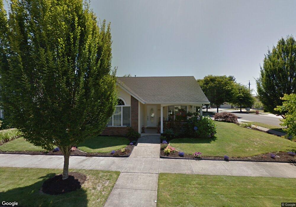
1392 Zinfandel Ln Eugene, OR 97404
Santa Clara NeighborhoodEstimated Value: $436,583 - $481,000
3
Beds
2
Baths
1,378
Sq Ft
$335/Sq Ft
Est. Value
About This Home
This home is located at 1392 Zinfandel Ln, Eugene, OR 97404 and is currently estimated at $461,896, approximately $335 per square foot. 1392 Zinfandel Ln is a home located in Lane County with nearby schools including Irving Elementary School, Willamette High School, and Nature Discovery Christian School.
Ownership History
Date
Name
Owned For
Owner Type
Purchase Details
Closed on
Mar 23, 2020
Sold by
Donaldson David D and Donaldson Linda E
Bought by
Orr Devon and Salo Hannah
Current Estimated Value
Home Financials for this Owner
Home Financials are based on the most recent Mortgage that was taken out on this home.
Original Mortgage
$261,600
Outstanding Balance
$230,737
Interest Rate
3.4%
Mortgage Type
New Conventional
Estimated Equity
$231,159
Purchase Details
Closed on
Jun 29, 2006
Sold by
Sogn Paul D and Sogn Rachelle D
Bought by
Donaldson David D and Donaldson Linda E
Home Financials for this Owner
Home Financials are based on the most recent Mortgage that was taken out on this home.
Original Mortgage
$195,360
Interest Rate
6.57%
Mortgage Type
Unknown
Purchase Details
Closed on
Oct 3, 1997
Sold by
Stingray Development Inc
Bought by
Sogn Douglas A and Sogn Paul D
Create a Home Valuation Report for This Property
The Home Valuation Report is an in-depth analysis detailing your home's value as well as a comparison with similar homes in the area
Home Values in the Area
Average Home Value in this Area
Purchase History
| Date | Buyer | Sale Price | Title Company |
|---|---|---|---|
| Orr Devon | $327,000 | Western Title & Escrow | |
| Donaldson David D | $244,200 | Western Title & Escrow Compa | |
| Sogn Douglas A | $35,400 | Cascade Title Co |
Source: Public Records
Mortgage History
| Date | Status | Borrower | Loan Amount |
|---|---|---|---|
| Open | Orr Devon | $261,600 | |
| Previous Owner | Donaldson David D | $195,360 |
Source: Public Records
Tax History Compared to Growth
Tax History
| Year | Tax Paid | Tax Assessment Tax Assessment Total Assessment is a certain percentage of the fair market value that is determined by local assessors to be the total taxable value of land and additions on the property. | Land | Improvement |
|---|---|---|---|---|
| 2025 | $4,528 | $260,336 | -- | -- |
| 2024 | $4,414 | $252,754 | -- | -- |
| 2023 | $4,414 | $245,393 | $0 | $0 |
| 2022 | $4,109 | $238,246 | $0 | $0 |
| 2021 | $4,022 | $231,307 | $0 | $0 |
| 2020 | $3,905 | $224,570 | $0 | $0 |
| 2019 | $3,713 | $218,030 | $0 | $0 |
| 2018 | $3,609 | $205,515 | $0 | $0 |
| 2017 | $3,449 | $205,515 | $0 | $0 |
| 2016 | $3,362 | $199,529 | $0 | $0 |
| 2015 | $3,295 | $193,717 | $0 | $0 |
| 2014 | $3,245 | $188,075 | $0 | $0 |
Source: Public Records
Map
Nearby Homes
- 3482 Cabernet Ln
- 3534 Korbel St
- 1375 Lorien Ln
- 1371 Tirion Ave
- 3365 Goose Cross Ln
- 30035 Cecil Ave
- 1278 Winery Ln
- 1291 Montecello Dr
- 1133 Irvington Dr
- 3933 Dorchester Ln
- 3855 Lancaster Dr
- 1179 Risden Place
- 3955 Lancaster Dr
- 1061 Argon Ave
- 992 Travis Ave
- 1075 Brotherton Ave
- 4170 Berrywood Dr
- 4053 Sabrena Ave
- 0 Monya Ln
- 3228 Tilden St
- 1380 Zinfandel Ln
- 1419 Napa Valley Ln
- 1409 Napa Valley Ln
- 1372 Zinfandel Ln
- 1389 Zinfandel Ln
- 1407 Zinfandel Ln
- 1492 Napa Valley Ln
- 1470 Napa Valley Ln
- 1405 Napa Valley Ln
- 1375 Zinfandel Ln
- 1415 Zinfandel Ln
- 1462 Napa Valley Ln
- 1364 Zinfandel Ln
- 1397 Napa Valley Ln
- 1448 Napa Valley Ln
- 1367 Zinfandel Ln
- 1425 Zinfandel Ln
- 1422 Napa Valley Ln
- 1408 Napa Valley Ln
- 1430 Napa Valley Ln