Estimated Value: $2,812,000 - $7,674,075
--
Bed
--
Bath
3,263
Sq Ft
$1,616/Sq Ft
Est. Value
About This Home
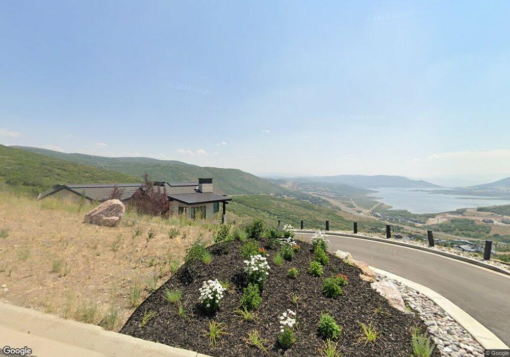
This home is located at 13920 N Deer Canyon Dr, Kamas, UT 84036 and is currently estimated at $5,271,519, approximately $1,615 per square foot. 13920 N Deer Canyon Dr is a home with nearby schools including Midway Elementary School, Rocky Mountain Middle School, and Wasatch High School.
Ownership History
Date
Name
Owned For
Owner Type
Purchase Details
Closed on
Jul 25, 2022
Sold by
Scott Workman David and Cox Ann
Bought by
Workman Family Trust
Current Estimated Value
Purchase Details
Closed on
Mar 22, 2018
Sold by
Deer Vista Llc
Bought by
Workman D Scott and Workman Ann C
Home Financials for this Owner
Home Financials are based on the most recent Mortgage that was taken out on this home.
Original Mortgage
$250,000
Interest Rate
4.38%
Mortgage Type
Purchase Money Mortgage
Create a Home Valuation Report for This Property
The Home Valuation Report is an in-depth analysis detailing your home's value as well as a comparison with similar homes in the area
Home Values in the Area
Average Home Value in this Area
Purchase History
| Date | Buyer | Sale Price | Title Company |
|---|---|---|---|
| Workman Family Trust | -- | Cornetet Meyer Rush And Staple | |
| Workman D Scott | -- | Real Advantage Title Insuran |
Source: Public Records
Mortgage History
| Date | Status | Borrower | Loan Amount |
|---|---|---|---|
| Previous Owner | Workman D Scott | $250,000 |
Source: Public Records
Tax History Compared to Growth
Tax History
| Year | Tax Paid | Tax Assessment Tax Assessment Total Assessment is a certain percentage of the fair market value that is determined by local assessors to be the total taxable value of land and additions on the property. | Land | Improvement |
|---|---|---|---|---|
| 2025 | $22,393 | $4,807,125 | $1,425,000 | $3,382,125 |
| 2024 | $22,393 | $4,799,810 | $1,250,000 | $3,549,810 |
| 2023 | $22,393 | $3,662,739 | $1,000,000 | $2,662,739 |
| 2022 | $28,662 | $3,074,650 | $483,050 | $2,591,600 |
| 2021 | $8,310 | $710,231 | $483,050 | $227,181 |
| 2020 | $5,829 | $483,050 | $483,050 | $0 |
| 2019 | $5,434 | $483,050 | $0 | $0 |
| 2018 | $4,478 | $398,050 | $0 | $0 |
| 2017 | $3,741 | $333,050 | $0 | $0 |
Source: Public Records
Map
Nearby Homes
- 13341 N Deer Canyon Dr
- 13690 N Deer Canyon Dr
- 203 W Peace Tree Trail
- 303 W West Peace Tree Trail
- 303 W Peace Tree Trail
- 909 W Peace Tree Trail Unit 306
- 909 W Peace Tree Trail Unit 311
- 909 W Peace Tree Trail Unit 611
- 909 W Peace Tree Trail Unit 507
- 909 W Peace Tree Trail Unit 513
- 909 W Peace Tree Trail Unit 203
- 1016 W Wasatch Spring Rd Unit X-4
- 13386 N Alexis Dr
- 1018 W Wasatch Spring Rd Unit X-3
- 13404 N Alexis Dr Unit D3
- 1022 W Wasatch Spring Rd Unit X-2
- 1026 W Wasatch Spring Rd Unit X-1
- 13885 N Deer Canyon Dr
- 13858 N Deer Canyon Dr
- 13991 N Deer Canyon Dr
- 357 W Vista Ridge Rd
- 385 W Vista Ridge Rd
- 13835 N Deer Canyon Dr
- 14025 N Deer Canyon Dr Unit 45
- 14025 N Deer Canyon Dr
- 315 W Vista Ridge Rd
- 555 W Vista Ridge Rd
- 13821 N Deer Canyon Dr
- 13795 N Deer Canyon Dr Unit 34
- 13795 N Deer Canyon Dr
- 390 W Vista Ridge Rd
- 470 W Vista Ridge Rd
- 13574 N Deer Canyon Dr
- 13574 N Deer Canyon Dr
- 530 W Vista Ridge Rd
- 745 W Peace Tree Trail
- 13640 N Deer Canyon Dr