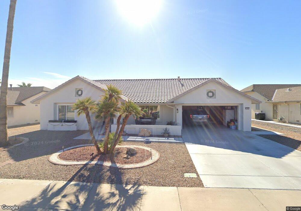
13921 W Sky Hawk Dr Unit 520 Sun City West, AZ 85375
Estimated Value: $398,000 - $421,000
2
Beds
2
Baths
2,144
Sq Ft
$192/Sq Ft
Est. Value
About This Home
This home is located at 13921 W Sky Hawk Dr Unit 520, Sun City West, AZ 85375 and is currently estimated at $412,522, approximately $192 per square foot. 13921 W Sky Hawk Dr Unit 520 is a home located in Maricopa County with nearby schools including FourteenSix Christian Academy.
Ownership History
Date
Name
Owned For
Owner Type
Purchase Details
Closed on
Jan 26, 2022
Sold by
Clear Recon Corporation
Bought by
Breckenridge Property Fund 201
Current Estimated Value
Purchase Details
Closed on
Sep 10, 2004
Sold by
Michaels Robert L and Michaels Darlene S
Bought by
Benanti James J
Purchase Details
Closed on
May 8, 2003
Sold by
Rabon Charles R and Rabon Mark
Bought by
Michaels Robert L and Michaels Darlene S
Home Financials for this Owner
Home Financials are based on the most recent Mortgage that was taken out on this home.
Original Mortgage
$137,600
Interest Rate
4.25%
Create a Home Valuation Report for This Property
The Home Valuation Report is an in-depth analysis detailing your home's value as well as a comparison with similar homes in the area
Home Values in the Area
Average Home Value in this Area
Purchase History
| Date | Buyer | Sale Price | Title Company |
|---|---|---|---|
| Breckenridge Property Fund 201 | $334,500 | None Listed On Document | |
| Benanti James J | $186,000 | First American Title Ins Co | |
| Michaels Robert L | $172,000 | First American Title Ins Co | |
| Breckenridge Property Fund 2016 Llc | $334,500 | None Listed On Document |
Source: Public Records
Mortgage History
| Date | Status | Borrower | Loan Amount |
|---|---|---|---|
| Previous Owner | Michaels Robert L | $137,600 |
Source: Public Records
Tax History Compared to Growth
Tax History
| Year | Tax Paid | Tax Assessment Tax Assessment Total Assessment is a certain percentage of the fair market value that is determined by local assessors to be the total taxable value of land and additions on the property. | Land | Improvement |
|---|---|---|---|---|
| 2025 | $1,262 | $20,729 | -- | -- |
| 2024 | $1,515 | $19,742 | -- | -- |
| 2023 | $1,515 | $28,380 | $5,670 | $22,710 |
| 2022 | $1,426 | $23,080 | $4,610 | $18,470 |
| 2021 | $1,610 | $21,030 | $4,200 | $16,830 |
| 2020 | $1,294 | $19,630 | $3,920 | $15,710 |
| 2019 | $1,268 | $17,350 | $3,470 | $13,880 |
| 2018 | $1,220 | $16,350 | $3,270 | $13,080 |
| 2017 | $1,174 | $15,480 | $3,090 | $12,390 |
| 2016 | $1,124 | $14,550 | $2,910 | $11,640 |
| 2015 | $1,079 | $13,170 | $2,630 | $10,540 |
Source: Public Records
Map
Nearby Homes
- 14105 W Sky Hawk Dr Unit 40
- 13718 W Gable Hill Dr
- 14111 W Circle Ridge Dr
- 14102 W Whitewood Dr
- 13709 W Whitewood Dr
- 13711 W Gable Hill Dr
- 14123 W Circle Ridge Dr Unit 40
- 13725 W Springdale Dr
- 13919 W Gable Hill Dr
- 14010 W Pavillion Dr
- 14140 W Circle Ridge Dr
- 21627 N 139th Dr
- 21433 N 142nd Dr
- 14307 W Whitewood Dr
- 14121 W Casa Linda Dr
- 13547 W Sky Hawk Dr
- 20854 N Gable Hill Dr
- 20826 N Desert Glen Dr
- 13819 W Elmbrook Dr
- 14133 W Vía Montoya
- 13921 W Sky Hawk Dr
- 13915 W Sky Hawk Dr
- 13927 W Sky Hawk Dr
- 13912 W Stardust Blvd
- 13912 W Stardust Blvd Unit 105
- 13912 W Stardust Blvd Unit 100
- 13912 W Stardust Blvd Unit 103
- 13912 W Stardust Blvd Unit 111
- 13912 W Stardust Blvd Unit 112
- 13909 W Sky Hawk Dr Unit 39
- 13918 W Sky Hawk Dr Unit 39
- 13926 W Sky Hawk Dr
- 13914 W Sky Hawk Dr
- 13907 W Sky Hawk Dr
- 13910 W Sky Hawk Dr
- 14007 W Circle Ridge Dr
- 14003 W Circle Ridge Dr Unit 40
- 14011 W Circle Ridge Dr
- 14015 W Circle Ridge Dr
- 14004 W Sky Hawk Dr Unit 40