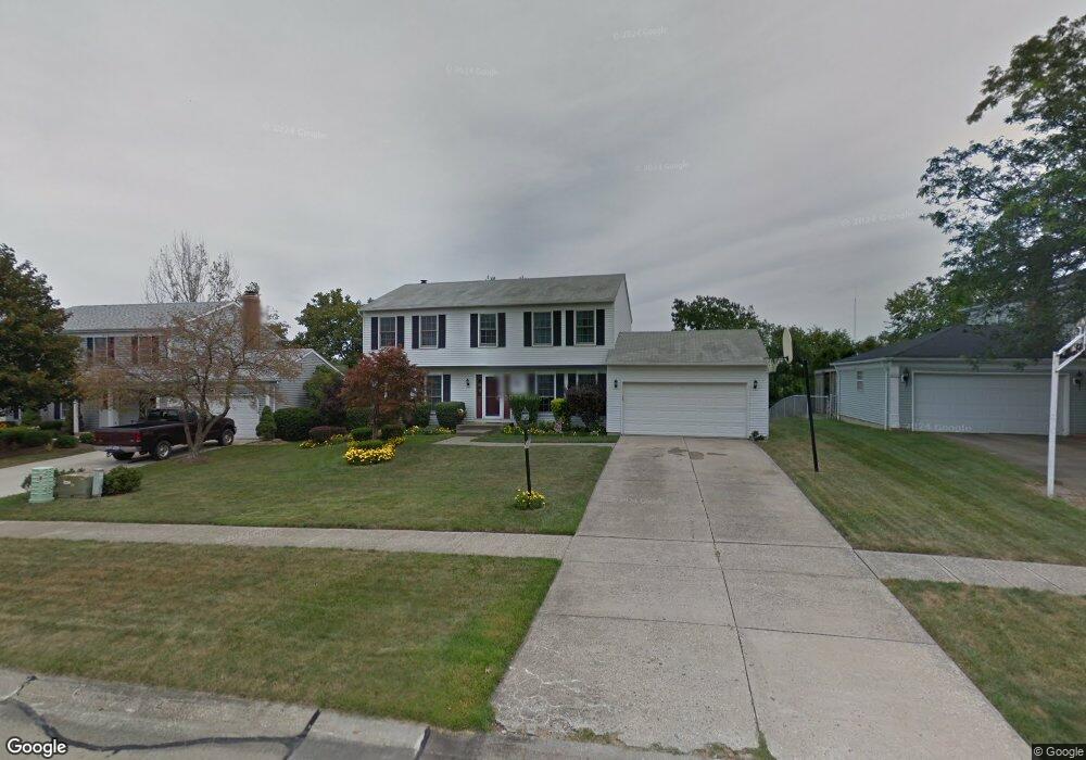
13930 Walking Stick Way Strongsville, OH 44136
Estimated Value: $374,990 - $400,000
4
Beds
3
Baths
2,208
Sq Ft
$178/Sq Ft
Est. Value
About This Home
This home is located at 13930 Walking Stick Way, Strongsville, OH 44136 and is currently estimated at $392,248, approximately $177 per square foot. 13930 Walking Stick Way is a home located in Cuyahoga County with nearby schools including Strongsville High School, Royal Redeemer Lutheran School, and Sts Joseph & John Interparochial School.
Ownership History
Date
Name
Owned For
Owner Type
Purchase Details
Closed on
Jul 27, 1993
Sold by
Nefzer Richard W
Bought by
Buehner David A
Current Estimated Value
Purchase Details
Closed on
Feb 24, 1988
Sold by
Walz James M and Walz Cathleen S
Bought by
Nefzer Richard W
Purchase Details
Closed on
Dec 16, 1981
Bought by
Walz James M and Walz Cathleen S
Purchase Details
Closed on
Jun 22, 1981
Bought by
Shave Maurice F
Purchase Details
Closed on
Jan 1, 1979
Bought by
North East Land Co
Create a Home Valuation Report for This Property
The Home Valuation Report is an in-depth analysis detailing your home's value as well as a comparison with similar homes in the area
Home Values in the Area
Average Home Value in this Area
Purchase History
| Date | Buyer | Sale Price | Title Company |
|---|---|---|---|
| Buehner David A | $152,000 | -- | |
| Nefzer Richard W | $125,600 | -- | |
| Walz James M | $102,900 | -- | |
| Hunting Valley Bldrs Inc | -- | -- | |
| Shave Maurice F | $24,000 | -- | |
| North East Land Co | -- | -- |
Source: Public Records
Tax History Compared to Growth
Tax History
| Year | Tax Paid | Tax Assessment Tax Assessment Total Assessment is a certain percentage of the fair market value that is determined by local assessors to be the total taxable value of land and additions on the property. | Land | Improvement |
|---|---|---|---|---|
| 2024 | $4,973 | $105,910 | $20,685 | $85,225 |
| 2023 | $5,374 | $85,820 | $20,370 | $65,450 |
| 2022 | $5,335 | $85,820 | $20,370 | $65,450 |
| 2021 | $5,293 | $85,820 | $20,370 | $65,450 |
| 2020 | $4,905 | $70,350 | $16,700 | $53,660 |
| 2019 | $4,761 | $201,000 | $47,700 | $153,300 |
| 2018 | $4,321 | $70,350 | $16,700 | $53,660 |
| 2017 | $4,349 | $65,560 | $13,370 | $52,190 |
| 2016 | $4,314 | $65,560 | $13,370 | $52,190 |
| 2015 | $4,375 | $65,560 | $13,370 | $52,190 |
| 2014 | $4,375 | $65,560 | $13,370 | $52,190 |
Source: Public Records
Map
Nearby Homes
- 14132 Walking Stick Way
- 13448 Compass Point Dr
- 14558 Drake Rd
- 13335 Tradewinds Dr
- 19252 Hidden Woods Ln
- 18987 Laurell Cir
- 19297 Hunt Rd
- 14292 Trenton Ave
- 14985 Camden Cir
- 19813 Cross Trail S
- 18229 Howe Rd
- 17130 Golden Star Dr
- 15188 Trails Landing
- 19694 Benbow Rd
- 19740 Benbow Rd
- 3137 Blackburn Ln
- 106 Briarleigh Dr
- 15604-REAR Boston Rd
- 18680 Bennett Rd
- 15772 Boston Rd
- 13916 Walking Stick Way
- 13944 Walking Stick Way
- 13902 Walking Stick Way
- 13958 Walking Stick Way
- 13929 Walking Stick Way
- 13915 Walking Stick Way
- 13943 Walking Stick Way
- 13888 Walking Stick Way
- 13972 Walking Stick Way
- 13904 E Bend Dr
- S/L 19 Walking Stick Way
- 13874 Walking Stick Way
- 13986 Walking Stick Way
- 13942 E Bend Dr
- 18381 Butternut Cir
- 13985 Walking Stick Way
- 18419 Butternut Cir
- 18343 Butternut Cir
- 13860 Walking Stick Way
- 13980 E Bend Dr