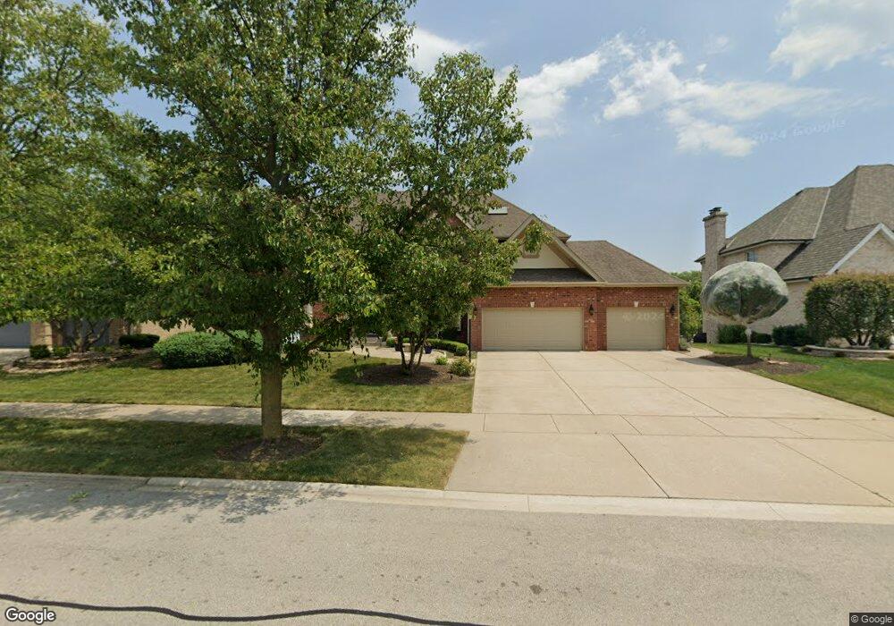
13933 Persimmon Dr Orland Park, IL 60467
Orland Grove NeighborhoodEstimated Value: $789,000 - $1,110,000
4
Beds
5
Baths
4,100
Sq Ft
$226/Sq Ft
Est. Value
About This Home
This home is located at 13933 Persimmon Dr, Orland Park, IL 60467 and is currently estimated at $927,497, approximately $226 per square foot. 13933 Persimmon Dr is a home located in Cook County with nearby schools including Orland Park Elementary School, High Point Elementary School, and Orland Jr High School.
Ownership History
Date
Name
Owned For
Owner Type
Purchase Details
Closed on
Oct 23, 2014
Sold by
Niles Jeffrey V and Niles Kathleen A
Bought by
The Niles Family Revocable Living Trust
Current Estimated Value
Purchase Details
Closed on
Sep 12, 2007
Sold by
Pappas Joanne
Bought by
Niles Jeffrey V and Niles Kathleen A
Home Financials for this Owner
Home Financials are based on the most recent Mortgage that was taken out on this home.
Original Mortgage
$658,000
Outstanding Balance
$417,880
Interest Rate
6.63%
Mortgage Type
Unknown
Estimated Equity
$509,617
Purchase Details
Closed on
Oct 31, 2004
Sold by
Pappas John G and Pappas Joanne
Bought by
Pappas Joanne
Create a Home Valuation Report for This Property
The Home Valuation Report is an in-depth analysis detailing your home's value as well as a comparison with similar homes in the area
Home Values in the Area
Average Home Value in this Area
Purchase History
| Date | Buyer | Sale Price | Title Company |
|---|---|---|---|
| The Niles Family Revocable Living Trust | -- | None Available | |
| Niles Jeffrey V | $823,000 | Premier Title | |
| Pappas Joanne | -- | -- |
Source: Public Records
Mortgage History
| Date | Status | Borrower | Loan Amount |
|---|---|---|---|
| Open | Niles Jeffrey V | $658,000 |
Source: Public Records
Tax History Compared to Growth
Tax History
| Year | Tax Paid | Tax Assessment Tax Assessment Total Assessment is a certain percentage of the fair market value that is determined by local assessors to be the total taxable value of land and additions on the property. | Land | Improvement |
|---|---|---|---|---|
| 2024 | $16,195 | $68,029 | $15,930 | $52,099 |
| 2023 | $15,566 | $80,000 | $15,930 | $64,070 |
| 2022 | $15,566 | $55,382 | $13,806 | $41,576 |
| 2021 | $15,059 | $55,382 | $13,806 | $41,576 |
| 2020 | $14,558 | $55,382 | $13,806 | $41,576 |
| 2019 | $15,904 | $61,372 | $12,744 | $48,628 |
| 2018 | $15,467 | $61,372 | $12,744 | $48,628 |
| 2017 | $15,607 | $63,190 | $12,744 | $50,446 |
| 2016 | $14,637 | $54,953 | $11,682 | $43,271 |
| 2015 | $14,461 | $54,953 | $11,682 | $43,271 |
| 2014 | $14,577 | $56,111 | $11,682 | $44,429 |
| 2013 | $13,972 | $57,144 | $11,682 | $45,462 |
Source: Public Records
Map
Nearby Homes
- 10956 Persimmon Ct
- 14000 108th Ave
- 14061 Persimmon Dr
- 10801 Doyle Ct
- 14137 108th Ave
- 14031 Norwich Ln Unit 301
- 11330 Brigitte Terrace
- 14340 108th Ave
- 10666 Golf Rd
- 11257 Melrose Ct
- 11132 Alexis Ln
- 10534 Golf Rd
- 13951 Green Valley Dr
- 13910 Green Valley Dr
- 13344 S Stephen Dr
- Richmond Plan at Brittany Glen
- Hampton Plan at Brittany Glen
- Cape Cod Plan at Brittany Glen
- Barrington Plan at Brittany Glen
- Augusta Plan at Brittany Glen
- 13925 Persimmon Dr
- 13941 Persimmon Dr
- 13917 Persimmon Dr
- 13949 Persimmon Dr
- 10931 Persimmon Ct
- 10942 W 140th St
- 13909 Persimmon Dr
- 10926 Persimmon Ct
- 13961 Persimmon Dr
- 10943 Persimmon Ct
- 10920 Atwood Ct
- 13900 108th Ave
- 10952 W 140th St
- 10940 Persimmon Ct
- 10906 Atwood Ct
- 14007 Persimmon Dr
- 13950 108th Ave
- 10947 W 140th St
- 10955 Persimmon Ct
- 13960 108th Ave