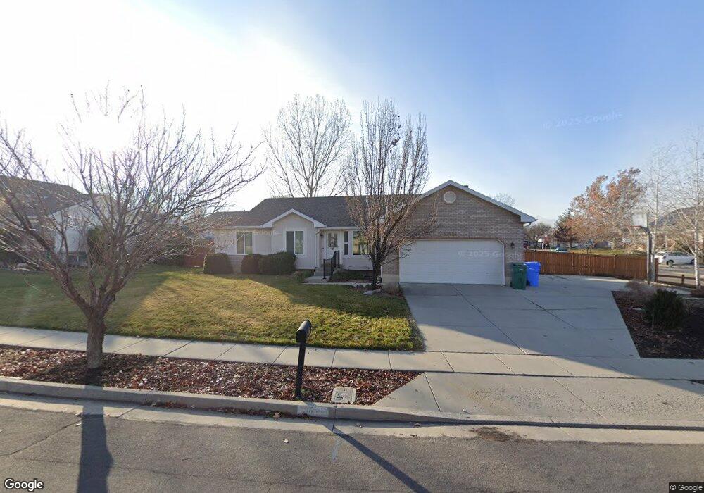
13938 S Hoyt Peak Cir Riverton, UT 84096
Estimated Value: $581,000 - $616,228
3
Beds
2
Baths
2,560
Sq Ft
$234/Sq Ft
Est. Value
About This Home
This home is located at 13938 S Hoyt Peak Cir, Riverton, UT 84096 and is currently estimated at $598,307, approximately $233 per square foot. 13938 S Hoyt Peak Cir is a home located in Salt Lake County with nearby schools including Foothills School, South Hills Middle School, and Mountain Ridge High School.
Ownership History
Date
Name
Owned For
Owner Type
Purchase Details
Closed on
Apr 30, 1998
Sold by
Ainsworth Ross
Bought by
Franchina Gary R and Franchina Bonnie H
Current Estimated Value
Home Financials for this Owner
Home Financials are based on the most recent Mortgage that was taken out on this home.
Original Mortgage
$110,400
Outstanding Balance
$21,496
Interest Rate
7.06%
Estimated Equity
$576,811
Create a Home Valuation Report for This Property
The Home Valuation Report is an in-depth analysis detailing your home's value as well as a comparison with similar homes in the area
Home Values in the Area
Average Home Value in this Area
Purchase History
| Date | Buyer | Sale Price | Title Company |
|---|---|---|---|
| Franchina Gary R | -- | -- |
Source: Public Records
Mortgage History
| Date | Status | Borrower | Loan Amount |
|---|---|---|---|
| Open | Franchina Gary R | $110,400 |
Source: Public Records
Tax History Compared to Growth
Tax History
| Year | Tax Paid | Tax Assessment Tax Assessment Total Assessment is a certain percentage of the fair market value that is determined by local assessors to be the total taxable value of land and additions on the property. | Land | Improvement |
|---|---|---|---|---|
| 2025 | $2,997 | $581,100 | $209,900 | $371,200 |
| 2024 | $2,997 | $518,700 | $192,800 | $325,900 |
| 2023 | $3,172 | $517,500 | $178,500 | $339,000 |
| 2022 | $3,271 | $523,500 | $175,000 | $348,500 |
| 2021 | $2,720 | $387,700 | $135,000 | $252,700 |
| 2020 | $2,642 | $351,100 | $105,000 | $246,100 |
| 2019 | $2,552 | $333,400 | $100,000 | $233,400 |
| 2018 | $2,431 | $312,600 | $92,400 | $220,200 |
| 2017 | $2,316 | $291,400 | $92,400 | $199,000 |
| 2016 | $2,211 | $265,900 | $92,400 | $173,500 |
| 2015 | $2,066 | $240,900 | $92,400 | $148,500 |
| 2014 | $1,989 | $227,400 | $88,100 | $139,300 |
Source: Public Records
Map
Nearby Homes
- 5036 W Cedar Point Peak Dr
- 13863 S Kessler Peak Dr
- 5030 Little Water Peak Dr
- 14049 S van Cott Peak Cir
- 14048 van Cott Peak Cir
- 14054 Elk Horn Peak Dr
- 13878 S Shaggy Peak Dr
- 14121 Elk Horn Peak Dr
- 13908 S 5180 W
- 4722 W Cillian Ln Unit 2411
- 4714 W Cillian Ln Unit 2410
- 4698 W Cillian Ln Unit 2409
- 4688 W Cillian Ln Unit 2408
- 4682 W Cillian Ln Unit 2407
- 4676 W Cillian Ln Unit 2406
- 4662 W Cillian Ln Unit 2405
- 5248 Little Water Peak Dr
- 4638 W Cillian Ln Unit 2403
- 13597 S Firetip Ct
- 14032 Lewiston Peak Dr
- 13938 Hoyt Peak Cir
- 13958 Hoyt Peak Cir
- 13937 Ben Lomond Peak Dr
- 13951 Ben Lomond Peak Dr
- 13964 Hoyt Peak Cir
- 13964 S Hoyt Peak Cir
- 4976 Kessler Peak Dr
- 4976 W Kessler Peak Dr
- 13941 Hoyt Peak Cir
- 13941 S Hoyt Peak Cir
- 4968 Kessler Peak Dr
- 4949 Kessler Peak Dr
- 13953 Hoyt Peak Cir
- 13967 S Ben Lomond Peak Dr
- 13967 Ben Lomond Peak Dr
- 4962 W Kessler Peak Dr
- 4962 Kessler Peak Dr
- 13965 Hoyt Peak Cir
- 13965 S Hoyt Peak Cir
- 13972 S Hoyt Peak Cir