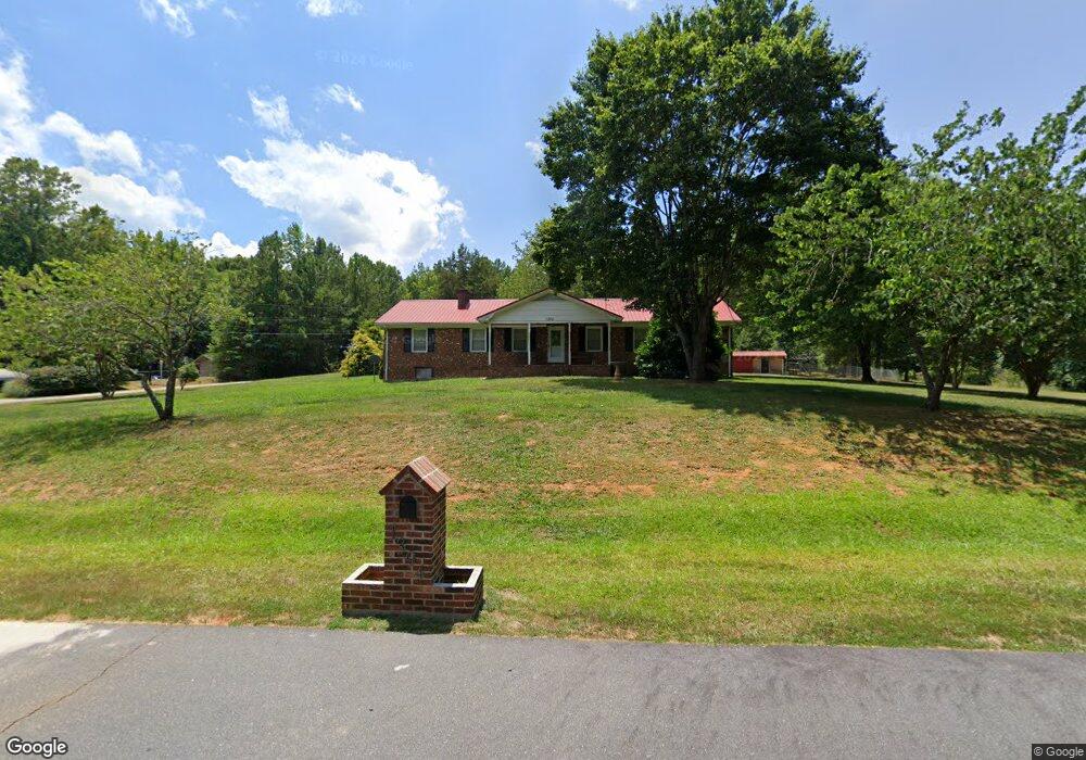
1394 Independence Ave Asheboro, NC 27205
Estimated Value: $255,000 - $307,000
--
Bed
2
Baths
1,582
Sq Ft
$173/Sq Ft
Est. Value
About This Home
This home is located at 1394 Independence Ave, Asheboro, NC 27205 and is currently estimated at $274,026, approximately $173 per square foot. 1394 Independence Ave is a home located in Randolph County with nearby schools including Sycamore Elementary School, Southmont Elementary School, and Southwestern Randolph Middle School.
Ownership History
Date
Name
Owned For
Owner Type
Purchase Details
Closed on
Sep 10, 2021
Sold by
Davis Jerry and Davis Dianna
Bought by
Aburto Juan Jose and Aburto Fabiola
Current Estimated Value
Home Financials for this Owner
Home Financials are based on the most recent Mortgage that was taken out on this home.
Original Mortgage
$190,000
Outstanding Balance
$172,509
Interest Rate
2.8%
Mortgage Type
New Conventional
Estimated Equity
$101,517
Purchase Details
Closed on
Oct 6, 2005
Sold by
Fontes Paul V
Bought by
Lashua Harry Herbert and Lashua Joyce Erma
Purchase Details
Closed on
Sep 20, 1993
Bought by
Lashua Harry Herbertlashua Joyce
Create a Home Valuation Report for This Property
The Home Valuation Report is an in-depth analysis detailing your home's value as well as a comparison with similar homes in the area
Home Values in the Area
Average Home Value in this Area
Purchase History
| Date | Buyer | Sale Price | Title Company |
|---|---|---|---|
| Aburto Juan Jose | $200,000 | None Available | |
| Lashua Harry Herbert | $112,000 | -- | |
| Lashua Harry Herbertlashua Joyce | $76,000 | -- |
Source: Public Records
Mortgage History
| Date | Status | Borrower | Loan Amount |
|---|---|---|---|
| Open | Aburto Juan Jose | $190,000 |
Source: Public Records
Tax History Compared to Growth
Tax History
| Year | Tax Paid | Tax Assessment Tax Assessment Total Assessment is a certain percentage of the fair market value that is determined by local assessors to be the total taxable value of land and additions on the property. | Land | Improvement |
|---|---|---|---|---|
| 2025 | $1,284 | $207,120 | $83,670 | $123,450 |
| 2024 | $1,284 | $207,120 | $83,670 | $123,450 |
| 2023 | $1,284 | $207,120 | $83,670 | $123,450 |
| 2022 | $976 | $129,680 | $42,940 | $86,740 |
| 2021 | $976 | $129,680 | $42,940 | $86,740 |
| 2020 | $937 | $129,680 | $42,940 | $86,740 |
| 2019 | $937 | $129,680 | $42,940 | $86,740 |
| 2018 | $838 | $112,830 | $39,940 | $72,890 |
| 2016 | $815 | $112,832 | $33,570 | $79,262 |
| 2015 | $818 | $112,832 | $33,570 | $79,262 |
| 2014 | -- | $112,832 | $33,570 | $79,262 |
Source: Public Records
Map
Nearby Homes
- 3828 Zoo Pkwy
- 916 S Creek Ct
- 2473 Zoo Pkwy
- 947 Rockcliff Terrace
- 4263 Zoo Pkwy
- 888 Newbern Ave
- 897 Bray Blvd
- 1201 Lindale Dr
- 431 Newbern Ave
- 0 Bray Blvd
- 3359 US Highway 220 Bus S
- 3359 U S 220 Business
- 248 CrooMcRest Rd
- 240 CrooMcRest Rd
- 0 Sykes Farm Rd
- 353 Auman Ave
- 261 Charles Ave
- 287 Eldorado Rd
- 228 Anchor Dr
- 0 Browers Chapel Rd
- 1524 Liberty Cir
- 1464 Independence Ave
- 1389 Independence Ave
- 00 Liberty Cir
- 3456 Zoo Pkwy
- 1031 Freedom Trail
- 1086 Freedom Trail
- 1614 Southwood Dr
- 1011 Freedom Trail
- 1026 Freedom Trail
- 1646 Southwood Dr
- 3602 Zoo Pkwy
- 1633 Southwood Dr
- 1083 Freedom State St
- 0 Freedom Trail
- 1652 Southwood Dr
- 996 Freedom Trail
- 1547 Liberty Circle Extension
- 3612 Zoo Pkwy
- 0 Liberty Cir