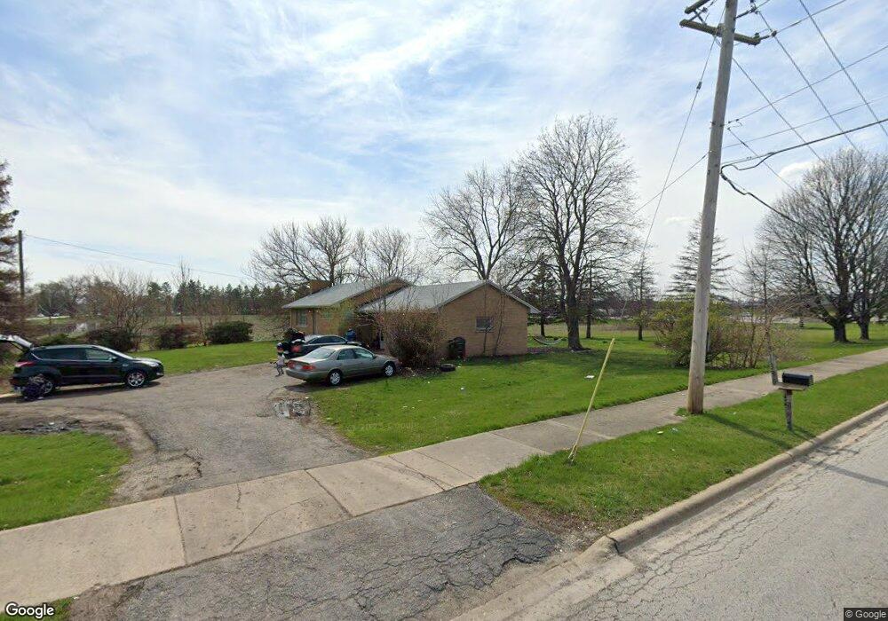
1394 N Randall Rd Aurora, IL 60506
Edgelawn Randall NeighborhoodEstimated Value: $247,700 - $291,000
--
Bed
--
Bath
1,140
Sq Ft
$235/Sq Ft
Est. Value
About This Home
This home is located at 1394 N Randall Rd, Aurora, IL 60506 and is currently estimated at $268,175, approximately $235 per square foot. 1394 N Randall Rd is a home located in Kane County with nearby schools including Fearn Elementary School, Jewel Middle School, and West Aurora High School.
Ownership History
Date
Name
Owned For
Owner Type
Purchase Details
Closed on
Mar 29, 2023
Sold by
D & S Clark Joint Revocable Trust
Bought by
Ls Holdings Llc
Current Estimated Value
Home Financials for this Owner
Home Financials are based on the most recent Mortgage that was taken out on this home.
Original Mortgage
$316,000
Outstanding Balance
$281,932
Interest Rate
5.9%
Mortgage Type
Credit Line Revolving
Estimated Equity
-$13,757
Purchase Details
Closed on
Sep 21, 2012
Sold by
Baker Sally and Baker Sally A
Bought by
Edwan R and Baker Sally A
Purchase Details
Closed on
Oct 12, 2006
Sold by
Clark Suzanne A and Clark Susan
Bought by
The Trustee Of D & S Clark Joint Revocable
Create a Home Valuation Report for This Property
The Home Valuation Report is an in-depth analysis detailing your home's value as well as a comparison with similar homes in the area
Home Values in the Area
Average Home Value in this Area
Purchase History
| Date | Buyer | Sale Price | Title Company |
|---|---|---|---|
| Ls Holdings Llc | $395,000 | None Listed On Document | |
| Edwan R | -- | None Available | |
| The Trustee Of D & S Clark Joint Revocable | -- | None Available |
Source: Public Records
Mortgage History
| Date | Status | Borrower | Loan Amount |
|---|---|---|---|
| Open | Ls Holdings Llc | $316,000 |
Source: Public Records
Tax History Compared to Growth
Tax History
| Year | Tax Paid | Tax Assessment Tax Assessment Total Assessment is a certain percentage of the fair market value that is determined by local assessors to be the total taxable value of land and additions on the property. | Land | Improvement |
|---|---|---|---|---|
| 2024 | $6,254 | $78,983 | $15,777 | $63,206 |
| 2023 | $6,220 | $72,621 | $14,097 | $58,524 |
| 2022 | $5,865 | $66,260 | $12,862 | $53,398 |
| 2021 | $5,865 | $61,689 | $11,975 | $49,714 |
| 2020 | $5,665 | $60,514 | $11,123 | $49,391 |
| 2019 | $5,483 | $56,068 | $10,306 | $45,762 |
| 2018 | $5,121 | $51,296 | $9,533 | $41,763 |
| 2017 | $5,239 | $50,906 | $10,334 | $40,572 |
| 2016 | $5,289 | $49,786 | $8,858 | $40,928 |
| 2015 | -- | $43,842 | $7,617 | $36,225 |
| 2014 | -- | $41,027 | $7,326 | $33,701 |
| 2013 | -- | $40,443 | $7,221 | $33,222 |
Source: Public Records
Map
Nearby Homes
- 1532 Golden Oaks Pkwy
- 1815 Brighton Cir
- 1513 Elder Dr
- 1475 Elder Dr
- 1035 Newcastle Ln
- 967 Sapphire Ln
- 959 Sapphire Ln
- 963 Sapphire Ln
- 960 Sapphire Ln
- 964 Sapphire Ln
- 910 Southbridge Dr
- 1120 Emerald Dr
- 1980 Sapphire Ln
- 972 Westgate Dr
- Lot 16 West Orchard Gateway Blvd
- 833 N Randall Rd Unit C4
- 1389 Monomoy St Unit B2
- Lot 13 Towne Center Dr
- Lot 1 South Towne Center Dr
- Lot 5 Towne Center Dr
- 1390 N Randall Rd
- Lot 27 N Randall Rd
- 1379 N Randall Rd
- 1373 N Randall Rd
- 1365 N Randall Rd
- 1552 Burr Oak Cir
- 1544 Burr Oak Cir
- 1355 N Randall Rd
- 1560 Burr Oak Cir
- 1536 Burr Oak Cir
- 1349 N Randall Rd
- 1528 Burr Oak Cir
- 1520 Burr Oak Cir Unit 1
- 1512 Burr Oak Cir
- 1568 Burr Oak Cir
- 1504 Burr Oak Cir
- 1576 Burr Oak Cir
- 1563 Burr Oak Cir
- 1496 Burr Oak Cir
- 1531 Burr Oak Cir