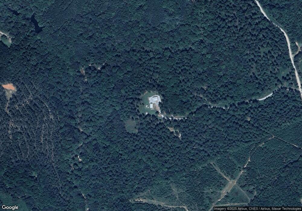
1395 Fork Creek Rd Bowman, GA 30624
Estimated Value: $178,000 - $418,000
1
Bed
--
Bath
1,066
Sq Ft
$288/Sq Ft
Est. Value
About This Home
This home is located at 1395 Fork Creek Rd, Bowman, GA 30624 and is currently estimated at $306,583, approximately $287 per square foot. 1395 Fork Creek Rd is a home with nearby schools including Elbert County Elementary School, Elbert County Primary School, and Elbert County Middle School.
Ownership History
Date
Name
Owned For
Owner Type
Purchase Details
Closed on
Oct 16, 2017
Sold by
Cornett William Joseph
Bought by
Farmer Corey W and Farmer Kyunghee Brooke
Current Estimated Value
Home Financials for this Owner
Home Financials are based on the most recent Mortgage that was taken out on this home.
Original Mortgage
$76,000
Outstanding Balance
$52,522
Interest Rate
3.78%
Mortgage Type
New Conventional
Estimated Equity
$254,061
Purchase Details
Closed on
Mar 27, 2012
Sold by
Gravitt Don Bradley
Bought by
Cornett William Joseph
Home Financials for this Owner
Home Financials are based on the most recent Mortgage that was taken out on this home.
Original Mortgage
$82,500
Interest Rate
3.95%
Mortgage Type
New Conventional
Purchase Details
Closed on
Jul 6, 2006
Sold by
Lunceford Aubrey and Lunceford Mark Maxwell
Bought by
Gravitt Don
Create a Home Valuation Report for This Property
The Home Valuation Report is an in-depth analysis detailing your home's value as well as a comparison with similar homes in the area
Home Values in the Area
Average Home Value in this Area
Purchase History
| Date | Buyer | Sale Price | Title Company |
|---|---|---|---|
| Farmer Corey W | $95,000 | -- | |
| Cornett William Joseph | $75,000 | -- | |
| Gravitt Don | $65,100 | -- |
Source: Public Records
Mortgage History
| Date | Status | Borrower | Loan Amount |
|---|---|---|---|
| Open | Farmer Corey W | $76,000 | |
| Previous Owner | Cornett William Joseph | $82,500 |
Source: Public Records
Tax History Compared to Growth
Tax History
| Year | Tax Paid | Tax Assessment Tax Assessment Total Assessment is a certain percentage of the fair market value that is determined by local assessors to be the total taxable value of land and additions on the property. | Land | Improvement |
|---|---|---|---|---|
| 2024 | $1,334 | $85,341 | $37,970 | $47,371 |
| 2023 | $1,329 | $85,341 | $37,970 | $47,371 |
| 2022 | $1,209 | $65,989 | $22,601 | $43,388 |
| 2021 | $825 | $50,149 | $22,601 | $27,548 |
| 2020 | $969 | $35,665 | $18,081 | $17,584 |
| 2019 | $1,007 | $35,665 | $18,081 | $17,584 |
| 2018 | $1,038 | $35,665 | $18,081 | $17,584 |
| 2017 | $1,054 | $33,532 | $18,081 | $15,451 |
| 2016 | $677 | $33,532 | $18,081 | $15,451 |
| 2015 | -- | $33,532 | $18,081 | $15,451 |
| 2014 | -- | $31,649 | $18,081 | $13,568 |
| 2013 | -- | $18,081 | $18,081 | $0 |
Source: Public Records
Map
Nearby Homes
- 1541 Cordell Rd
- 1574 Cordell Rd
- 0 Sand Hill Rd Unit 10595328
- 1257 Seymour Rd
- 1255 Seymour Rd
- 2448 Allen White Rd
- 2784 Stanley Maxwell Rd
- 3334 Cherokee Rd
- 0 Fork Creek Rd Unit 10616779
- 0 Fork Creek Rd Unit 7659678
- 2070 Hobbs Noggle Rd NW
- 0 Stinchcomb Rd Unit 9 10587637
- 0 Stinchcomb Rd Unit 7635449
- 2051 Hewell Rd NW
- 2198 Bennett Rd
- 2004 Christian Rd
- 1163 Nickville Rd
- 0 River Rd Unit 10639917
- 2851 Bowman Hwy
- 1963 Rehoboth Rd Unit EXTENSION
- 1408 Fork Creek Rd
- 1347 Fork Creek Rd
- 0 Turman Rd Unit 8B 3029713
- 0 Turman Rd Unit 3165482
- 0 Turman Rd Unit 3178014
- 0 Turman Rd Unit 8B 7156084
- 0 Turman Rd Unit 8-A 7156028
- 1506 Fork Creek Rd
- 1587 Turman Rd
- 1541 Turman Rd
- 1402 Turman Rd
- 1655 Turman Rd
- 18 Horace Rd
- 2670 Sand Hill Rd
- 0 Turman Rd Unit 7321174
- 2732 Warren Brown Rd
- 2730 Warren Brown Rd
- 2467 Hughes Rd NW
- 2604 Hughes Rd
- 2594 Hughes Rd
