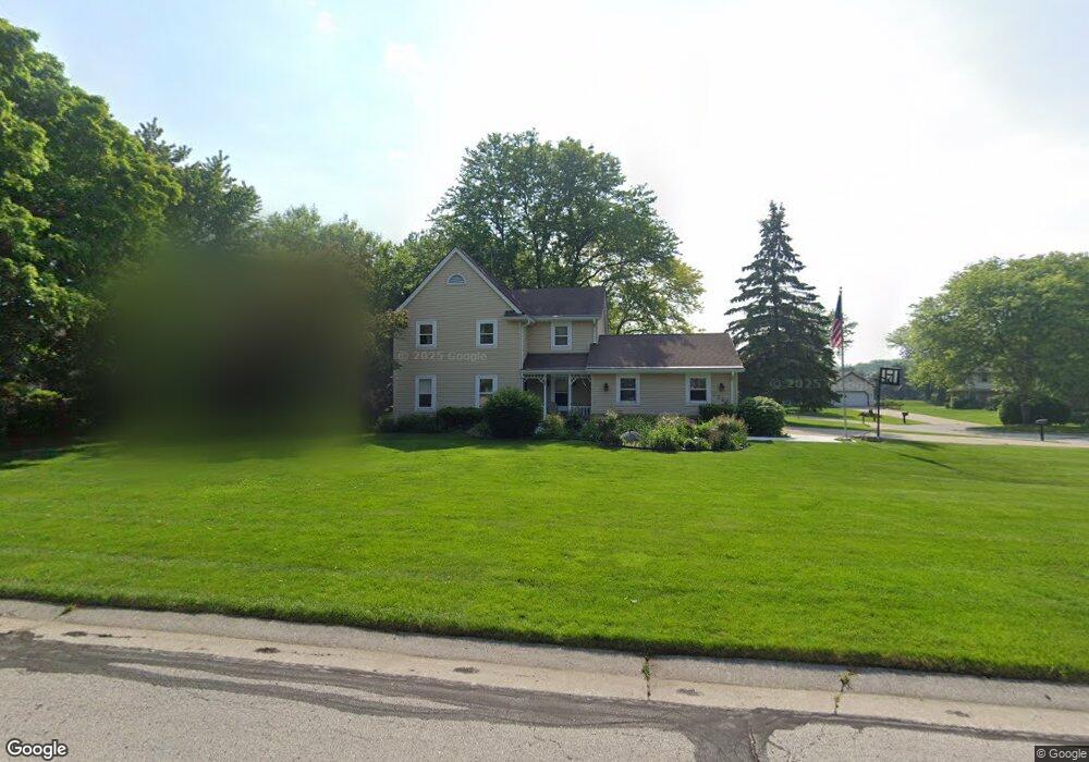
1395 Independence Dr Brookfield, WI 53045
Estimated Value: $537,583 - $625,000
4
Beds
4
Baths
2,266
Sq Ft
$258/Sq Ft
Est. Value
About This Home
This home is located at 1395 Independence Dr, Brookfield, WI 53045 and is currently estimated at $584,646, approximately $258 per square foot. 1395 Independence Dr is a home located in Waukesha County with nearby schools including Brookfield Elementary School, Wisconsin Hills Middle School, and Brookfield Central High School.
Ownership History
Date
Name
Owned For
Owner Type
Purchase Details
Closed on
Aug 4, 2006
Sold by
Brown Ian D and Brown Caroline E
Bought by
Mardikar Anway and Pimpale Monali
Current Estimated Value
Home Financials for this Owner
Home Financials are based on the most recent Mortgage that was taken out on this home.
Original Mortgage
$265,600
Outstanding Balance
$160,240
Interest Rate
6.85%
Mortgage Type
Purchase Money Mortgage
Estimated Equity
$424,406
Purchase Details
Closed on
Aug 2, 2002
Sold by
Beaumier David G and Beaumier Marilyn J
Bought by
Brown Ian D and Brown Caroline E
Home Financials for this Owner
Home Financials are based on the most recent Mortgage that was taken out on this home.
Original Mortgage
$230,000
Interest Rate
6.56%
Mortgage Type
Purchase Money Mortgage
Create a Home Valuation Report for This Property
The Home Valuation Report is an in-depth analysis detailing your home's value as well as a comparison with similar homes in the area
Home Values in the Area
Average Home Value in this Area
Purchase History
| Date | Buyer | Sale Price | Title Company |
|---|---|---|---|
| Mardikar Anway | $332,000 | Priority Title Corporation | |
| Brown Ian D | $320,000 | -- |
Source: Public Records
Mortgage History
| Date | Status | Borrower | Loan Amount |
|---|---|---|---|
| Open | Mardikar Anway | $265,600 | |
| Previous Owner | Brown Ian D | $230,000 |
Source: Public Records
Tax History
| Year | Tax Paid | Tax Assessment Tax Assessment Total Assessment is a certain percentage of the fair market value that is determined by local assessors to be the total taxable value of land and additions on the property. | Land | Improvement |
|---|---|---|---|---|
| 2024 | $4,412 | $399,300 | $135,000 | $264,300 |
| 2023 | $4,409 | $399,300 | $135,000 | $264,300 |
| 2022 | $4,725 | $333,600 | $130,000 | $203,600 |
| 2021 | $5,001 | $333,600 | $130,000 | $203,600 |
| 2020 | $5,228 | $333,600 | $130,000 | $203,600 |
| 2019 | $5,018 | $333,600 | $130,000 | $203,600 |
| 2018 | $5,093 | $328,500 | $130,000 | $198,500 |
| 2017 | $5,099 | $328,500 | $130,000 | $198,500 |
| 2016 | $5,173 | $328,500 | $130,000 | $198,500 |
| 2015 | $5,145 | $328,500 | $130,000 | $198,500 |
| 2014 | $5,337 | $328,500 | $130,000 | $198,500 |
| 2013 | $5,337 | $328,500 | $130,000 | $198,500 |
Source: Public Records
Map
Nearby Homes
- 20300 Yorktown Ct
- 1775 Derrin Ln
- 1825 Derrin Ln
- 2000 Kathlynn Ct
- 1040 Lansdowne Ct Unit V6
- 1045 Lansdowne Ct Unit V39
- 850 Janacek Rd
- 1930 Cotton Tail Ln
- 18865 Tanala Dr
- 20305 Downing Ct
- 21965 W North Ave
- 18665 Le Chateau Dr
- 2423 Kossow Rd
- 2465 Lionel Ct
- 2550 Harmony Cir
- 2570 Gaywood Ct
- Lt118 Berwick Ct
- Lt120 Berwick Ct
- Lt116 Berwick Ct
- Lt114 Berwick Ct
- 20335 Trenton Ct
- 1400 Independence Dr
- 20330 Yorktown Ct
- 20365 Trenton Ct
- 20310 Trenton Ct
- 20230 Liberty Ct
- 20360 Trenton Ct
- 20195 Liberty Ct
- 1360 Centennial Ct
- 20360 Yorktown Ct
- 1335 Independence Dr
- 20325 Independence Dr
- 1470 Independence Dr
- 1455 Liberty Ct
- 20165 Freedom Ct
- 1350 Centennial Ct
- 20365 Independence Dr
- 20365 Yorktown Ct
- 1315 Independence Dr
- 1490 Constitution Dr
Your Personal Tour Guide
Ask me questions while you tour the home.