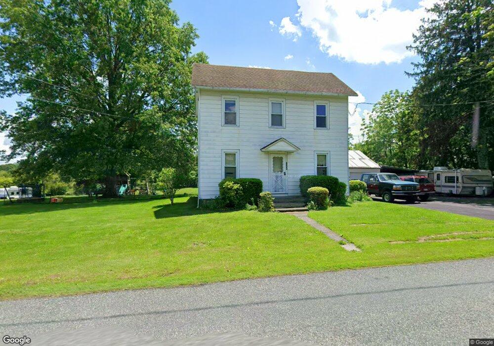
1395 Kumry Rd Pennsburg, PA 18073
Milford-Quakertown NeighborhoodEstimated Value: $230,000 - $331,000
3
Beds
1
Bath
1,488
Sq Ft
$192/Sq Ft
Est. Value
About This Home
This home is located at 1395 Kumry Rd, Pennsburg, PA 18073 and is currently estimated at $286,336, approximately $192 per square foot. 1395 Kumry Rd is a home located in Bucks County with nearby schools including Pfaff Elementary School, Quakertown Community Senior High School, and Red Hill Christian School.
Ownership History
Date
Name
Owned For
Owner Type
Purchase Details
Closed on
Dec 30, 2019
Sold by
Hitchcock Susan
Bought by
Roth Cody A
Current Estimated Value
Home Financials for this Owner
Home Financials are based on the most recent Mortgage that was taken out on this home.
Original Mortgage
$133,000
Outstanding Balance
$117,737
Interest Rate
3.7%
Mortgage Type
New Conventional
Estimated Equity
$168,599
Purchase Details
Closed on
Oct 3, 1961
Bought by
Mease Donald and Mease Mary
Create a Home Valuation Report for This Property
The Home Valuation Report is an in-depth analysis detailing your home's value as well as a comparison with similar homes in the area
Home Values in the Area
Average Home Value in this Area
Purchase History
| Date | Buyer | Sale Price | Title Company |
|---|---|---|---|
| Roth Cody A | $140,000 | Abe Settlement Services Llc | |
| Mease Donald | -- | -- |
Source: Public Records
Mortgage History
| Date | Status | Borrower | Loan Amount |
|---|---|---|---|
| Open | Roth Cody A | $133,000 |
Source: Public Records
Tax History Compared to Growth
Tax History
| Year | Tax Paid | Tax Assessment Tax Assessment Total Assessment is a certain percentage of the fair market value that is determined by local assessors to be the total taxable value of land and additions on the property. | Land | Improvement |
|---|---|---|---|---|
| 2025 | $3,065 | $15,200 | $2,960 | $12,240 |
| 2024 | $3,065 | $15,200 | $2,960 | $12,240 |
| 2023 | $3,035 | $15,200 | $2,960 | $12,240 |
| 2022 | $2,983 | $15,200 | $2,960 | $12,240 |
| 2021 | $2,983 | $15,200 | $2,960 | $12,240 |
| 2020 | $2,983 | $15,200 | $2,960 | $12,240 |
| 2019 | $2,901 | $15,200 | $2,960 | $12,240 |
| 2018 | $2,800 | $15,200 | $2,960 | $12,240 |
| 2017 | $2,714 | $15,200 | $2,960 | $12,240 |
| 2016 | $2,714 | $15,200 | $2,960 | $12,240 |
| 2015 | -- | $15,200 | $2,960 | $12,240 |
| 2014 | -- | $15,200 | $2,960 | $12,240 |
Source: Public Records
Map
Nearby Homes
- 1730 Fels Rd
- 1765 Old Plains Rd
- 1270 Fennel Rd
- 1830 Geryville Pike
- 2225 Keiper Rd
- 0 Geryville Pike
- 2120 Brinkman Rd
- 1625 Canary Rd
- 1805 Leedum Ln
- 0 Krammes Rd Unit PABU2104522
- 3005 Lynwood Ct
- 1615 Canary Rd
- 1605 Canary Rd
- 3040 Davenport Way Unit M120 L
- 3045 Davenport Way Unit 99 L
- 1410 Fels Rd
- 2071 Baus Rd
- 2124 Morgan Hill Dr
- 2563 Wasser Rd
- 3021 Finland Rd