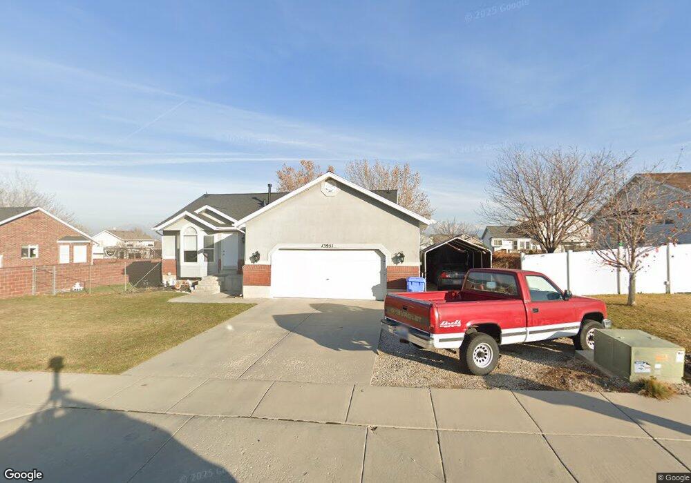
13951 Cedar Point Peak Cir Riverton, UT 84096
Estimated Value: $569,000 - $592,000
4
Beds
3
Baths
1,168
Sq Ft
$497/Sq Ft
Est. Value
About This Home
This home is located at 13951 Cedar Point Peak Cir, Riverton, UT 84096 and is currently estimated at $579,957, approximately $496 per square foot. 13951 Cedar Point Peak Cir is a home located in Salt Lake County with nearby schools including Foothills School, South Hills Middle School, and Mountain Ridge High School.
Ownership History
Date
Name
Owned For
Owner Type
Purchase Details
Closed on
Apr 3, 2025
Sold by
Pena Kenny L and Pena Shauna
Bought by
Kenny & Shauna Pena Family Trust and Pena
Current Estimated Value
Purchase Details
Closed on
Jun 19, 1997
Sold by
Waldenwood Homes Inc
Bought by
Pena Kenny L and Pena Shauna
Home Financials for this Owner
Home Financials are based on the most recent Mortgage that was taken out on this home.
Original Mortgage
$126,381
Interest Rate
7.94%
Mortgage Type
VA
Purchase Details
Closed on
Dec 22, 1995
Sold by
Stevens Donald L
Bought by
Mortgage Investment Trust
Purchase Details
Closed on
Jan 19, 1995
Sold by
Pedersen Michael Keith and Pedersen Drucilla
Bought by
Stevens Donald L
Create a Home Valuation Report for This Property
The Home Valuation Report is an in-depth analysis detailing your home's value as well as a comparison with similar homes in the area
Home Values in the Area
Average Home Value in this Area
Purchase History
| Date | Buyer | Sale Price | Title Company |
|---|---|---|---|
| Kenny & Shauna Pena Family Trust | -- | Masters Title Insurance Agency | |
| Kenny & Shauna Pena Family Trust | -- | Masters Title Insurance Agency | |
| Pena Kenny L | -- | -- | |
| Mortgage Investment Trust | -- | -- | |
| Stevens Donald L | -- | -- |
Source: Public Records
Mortgage History
| Date | Status | Borrower | Loan Amount |
|---|---|---|---|
| Previous Owner | Pena Kenny L | $126,381 |
Source: Public Records
Tax History Compared to Growth
Tax History
| Year | Tax Paid | Tax Assessment Tax Assessment Total Assessment is a certain percentage of the fair market value that is determined by local assessors to be the total taxable value of land and additions on the property. | Land | Improvement |
|---|---|---|---|---|
| 2025 | $789 | $567,500 | $209,900 | $357,600 |
| 2024 | $789 | $504,200 | $192,800 | $311,400 |
| 2023 | $789 | $500,700 | $178,500 | $322,200 |
| 2022 | $2,842 | $506,500 | $175,000 | $331,500 |
| 2021 | $2,268 | $373,400 | $135,000 | $238,400 |
| 2020 | $2,175 | $338,400 | $105,000 | $233,400 |
| 2019 | $2,106 | $323,600 | $100,000 | $223,600 |
| 2018 | $2,001 | $304,700 | $92,400 | $212,300 |
| 2017 | $1,883 | $282,400 | $92,400 | $190,000 |
| 2016 | $2,169 | $260,900 | $92,400 | $168,500 |
| 2015 | $2,079 | $242,400 | $92,400 | $150,000 |
| 2014 | $2,010 | $229,800 | $88,100 | $141,700 |
Source: Public Records
Map
Nearby Homes
- 14054 Elk Horn Peak Dr
- 14048 van Cott Peak Cir
- 13908 S 5180 W
- 13863 S Kessler Peak Dr
- 4999 W Cave Peak Dr
- 5031 Greenstreak Dr
- 14254 S Amber Rose Ln
- 5279 Leila Ln
- 13597 S Firetip Ct
- 4827 Boulder Meadow Dr
- 4722 W Cillian Ln Unit 2411
- 14347 S Mount Ogden Peak Dr
- 4714 W Cillian Ln Unit 2410
- 4698 W Cillian Ln Unit 2409
- 4688 W Cillian Ln Unit 2408
- 4682 W Cillian Ln Unit 2407
- 4676 W Cillian Ln Unit 2406
- 14328 S Sun Bloom Ln
- 4662 W Cillian Ln Unit 2405
- 4638 W Cillian Ln Unit 2403
- 13965 S Cedar Point Peak Cir
- 13937 Cedar Point Peak Cir
- 13965 Cedar Point Peak Cir
- 13950 S Haystack Peak Cir
- 13950 Haystack Peak Cir
- 13962 Haystack Peak Cir
- 13936 Haystack Peak Cir
- 13936 S Haystack Peak Cir
- 13962 S 5050 W
- 13950 Cedar Point Peak Cir
- 13925 Cedar Point Peak Cir
- 13962 Cedar Point Peak Cir
- 13975 S Cedar Point Peak Cir
- 13975 Cedar Point Peak Cir
- 13962 S Cedar Point Peak Cir
- 13936 Cedar Point Peak Cir
- 13986 Cedar Point Peak Cir
- 13924 S Haystack Peak Cir
- 13976 Haystack Peak Cir
- 13976 S Haystack Peak Cir