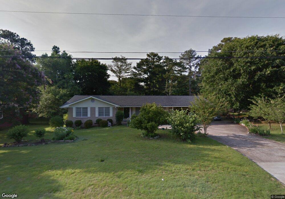
1396 Cherokee Trail Lawrenceville, GA 30043
Estimated Value: $285,786 - $354,000
3
Beds
2
Baths
1,601
Sq Ft
$200/Sq Ft
Est. Value
About This Home
This home is located at 1396 Cherokee Trail, Lawrenceville, GA 30043 and is currently estimated at $319,697, approximately $199 per square foot. 1396 Cherokee Trail is a home located in Gwinnett County with nearby schools including Jackson Elementary School, Northbrook Middle School, and Peachtree Ridge High School.
Ownership History
Date
Name
Owned For
Owner Type
Purchase Details
Closed on
Jul 30, 2003
Sold by
Abbassi Farhad
Bought by
Dang Manh T
Current Estimated Value
Home Financials for this Owner
Home Financials are based on the most recent Mortgage that was taken out on this home.
Original Mortgage
$126,022
Outstanding Balance
$56,785
Interest Rate
5.94%
Mortgage Type
FHA
Estimated Equity
$262,912
Purchase Details
Closed on
Jun 24, 2003
Sold by
Yang Kaby Trust
Bought by
Abbassi Farhad
Home Financials for this Owner
Home Financials are based on the most recent Mortgage that was taken out on this home.
Original Mortgage
$126,022
Outstanding Balance
$56,785
Interest Rate
5.94%
Mortgage Type
FHA
Estimated Equity
$262,912
Purchase Details
Closed on
Sep 21, 1994
Sold by
Stills Lloyd L Bettye E
Bought by
Yang Kaby See
Home Financials for this Owner
Home Financials are based on the most recent Mortgage that was taken out on this home.
Original Mortgage
$78,100
Interest Rate
8.56%
Mortgage Type
FHA
Create a Home Valuation Report for This Property
The Home Valuation Report is an in-depth analysis detailing your home's value as well as a comparison with similar homes in the area
Home Values in the Area
Average Home Value in this Area
Purchase History
| Date | Buyer | Sale Price | Title Company |
|---|---|---|---|
| Dang Manh T | $128,000 | -- | |
| Abbassi Farhad | -- | -- | |
| Yang Kaby See | $79,900 | -- |
Source: Public Records
Mortgage History
| Date | Status | Borrower | Loan Amount |
|---|---|---|---|
| Open | Dang Manh T | $126,022 | |
| Previous Owner | Yang Kaby See | $78,100 |
Source: Public Records
Tax History Compared to Growth
Tax History
| Year | Tax Paid | Tax Assessment Tax Assessment Total Assessment is a certain percentage of the fair market value that is determined by local assessors to be the total taxable value of land and additions on the property. | Land | Improvement |
|---|---|---|---|---|
| 2024 | $738 | $109,240 | $22,400 | $86,840 |
| 2023 | $738 | $109,240 | $22,400 | $86,840 |
| 2022 | $694 | $109,240 | $22,400 | $86,840 |
| 2021 | $679 | $71,200 | $15,720 | $55,480 |
| 2020 | $677 | $71,200 | $15,720 | $55,480 |
| 2019 | $637 | $57,480 | $16,000 | $41,480 |
| 2018 | $619 | $57,480 | $16,000 | $41,480 |
| 2016 | $657 | $46,720 | $15,600 | $31,120 |
| 2015 | $568 | $26,280 | $5,200 | $21,080 |
| 2014 | -- | $26,280 | $5,200 | $21,080 |
Source: Public Records
Map
Nearby Homes
- 1292 Cherokee Trail
- 1165 Luther Way
- 1246 Lucan Ln Unit WC2.29
- 1236 Lucan Ln Unit WC2.30
- 1226 Lucan Ln Unit WC2.31
- 1216 Lucan Ln Unit WC2.32
- 1416 Lucan Ln Unit WC2.20
- 1346 Lucan Ln Unit WC2.27
- 1356 Lucan Ln Unit WC2.26
- 1368 Christiana Dr
- 1181 Colony Bend Dr
- 1312 Yorktown Cir Unit 3
- 1560 Park Grove Dr
- 1300 Sever Woods Dr
- 1584 Park Grove Dr
- 1447 High Sierra Dr
- 1182 Bailing Dr
- 1419 Evers Place Unit 2
- 1131 Bailing Dr
- 1460 Walnut Hill Cir
- 1408 Cherokee Trail
- 1384 Cherokee Trail
- 1399 Mohawk Dr
- 1409 Mohawk Dr
- 1383 Mohawk Dr
- 1397 Cherokee Trail
- 1385 Cherokee Trail
- 1421 Cherokee Trail
- 1409 Cherokee Trail
- 1362 Cherokee Trail
- 1420 Cherokee Trail
- 1371 Mohawk Dr
- 1423 Mohawk Dr
- 1423 Mohawk Dr NW
- 1373 Cherokee Trail
- 1450 Howard Way
- 1390 Mohawk Dr
- 1432 Cherokee Trail
- 1460 Howard Way Unit 3
- 1440 Howard Way