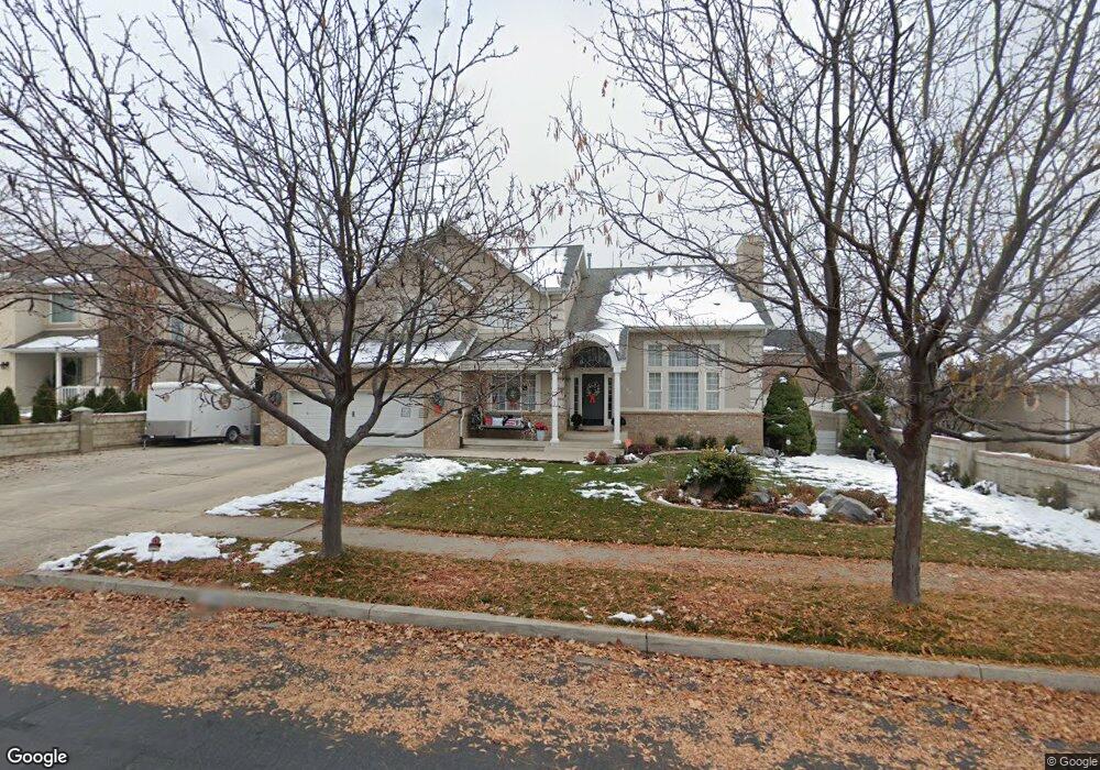
1396 N 1020 E American Fork, UT 84003
Estimated Value: $797,000 - $827,000
7
Beds
4
Baths
4,213
Sq Ft
$192/Sq Ft
Est. Value
About This Home
This home is located at 1396 N 1020 E, American Fork, UT 84003 and is currently estimated at $808,073, approximately $191 per square foot. 1396 N 1020 E is a home located in Utah County with nearby schools including Deerfield Elementary School, Mountain Ridge Junior High School, and American Fork High School.
Ownership History
Date
Name
Owned For
Owner Type
Purchase Details
Closed on
Mar 16, 2021
Sold by
Hardman Daniel H and Hardman Linda K
Bought by
Reed John
Current Estimated Value
Home Financials for this Owner
Home Financials are based on the most recent Mortgage that was taken out on this home.
Original Mortgage
$504,000
Outstanding Balance
$454,064
Interest Rate
3%
Mortgage Type
New Conventional
Estimated Equity
$354,009
Purchase Details
Closed on
Oct 19, 2012
Sold by
Hardman Daniel H and Hardman Linda K
Bought by
Hardman Daniel H and Hardman Linda K
Purchase Details
Closed on
Jul 25, 2012
Sold by
Hardman Daniel H and Hardman Linda K
Bought by
Hardman Daniel H and Hardman Linda L
Purchase Details
Closed on
Mar 18, 2010
Sold by
Hardman Daniel H and Hardman Linda K
Bought by
Hardman Daniel H and Hardman Linda K
Purchase Details
Closed on
Sep 7, 2004
Sold by
Bodell Ina Marie
Bought by
Johnson Donnell and Johnson Heather
Home Financials for this Owner
Home Financials are based on the most recent Mortgage that was taken out on this home.
Original Mortgage
$229,600
Interest Rate
6.06%
Mortgage Type
Purchase Money Mortgage
Purchase Details
Closed on
Sep 3, 2004
Sold by
Johnson Donnel and Johnson Heather
Bought by
Hardman Daniel H and Hardman Linda K
Home Financials for this Owner
Home Financials are based on the most recent Mortgage that was taken out on this home.
Original Mortgage
$229,600
Interest Rate
6.06%
Mortgage Type
Purchase Money Mortgage
Create a Home Valuation Report for This Property
The Home Valuation Report is an in-depth analysis detailing your home's value as well as a comparison with similar homes in the area
Home Values in the Area
Average Home Value in this Area
Purchase History
| Date | Buyer | Sale Price | Title Company |
|---|---|---|---|
| Reed John | -- | Inwest Title | |
| Hardman Daniel H | -- | None Available | |
| Hardman Daniel H | -- | None Available | |
| Hardman Daniel H | -- | None Available | |
| Johnson Donnell | -- | Sundance Title Insurance Ag | |
| Hardman Daniel H | -- | Sundance Title Insurance Ag |
Source: Public Records
Mortgage History
| Date | Status | Borrower | Loan Amount |
|---|---|---|---|
| Open | Reed John | $504,000 | |
| Previous Owner | Hardman Daniel H | $229,600 | |
| Closed | Hardman Daniel H | $43,050 |
Source: Public Records
Tax History
| Year | Tax Paid | Tax Assessment Tax Assessment Total Assessment is a certain percentage of the fair market value that is determined by local assessors to be the total taxable value of land and additions on the property. | Land | Improvement |
|---|---|---|---|---|
| 2025 | $3,171 | $375,815 | -- | -- |
| 2024 | $3,171 | $352,330 | $0 | $0 |
| 2023 | $3,056 | $360,030 | $0 | $0 |
| 2022 | $3,063 | $356,070 | $0 | $0 |
| 2021 | $2,687 | $488,000 | $164,200 | $323,800 |
| 2020 | $2,614 | $460,400 | $152,000 | $308,400 |
| 2019 | $2,375 | $432,600 | $141,400 | $291,200 |
| 2018 | $2,316 | $403,300 | $134,400 | $268,900 |
| 2017 | $2,318 | $217,910 | $0 | $0 |
| 2016 | $2,371 | $207,075 | $0 | $0 |
| 2015 | $2,335 | $193,545 | $0 | $0 |
| 2014 | $2,122 | $173,470 | $0 | $0 |
Source: Public Records
Map
Nearby Homes
- 9587 N 4500 W
- 9617 N 4500 W
- 4675 W Ferguson Way
- 1089 N 950 E
- 1125 N 1270 E
- 1077 N 950 E
- 1058 N 930 E Unit 64
- 1045 N 930 E Unit 58
- 4552 W Windsor Cir
- 4531 W Cambridge Dr
- 9752 N Dorchester Dr
- 4979 W Willowbank Dr
- 4968 W Evergreen Ln
- 5061 W Evergreen Ln
- 5034 W Green Ash Ln
- 5042 W Green Ash Ln
- 4998 W Green Ash Ln
- 4992 W Green Ash Ln
- 5056 W Green Ash Ln
- 1793 E Kern Mountain
Your Personal Tour Guide
Ask me questions while you tour the home.