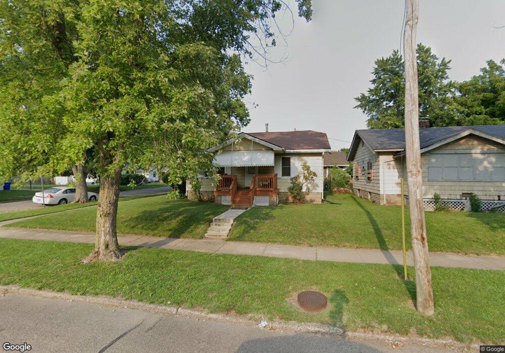
1396 N Walnut Grove Ave Decatur, IL 62526
Neighborhood Empowerment NeighborhoodEstimated Value: $35,000 - $45,000
--
Bed
--
Bath
840
Sq Ft
$48/Sq Ft
Est. Value
About This Home
This home is located at 1396 N Walnut Grove Ave, Decatur, IL 62526 and is currently estimated at $40,027, approximately $47 per square foot. 1396 N Walnut Grove Ave is a home located in Macon County with nearby schools including Stephen Decatur Middle School, Northwest Christian Campus, and Teen Challenge-Home For Girls.
Ownership History
Date
Name
Owned For
Owner Type
Purchase Details
Closed on
Sep 29, 2010
Sold by
Anderson Robert R
Bought by
Anderson Robert R and Anderson Katherine D
Current Estimated Value
Home Financials for this Owner
Home Financials are based on the most recent Mortgage that was taken out on this home.
Original Mortgage
$29,600
Interest Rate
4.26%
Mortgage Type
New Conventional
Purchase Details
Closed on
Oct 1, 1998
Create a Home Valuation Report for This Property
The Home Valuation Report is an in-depth analysis detailing your home's value as well as a comparison with similar homes in the area
Home Values in the Area
Average Home Value in this Area
Purchase History
| Date | Buyer | Sale Price | Title Company |
|---|---|---|---|
| Anderson Robert R | -- | None Available | |
| -- | $47,000 | -- |
Source: Public Records
Mortgage History
| Date | Status | Borrower | Loan Amount |
|---|---|---|---|
| Closed | Anderson Robert R | $29,600 |
Source: Public Records
Tax History Compared to Growth
Tax History
| Year | Tax Paid | Tax Assessment Tax Assessment Total Assessment is a certain percentage of the fair market value that is determined by local assessors to be the total taxable value of land and additions on the property. | Land | Improvement |
|---|---|---|---|---|
| 2024 | $369 | $9,401 | $442 | $8,959 |
| 2023 | $379 | $9,068 | $426 | $8,642 |
| 2022 | $390 | $8,312 | $394 | $7,918 |
| 2021 | $392 | $7,762 | $368 | $7,394 |
| 2020 | $405 | $7,400 | $350 | $7,050 |
| 2019 | $405 | $7,400 | $350 | $7,050 |
| 2018 | $400 | $8,056 | $197 | $7,859 |
| 2017 | $399 | $8,271 | $202 | $8,069 |
| 2016 | $403 | $8,355 | $204 | $8,151 |
| 2015 | $389 | $9,132 | $135 | $8,997 |
| 2014 | $365 | $9,042 | $134 | $8,908 |
| 2013 | $364 | $9,382 | $139 | $9,243 |
Source: Public Records
Map
Nearby Homes
- 933 W Division St
- 837 W Grand Ave
- 1653 N Maple Ave
- 1545 N Monroe St
- 644 W Division St
- 1504 N Monroe St
- 1319 W Waggoner St
- 1915 N Monroe St
- 1535 N Mcclellan Ave
- 1530 W Cushing St
- 1245 N Union St
- 917 N Wilder Ave
- 1065 W Green St
- 1645 W Center St
- 1675 W Center St
- 1451 W Marietta St
- 875 N Monroe St
- 1625 W Garfield Ave
- 844 N Edward St
- 230 W Garfield Ave
- 1388 N Walnut Grove Ave
- 955 W Center St
- 1404 N Walnut Grove Ave
- 1380 N Walnut Grove Ave
- 947 W Center St
- 1405 N Walnut Grove Ave
- 939 W Center St
- 1415 N Walnut Grove Ave
- 1436 N Walnut Grove Ave
- 1423 N Walnut Grove Ave
- 1372 N Walnut Grove Ave
- 930 W Center St
- 1389 N Walnut Grove Ave
- 1429 N Walnut Grove Ave
- 1435 N Walnut Grove Ave Unit RA
- 1454 N Walnut Grove Ave
- 1383 N Walnut Grove Ave
- 931 W Center St
- 922 W Center St
- 1364 N Walnut Grove Ave