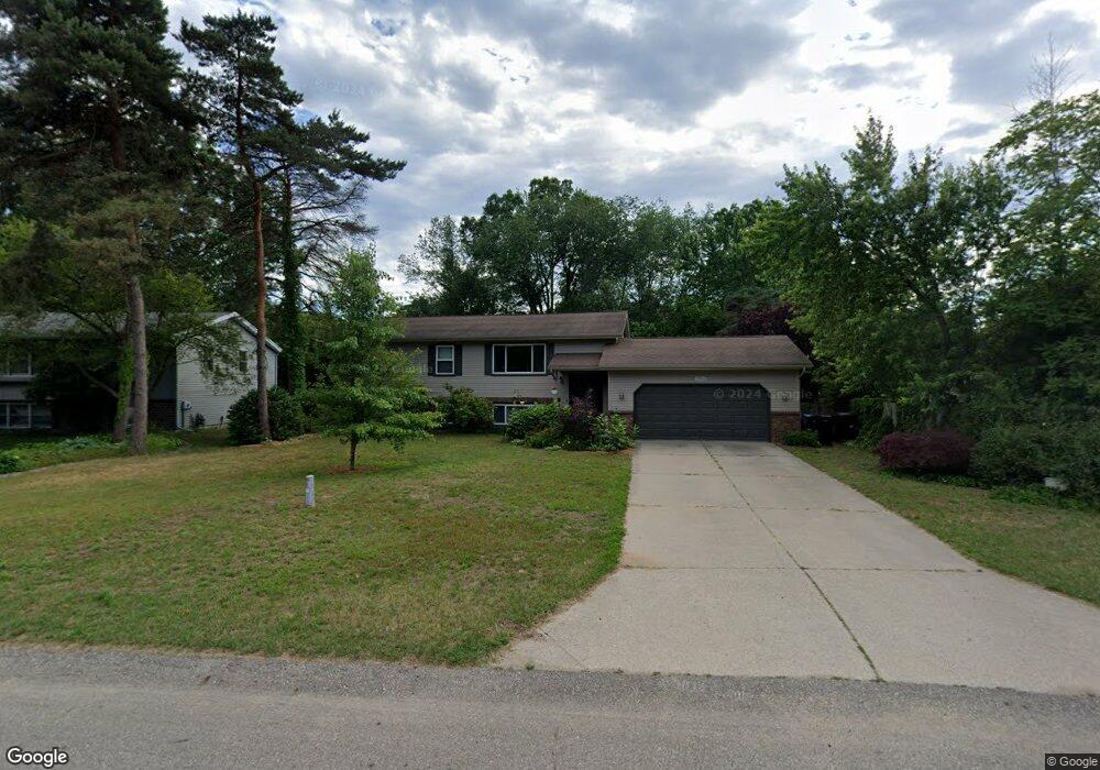
13961 Fox Trail Dr Holland, MI 49424
Estimated Value: $323,000 - $385,000
4
Beds
3
Baths
1,842
Sq Ft
$193/Sq Ft
Est. Value
About This Home
This home is located at 13961 Fox Trail Dr, Holland, MI 49424 and is currently estimated at $355,225, approximately $192 per square foot. 13961 Fox Trail Dr is a home located in Ottawa County with nearby schools including Pine Creek Elementary School, Harbor Lights Middle School, and West Ottawa High School.
Ownership History
Date
Name
Owned For
Owner Type
Purchase Details
Closed on
Sep 18, 2008
Sold by
Sturgis Charles E
Bought by
Hsbc Mortgage Services Inc
Current Estimated Value
Purchase Details
Closed on
Oct 1, 2004
Sold by
Veldhof Brian and Veldhof Pamela
Bought by
Sturgis Charles E
Home Financials for this Owner
Home Financials are based on the most recent Mortgage that was taken out on this home.
Original Mortgage
$133,500
Interest Rate
5.93%
Mortgage Type
Purchase Money Mortgage
Create a Home Valuation Report for This Property
The Home Valuation Report is an in-depth analysis detailing your home's value as well as a comparison with similar homes in the area
Home Values in the Area
Average Home Value in this Area
Purchase History
| Date | Buyer | Sale Price | Title Company |
|---|---|---|---|
| Hsbc Mortgage Services Inc | $93,329 | None Available | |
| Sturgis Charles E | $153,500 | Chicago Title |
Source: Public Records
Mortgage History
| Date | Status | Borrower | Loan Amount |
|---|---|---|---|
| Previous Owner | Sturgis Charles E | $133,500 |
Source: Public Records
Tax History Compared to Growth
Tax History
| Year | Tax Paid | Tax Assessment Tax Assessment Total Assessment is a certain percentage of the fair market value that is determined by local assessors to be the total taxable value of land and additions on the property. | Land | Improvement |
|---|---|---|---|---|
| 2025 | $2,356 | $143,500 | $0 | $0 |
| 2024 | $1,785 | $134,400 | $0 | $0 |
| 2023 | $1,722 | $110,000 | $0 | $0 |
| 2022 | $2,211 | $108,900 | $0 | $0 |
| 2021 | $2,150 | $103,900 | $0 | $0 |
| 2020 | $2,075 | $89,400 | $0 | $0 |
| 2019 | $2,041 | $62,800 | $0 | $0 |
| 2018 | $1,894 | $75,300 | $12,500 | $62,800 |
| 2017 | $1,865 | $69,700 | $0 | $0 |
| 2016 | $1,855 | $64,600 | $0 | $0 |
| 2015 | $1,776 | $60,700 | $0 | $0 |
| 2014 | $1,776 | $58,400 | $0 | $0 |
Source: Public Records
Map
Nearby Homes
- 14159 Pheasant Run
- 961 Shadybrook Dr
- 13652 Signature Dr
- 13654 Signature Dr
- 888 S Kingwood Ct
- 790 Mayfield Ave
- 785 Mary Ave
- 1020 Katra Ln Unit 52
- Integrity 1610 Plan at Silverwater
- Integrity 1250 Plan at Silverwater
- Integrity 1880 Plan at Silverwater
- Integrity 1560 Plan at Silverwater
- Traditions 2900 V8.2b Plan at Silverwater
- Integrity 1605 Plan at Silverwater
- Elements 2700 Plan at Silverwater
- Integrity 1530 Plan at Silverwater
- Traditions 1600 V8.0b Plan at Silverwater
- Integrity 1800 Plan at Silverwater
- Traditions 2800 V8.0b Plan at Silverwater
- Integrity 2060 Plan at Silverwater
- 13961 Foxtrail Dr
- 14064 Pheasant Run
- 13977 Fox Trail Dr
- 13995 Fox Trail
- 14080 Pheasant Run
- 14061 Fox Trail Dr
- 14077 Fox Trail Dr
- 13995 Fox Trail Dr
- 13958 Fox Trail Dr
- 13960 Fox Trail Dr
- 14093 Fox Trail Dr
- 14094 Pheasant Run
- 13946 Fox Trail Dr
- 14081 Pheasant Run
- 13934 Fox Trail Dr
- 14060 Fox Trail Dr
- 14109 Fox Trail Dr
- 14044 Fox Trail Dr
- 14108 Pheasant Run
- 14076 Fox Trail Dr