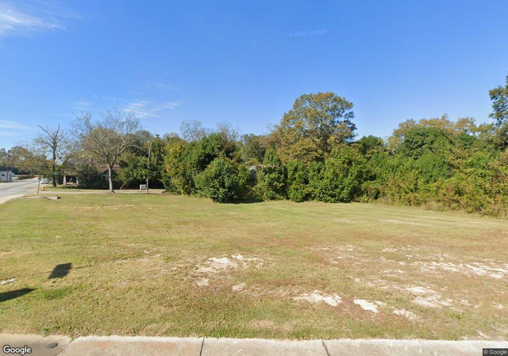
1397 Duncan Ave Macon, GA 31201
Napier Heights Historic District NeighborhoodEstimated Value: $23,002 - $174,000
3
Beds
3
Baths
1,774
Sq Ft
$47/Sq Ft
Est. Value
About This Home
This home is located at 1397 Duncan Ave, Macon, GA 31201 and is currently estimated at $83,501, approximately $47 per square foot. 1397 Duncan Ave is a home located in Bibb County with nearby schools including Williams Elementary School, Miller Fine Arts Magnet Middle School, and Central High School.
Ownership History
Date
Name
Owned For
Owner Type
Purchase Details
Closed on
Nov 9, 2017
Sold by
Mccord Samuel Wade
Bought by
Macon Bibb County Land Bank Authority
Current Estimated Value
Purchase Details
Closed on
May 10, 2006
Sold by
Mays Terrilia
Bought by
Mays Terrilia and Kindred William H
Purchase Details
Closed on
Nov 6, 2003
Purchase Details
Closed on
Jul 19, 2002
Purchase Details
Closed on
Jul 25, 2001
Purchase Details
Closed on
Apr 2, 2001
Create a Home Valuation Report for This Property
The Home Valuation Report is an in-depth analysis detailing your home's value as well as a comparison with similar homes in the area
Home Values in the Area
Average Home Value in this Area
Purchase History
| Date | Buyer | Sale Price | Title Company |
|---|---|---|---|
| Macon Bibb County Land Bank Authority | $10,051 | None Available | |
| Mays Terrilia | -- | None Availabale | |
| Mays Terrilia | $12,500 | None Availabale | |
| -- | $40,800 | -- | |
| -- | $120,000 | -- | |
| -- | $97,000 | -- | |
| -- | $30,000 | -- |
Source: Public Records
Tax History Compared to Growth
Tax History
| Year | Tax Paid | Tax Assessment Tax Assessment Total Assessment is a certain percentage of the fair market value that is determined by local assessors to be the total taxable value of land and additions on the property. | Land | Improvement |
|---|---|---|---|---|
| 2024 | $61 | $2,400 | $2,400 | $0 |
| 2023 | $61 | $2,400 | $2,400 | $0 |
| 2022 | $85 | $2,467 | $2,467 | $0 |
| 2021 | $94 | $2,467 | $2,467 | $0 |
| 2020 | $96 | $2,467 | $2,467 | $0 |
| 2019 | $97 | $2,467 | $2,467 | $0 |
| 2018 | $100 | $3,061 | $2,467 | $594 |
| 2017 | $156 | $4,155 | $2,467 | $1,688 |
| 2016 | $436 | $12,592 | $2,467 | $10,125 |
| 2015 | $834 | $17,039 | $2,574 | $14,464 |
| 2014 | $960 | $17,039 | $2,574 | $14,464 |
Source: Public Records
Map
Nearby Homes
- 2014 Montpelier Ave
- 1184 Holt Ave
- 1446 Marion Place
- 1159 Huguenin Ave
- 1156 Huguenin Ave
- 2079 E Napier Ave
- 2341 Beech Ave
- 1195 Lawton Dr
- 1495 Ninadel Dr
- 2485 Beech Ave
- 1987 Dannenberg Ave
- 1145 Patterson St
- 2497 Napier Ave
- 2571 Richard St
- 2575 Richard St
- 2586 Dubose St
- 1285 Pio Nono Ave
- 1481 Pio Nono Ave
- 1374 Holt Ave
- 1360 Holt Ave
- 2003 Montpelier Ave
- 1940 Montpelier Ave
- 1964 Montpelier Ave
- 1346 Holt Ave
- 1375 Duncan Ave
- 1375 Duncan Ave Unit 5
- 0 Marion Place Unit 7199020
- 0 Marion Place Unit 8157959
- 0 Marion Place Unit 7300609
- 0 Marion Place
- 1365 Holt Ave
- 2009 Montpelier Ave
- 1986 Montpelier Ave
- 1856 Montpelier Ave
- 1380 Duncan Ave
- 1437 Duncan Ave
- 0 Montpelier Ave Unit 8816664
- 0 Montpelier Ave Unit 8320056
