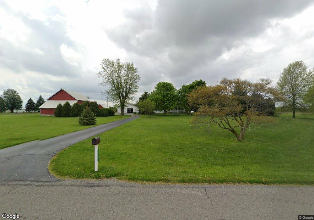
13975 Bloomlock Rd Spencerville, OH 45887
Estimated Value: $199,000 - $308,000
3
Beds
2
Baths
1,584
Sq Ft
$155/Sq Ft
Est. Value
About This Home
This home is located at 13975 Bloomlock Rd, Spencerville, OH 45887 and is currently estimated at $245,584, approximately $155 per square foot. 13975 Bloomlock Rd is a home.
Ownership History
Date
Name
Owned For
Owner Type
Purchase Details
Closed on
Nov 12, 2025
Sold by
Schwinnen Bradley F and Schwinnen Jessica L
Bought by
Bradley And Jessica Schwinnen Living Trust and Schwinnen
Current Estimated Value
Purchase Details
Closed on
Jun 20, 2016
Sold by
Schwinnen Cynthia J
Bought by
Schwinnen Bradley
Home Financials for this Owner
Home Financials are based on the most recent Mortgage that was taken out on this home.
Original Mortgage
$127,200
Interest Rate
3.58%
Mortgage Type
New Conventional
Create a Home Valuation Report for This Property
The Home Valuation Report is an in-depth analysis detailing your home's value as well as a comparison with similar homes in the area
Purchase History
| Date | Buyer | Sale Price | Title Company |
|---|---|---|---|
| Bradley And Jessica Schwinnen Living Trust | -- | None Listed On Document | |
| Schwinnen Bradley | $164,400 | None Available |
Source: Public Records
Mortgage History
| Date | Status | Borrower | Loan Amount |
|---|---|---|---|
| Previous Owner | Schwinnen Bradley | $127,200 |
Source: Public Records
Tax History
| Year | Tax Paid | Tax Assessment Tax Assessment Total Assessment is a certain percentage of the fair market value that is determined by local assessors to be the total taxable value of land and additions on the property. | Land | Improvement |
|---|---|---|---|---|
| 2024 | $1,877 | $62,130 | $17,260 | $44,870 |
| 2023 | $1,373 | $42,840 | $11,900 | $30,940 |
| 2022 | $1,403 | $42,840 | $11,900 | $30,940 |
| 2021 | $1,406 | $42,840 | $11,900 | $30,940 |
| 2020 | $1,237 | $39,380 | $12,010 | $27,370 |
| 2019 | $1,237 | $39,380 | $12,010 | $27,370 |
| 2018 | $1,242 | $39,380 | $12,010 | $27,370 |
| 2017 | $1,130 | $35,460 | $12,010 | $23,450 |
| 2016 | $1,122 | $35,460 | $12,010 | $23,450 |
Source: Public Records
Map
Nearby Homes
- 21302 Masters Rd
- 14101 Allentown Rd
- 241 King St
- 827 S Washington St
- 19059 Wittington St
- 420 S Cass St
- 310 E Suthoff St
- 483 S Franklin St
- 15044 Main St
- 714 Briggs Ave Unit 1
- 424 S Canal St
- 18906 Bebb St
- 708 W 1st St
- 221 S Main St
- 408 N Mulberry St
- 709 W 4th St
- 433 W 4th St
- 421 W 4th St
- 417 W 4th St
- 313 S Broadway St
- 14041 Bloomlock Rd
- 13740 Bloomlock Rd
- 13745 Bloomlock Rd
- 13660 Bloomlock Rd
- 2880 Sharf Rd
- 2706 Sharf Rd
- 13550 Bloomlock Rd
- 13916 Fruend Rd
- 2666 Sharf Rd
- 14405 Bloomlock Rd
- 13814 Fruend Rd
- 13915 Fruend Rd
- 13781 Fruend Rd
- 14260 Fruend Rd
- 3400 Sharf Rd
- 3433 Sharf Rd
- 13405 Bloomlock Rd
- 3485 Sharf Rd
- 14395 Fruend Rd
Your Personal Tour Guide
Ask me questions while you tour the home.