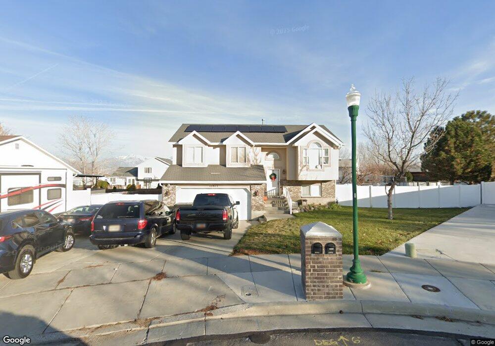
13975 S Cedar Point Peak Cir Riverton, UT 84096
Estimated Value: $531,000 - $579,000
4
Beds
1
Bath
1,854
Sq Ft
$297/Sq Ft
Est. Value
About This Home
This home is located at 13975 S Cedar Point Peak Cir, Riverton, UT 84096 and is currently estimated at $549,827, approximately $296 per square foot. 13975 S Cedar Point Peak Cir is a home located in Salt Lake County with nearby schools including Foothills School, South Hills Middle School, and Mountain Ridge High School.
Ownership History
Date
Name
Owned For
Owner Type
Purchase Details
Closed on
Jul 9, 2020
Sold by
Adams Shannon Laureen and Mitchell Patrick Alan
Bought by
Adams Shannon Laureen and The Shannon Adams Living Trust
Current Estimated Value
Home Financials for this Owner
Home Financials are based on the most recent Mortgage that was taken out on this home.
Original Mortgage
$228,000
Outstanding Balance
$202,175
Interest Rate
3.1%
Mortgage Type
New Conventional
Estimated Equity
$347,652
Purchase Details
Closed on
Dec 23, 2019
Sold by
Mitchell Patrick Alan and Adams Shannon
Bought by
Adams Shannon Laureen and Shannon Adams Living Trust
Purchase Details
Closed on
Apr 2, 2018
Sold by
Mitchell Patrick Alan
Bought by
Mitchell Patrick Alan and Adams Shannon
Home Financials for this Owner
Home Financials are based on the most recent Mortgage that was taken out on this home.
Original Mortgage
$30,000
Interest Rate
4.4%
Mortgage Type
Credit Line Revolving
Purchase Details
Closed on
Aug 5, 2014
Sold by
Roylance Chris J and Wailes Brooke
Bought by
Mitchell Patrick Alan
Home Financials for this Owner
Home Financials are based on the most recent Mortgage that was taken out on this home.
Original Mortgage
$190,000
Interest Rate
4.12%
Mortgage Type
New Conventional
Purchase Details
Closed on
Jun 15, 2006
Sold by
Evans Randy and Evans Bobbie
Bought by
Roylance Chris J and Wailes Brooke
Home Financials for this Owner
Home Financials are based on the most recent Mortgage that was taken out on this home.
Original Mortgage
$171,000
Interest Rate
8.3%
Mortgage Type
Fannie Mae Freddie Mac
Purchase Details
Closed on
Jul 22, 1998
Sold by
Walden Wood Homes Inc
Bought by
Evans Randy and Evans Bobbie
Home Financials for this Owner
Home Financials are based on the most recent Mortgage that was taken out on this home.
Original Mortgage
$128,272
Interest Rate
7.01%
Mortgage Type
FHA
Create a Home Valuation Report for This Property
The Home Valuation Report is an in-depth analysis detailing your home's value as well as a comparison with similar homes in the area
Home Values in the Area
Average Home Value in this Area
Purchase History
| Date | Buyer | Sale Price | Title Company |
|---|---|---|---|
| Adams Shannon Laureen | -- | Eagle Gate Title Ins Agcy | |
| Adams Shannon Laureen | -- | Eagle Gate Title Ins Agcy | |
| Adams Shannon Laureen | -- | None Available | |
| Mitchell Patrick Alan | -- | First American Title | |
| Mitchell Patrick Alan | -- | First American Title | |
| Roylance Chris J | -- | Equity Title | |
| Evans Randy | -- | -- |
Source: Public Records
Mortgage History
| Date | Status | Borrower | Loan Amount |
|---|---|---|---|
| Open | Adams Shannon Laureen | $228,000 | |
| Closed | Mitchell Patrick Alan | $30,000 | |
| Closed | Mitchell Patrick Alan | $190,000 | |
| Previous Owner | Roylance Chris J | $171,000 | |
| Previous Owner | Evans Randy | $128,272 |
Source: Public Records
Tax History Compared to Growth
Tax History
| Year | Tax Paid | Tax Assessment Tax Assessment Total Assessment is a certain percentage of the fair market value that is determined by local assessors to be the total taxable value of land and additions on the property. | Land | Improvement |
|---|---|---|---|---|
| 2025 | $2,558 | $492,200 | $209,900 | $282,300 |
| 2024 | $2,558 | $442,800 | $192,800 | $250,000 |
| 2023 | $2,703 | $441,100 | $178,500 | $262,600 |
| 2022 | $2,786 | $445,900 | $175,000 | $270,900 |
| 2021 | $2,365 | $337,000 | $135,000 | $202,000 |
| 2020 | $2,234 | $296,800 | $105,000 | $191,800 |
| 2019 | $2,156 | $281,600 | $100,000 | $181,600 |
| 2018 | $2,043 | $262,800 | $92,400 | $170,400 |
| 2017 | $1,944 | $243,700 | $92,400 | $151,300 |
| 2016 | $1,933 | $232,500 | $92,400 | $140,100 |
| 2015 | $1,882 | $219,400 | $92,400 | $127,000 |
| 2014 | $1,789 | $207,900 | $88,100 | $119,800 |
Source: Public Records
Map
Nearby Homes
- 14054 Elk Horn Peak Dr
- 14048 van Cott Peak Cir
- 14049 S van Cott Peak Cir
- 5036 W Cedar Point Peak Dr
- 13908 S 5180 W
- 13878 S Shaggy Peak Dr
- 14121 Elk Horn Peak Dr
- 5030 Little Water Peak Dr
- 14032 Lewiston Peak Dr
- 5288 Shaggy Peak Dr
- 5248 Little Water Peak Dr
- 14254 S Amber Rose Ln
- 13863 S Kessler Peak Dr
- 14322 Pepper Grass Ln
- 14347 S Mount Ogden Peak Dr
- 13597 S Firetip Ct
- 14272 S Highfield Dr
- 4722 W Cillian Ln Unit 2411
- 4714 W Cillian Ln Unit 2410
- 4698 W Cillian Ln Unit 2409
- 13975 Cedar Point Peak Cir
- 13976 S Haystack Peak Cir
- 13976 Haystack Peak Cir
- 13979 Cedar Point Peak Cir
- 13965 Cedar Point Peak Cir
- 13965 S Cedar Point Peak Cir
- 13962 Haystack Peak Cir
- 13980 Haystack Peak Cir
- 13962 S 5050 W
- 13980 S Haystack Peak Cir
- 5078 van Cott Peak Dr
- 13980 Cedar Point Peak Cir
- 13980 S Cedar Point Peak Cir
- 5056 van Cott Peak Dr
- 5056 W van Cott Peak Dr
- 5088 van Cott Peak Dr
- 5088 W van Cott Peak Dr
- 13951 Cedar Point Peak Cir
- 13986 Cedar Point Peak Cir
- 5106 van Cott Peak Cir