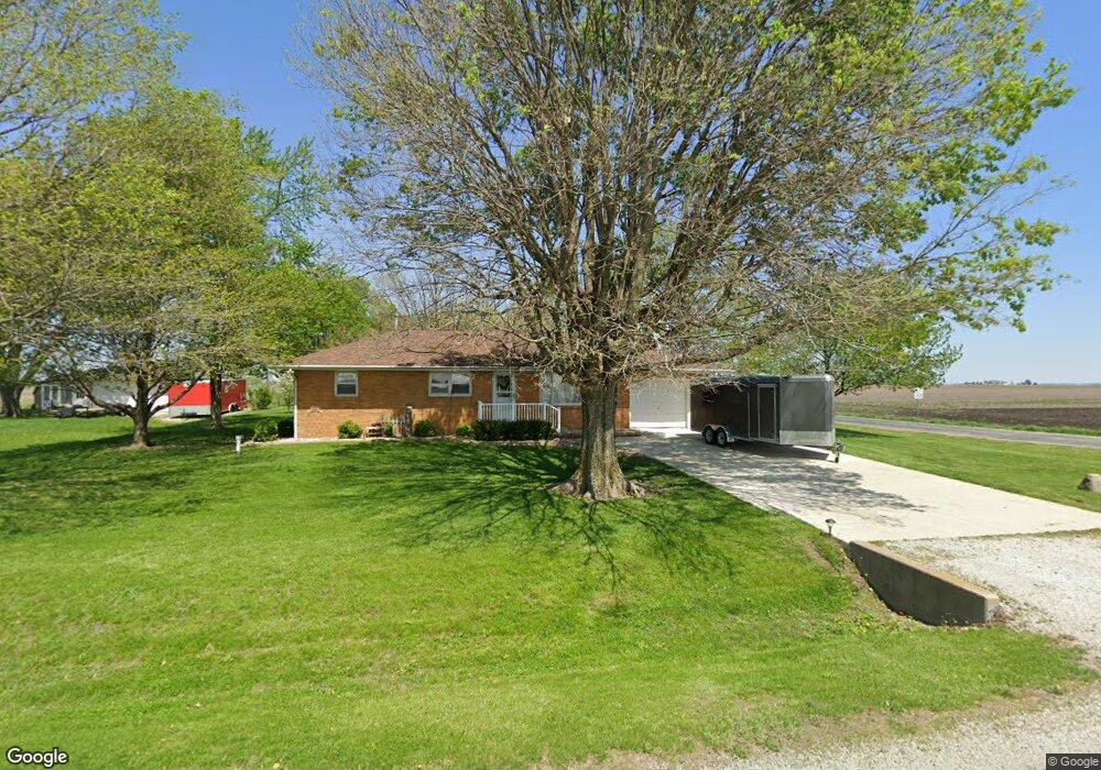
1398 Airport Rd Lincoln, IL 62656
Estimated Value: $162,107 - $186,000
--
Bed
--
Bath
1,248
Sq Ft
$140/Sq Ft
Est. Value
About This Home
This home is located at 1398 Airport Rd, Lincoln, IL 62656 and is currently estimated at $174,277, approximately $139 per square foot. 1398 Airport Rd is a home located in Logan County with nearby schools including Chester-East Lincoln Elementary School, Lincoln Community High School, and Carroll Catholic School.
Ownership History
Date
Name
Owned For
Owner Type
Purchase Details
Closed on
Nov 23, 2021
Sold by
Anderson Marty L
Bought by
Anderson Mark L
Current Estimated Value
Purchase Details
Closed on
Oct 12, 2021
Sold by
Anderson Doris A
Bought by
Anderson Marty L and Anderson Mark L
Create a Home Valuation Report for This Property
The Home Valuation Report is an in-depth analysis detailing your home's value as well as a comparison with similar homes in the area
Home Values in the Area
Average Home Value in this Area
Purchase History
| Date | Buyer | Sale Price | Title Company |
|---|---|---|---|
| Anderson Mark L | $41,000 | None Available | |
| Anderson Marty L | $41,000 | None Available |
Source: Public Records
Tax History Compared to Growth
Tax History
| Year | Tax Paid | Tax Assessment Tax Assessment Total Assessment is a certain percentage of the fair market value that is determined by local assessors to be the total taxable value of land and additions on the property. | Land | Improvement |
|---|---|---|---|---|
| 2024 | $3,057 | $53,010 | $9,480 | $43,530 |
| 2023 | $2,980 | $49,090 | $8,780 | $40,310 |
| 2022 | $2,980 | $45,880 | $8,210 | $37,670 |
| 2021 | $2,853 | $44,050 | $7,880 | $36,170 |
| 2020 | $2,814 | $43,400 | $7,760 | $35,640 |
| 2019 | $2,724 | $42,550 | $7,610 | $34,940 |
| 2018 | $2,686 | $41,710 | $7,460 | $34,250 |
| 2017 | $2,698 | $41,710 | $7,460 | $34,250 |
| 2016 | $3,174 | $47,980 | $7,450 | $40,530 |
| 2015 | $1,912 | $46,300 | $7,130 | $39,170 |
| 2014 | $1,912 | $46,300 | $7,130 | $39,170 |
| 2013 | $1,912 | $43,950 | $6,770 | $37,180 |
| 2012 | $1,912 | $44,740 | $6,890 | $37,850 |
Source: Public Records
Map
Nearby Homes
- 2354 Railsplitter Ave
- 2294 Railsplitter Ave
- 1354 Airport Rd
- 103 Crestwood Dr
- 102 Crestwood Dr
- 145 Half Moon St
- 180 Regent St
- 1503 N Kankakee St
- 1431 N Ottawa St
- 1019 N Mclean St
- 1208 N Kankakee St
- 1842 Castle Pine Place
- 1204 N Ottawa St
- 1107 N Kankakee St
- 311 Davenport St
- 1624 Delavan St
- 6 Meadow Ln
- 915 Peoria St
- 315 N Sherman St
- 1227 Delavan St
- 1396 Airport Rd
- 1705 1400th Ave
- 1394 Airport Rd
- 1707 1400th Ave
- 1390 Airport Rd
- 1711 1400th Ave
- 1715 1400th Ave
- 1386 Airport Rd
- 1717 1400th Ave
- 1382 Airport Rd
- 1721 1400th Ave
- 1380 Airport Rd
- 1378 Airport Rd
- 1723 1400th Ave
- 285 Heritage Ave
- 280 Heritage Ave
- 275 Heritage Ave
- 1376 Airport Rd
- 1725 1400th Ave
- 270 Heritage Ave