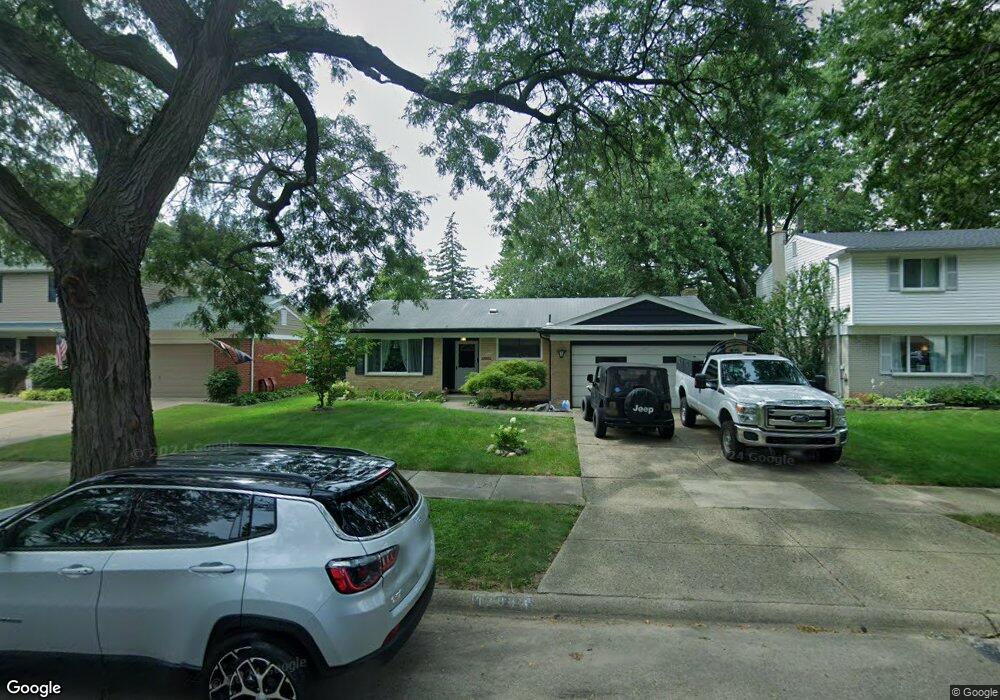
13981 Cranston St Livonia, MI 48154
Estimated Value: $295,000 - $333,000
3
Beds
2
Baths
1,480
Sq Ft
$213/Sq Ft
Est. Value
About This Home
This home is located at 13981 Cranston St, Livonia, MI 48154 and is currently estimated at $315,921, approximately $213 per square foot. 13981 Cranston St is a home located in Wayne County with nearby schools including Kennedy Elementary School, Johnson Upper Elementary School, and Frost Middle School.
Ownership History
Date
Name
Owned For
Owner Type
Purchase Details
Closed on
Aug 19, 2016
Sold by
Town William J
Bought by
Treen Elizabeth
Current Estimated Value
Home Financials for this Owner
Home Financials are based on the most recent Mortgage that was taken out on this home.
Original Mortgage
$108,400
Interest Rate
3.43%
Mortgage Type
New Conventional
Purchase Details
Closed on
Jun 30, 2010
Sold by
Town Carla
Bought by
Treen Elizabeth
Home Financials for this Owner
Home Financials are based on the most recent Mortgage that was taken out on this home.
Original Mortgage
$94,350
Interest Rate
10%
Mortgage Type
Seller Take Back
Purchase Details
Closed on
Mar 18, 2008
Sold by
Voye Eleanor and Town Carla
Bought by
Voye Eleanor and Eleanor Voye Trust
Create a Home Valuation Report for This Property
The Home Valuation Report is an in-depth analysis detailing your home's value as well as a comparison with similar homes in the area
Home Values in the Area
Average Home Value in this Area
Purchase History
| Date | Buyer | Sale Price | Title Company |
|---|---|---|---|
| Treen Elizabeth | $115,000 | Title Source Inc | |
| Treen Elizabeth | $115,000 | None Available | |
| Voye Eleanor | -- | First American Title Ins Co |
Source: Public Records
Mortgage History
| Date | Status | Borrower | Loan Amount |
|---|---|---|---|
| Previous Owner | Treen Elizabeth | $108,400 | |
| Previous Owner | Treen Elizabeth | $94,350 |
Source: Public Records
Tax History Compared to Growth
Tax History
| Year | Tax Paid | Tax Assessment Tax Assessment Total Assessment is a certain percentage of the fair market value that is determined by local assessors to be the total taxable value of land and additions on the property. | Land | Improvement |
|---|---|---|---|---|
| 2025 | $2,025 | $155,400 | $0 | $0 |
| 2024 | $2,025 | $147,000 | $0 | $0 |
| 2023 | $1,932 | $131,100 | $0 | $0 |
| 2022 | $3,392 | $120,900 | $0 | $0 |
| 2021 | $3,295 | $116,300 | $0 | $0 |
| 2019 | $3,161 | $104,200 | $0 | $0 |
| 2018 | $1,633 | $96,900 | $0 | $0 |
| 2017 | $2,891 | $90,900 | $0 | $0 |
| 2016 | $3,039 | $90,900 | $0 | $0 |
| 2015 | $6,865 | $78,710 | $0 | $0 |
| 2012 | -- | $64,960 | $16,070 | $48,890 |
Source: Public Records
Map
Nearby Homes
- 14214 Cranston St
- 32950 Perth St
- 32136 Lyndon St
- 33025 Martin St
- 14327 Arden St
- 33040 Allen St
- 14563 Melrose St
- 14677 Auburndale St
- 33233 Lyndon St
- 14164 Bainbridge St
- 14879 Fairfield St
- 14154 Hubbell St
- 31126 Grennada St
- 31221 Lyndon St
- 14292 Hubbell St
- 15075 Hubbard St Unit 5
- 15040 Berwick St
- 32651 5 Mile Rd Unit 15
- 14127 Hillcrest St
- 30831 Lyndon St
- 13999 Cranston St
- 13963 Cranston St
- 13960 Hubbard St
- 13978 Hubbard St
- 14015 Cranston St
- 13996 Hubbard St
- 14014 Hubbard St
- 14035 Cranston St
- 13980 Cranston St
- 13962 Cranston St
- 13998 Cranston St
- 32333 Scone St Unit Bldg-Unit
- 32333 Scone St
- 32355 Scone St
- 14032 Hubbard St
- 14016 Cranston St
- 32311 Scone St
- 14053 Cranston St
- 32289 Scone St
- 14034 Cranston St