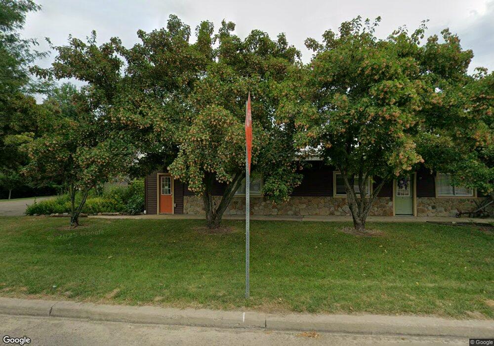
13993 Route 19 Waterford, PA 16441
Estimated Value: $148,000 - $273,000
--
Bed
--
Bath
6,148
Sq Ft
$35/Sq Ft
Est. Value
About This Home
This home is located at 13993 Route 19, Waterford, PA 16441 and is currently estimated at $218,000, approximately $35 per square foot. 13993 Route 19 is a home with nearby schools including Fort Leboeuf Middle School and Fort Leboeuf Senior High School.
Ownership History
Date
Name
Owned For
Owner Type
Purchase Details
Closed on
Dec 4, 2008
Sold by
Northwest Savings Bank
Bought by
Menoher Deborah J
Current Estimated Value
Purchase Details
Closed on
Feb 4, 2008
Sold by
Merry John P and Merry Ann N
Bought by
Northwest Savings Bank
Purchase Details
Closed on
Jun 8, 2005
Sold by
Merry John P and Merry Ann N
Bought by
Commonwealth Of Pennsylvania
Purchase Details
Closed on
Sep 10, 2002
Sold by
Fuller Elmer C and Fuller Susan M
Bought by
Merry John P and Merry Ann N
Create a Home Valuation Report for This Property
The Home Valuation Report is an in-depth analysis detailing your home's value as well as a comparison with similar homes in the area
Home Values in the Area
Average Home Value in this Area
Purchase History
| Date | Buyer | Sale Price | Title Company |
|---|---|---|---|
| Menoher Deborah J | $70,000 | None Available | |
| Northwest Savings Bank | -- | None Available | |
| Commonwealth Of Pennsylvania | -- | -- | |
| Merry John P | $110,000 | -- |
Source: Public Records
Tax History Compared to Growth
Tax History
| Year | Tax Paid | Tax Assessment Tax Assessment Total Assessment is a certain percentage of the fair market value that is determined by local assessors to be the total taxable value of land and additions on the property. | Land | Improvement |
|---|---|---|---|---|
| 2025 | $2,773 | $121,400 | $14,400 | $107,000 |
| 2024 | $2,604 | $121,400 | $14,400 | $107,000 |
| 2023 | $2,525 | $121,400 | $14,400 | $107,000 |
| 2022 | $2,461 | $121,400 | $14,400 | $107,000 |
| 2021 | $2,405 | $121,400 | $14,400 | $107,000 |
| 2020 | $2,314 | $121,400 | $14,400 | $107,000 |
| 2019 | $2,284 | $121,400 | $14,400 | $107,000 |
| 2018 | $2,247 | $121,400 | $14,400 | $107,000 |
| 2017 | $2,190 | $121,400 | $14,400 | $107,000 |
| 2016 | $2,687 | $121,400 | $14,400 | $107,000 |
| 2015 | $2,656 | $121,400 | $14,400 | $107,000 |
| 2014 | $1,246 | $121,400 | $14,400 | $107,000 |
Source: Public Records
Map
Nearby Homes
- 2363 E Center St
- 13672 Route 19
- 1381 Kinter Hill Rd
- Tbd 1 Plank Rd Unit LotWP001
- Tbd Plank Rd
- 4060 Route 6
- TBD 1 Plank Rd
- TBD2 Plank Rd
- 3920 Stone Quarry Rd
- 34 Lincoln Ave
- 162 E 2nd St
- 3590 Draketown Rd
- 3254 Route 6n
- 0 E 3rd St
- 11226 Route
- 13251 Kline Rd
- 438 Circuit St
- 134 Primrose Ln
- 819 Chestnut St
- 9351 Peach St
- 13993 Us-19 Unit 4
- 13993 Us-19 Unit 5
- 13985 Route 19
- 22892 U S 19
- 22735 U S 19
- 14015 U S 19
- 14035 U S 19
- 14039 Route 19
- 13920 Route 19
- 14090 Route 19
- 13899 Route 19
- 13895 Route 19
- 13895 U S 19
- 14141 Route 19
- 0 Conneauttee Rd
- 00 Conneauttee Rd
- 14150 Route 19
- 13876 Route 19
- 13869 U S 19
- 13869 Route 19