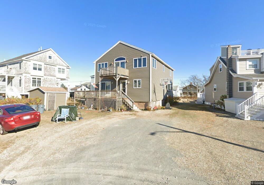
14 66th St Newburyport, MA 01950
Estimated Value: $1,242,000 - $1,434,000
3
Beds
4
Baths
2,378
Sq Ft
$555/Sq Ft
Est. Value
About This Home
This home is located at 14 66th St, Newburyport, MA 01950 and is currently estimated at $1,319,227, approximately $554 per square foot. 14 66th St is a home located in Essex County with nearby schools including Francis T. Bresnahan Elementary School, Edward G. Molin Elementary School, and Rupert A. Nock Middle School.
Create a Home Valuation Report for This Property
The Home Valuation Report is an in-depth analysis detailing your home's value as well as a comparison with similar homes in the area
Home Values in the Area
Average Home Value in this Area
Tax History Compared to Growth
Tax History
| Year | Tax Paid | Tax Assessment Tax Assessment Total Assessment is a certain percentage of the fair market value that is determined by local assessors to be the total taxable value of land and additions on the property. | Land | Improvement |
|---|---|---|---|---|
| 2025 | $9,291 | $969,800 | $460,700 | $509,100 |
| 2024 | $9,027 | $905,400 | $418,800 | $486,600 |
| 2023 | $7,923 | $737,700 | $332,400 | $405,300 |
| 2022 | $7,390 | $615,300 | $277,000 | $338,300 |
| 2021 | $7,397 | $585,200 | $273,700 | $311,500 |
| 2020 | $7,514 | $585,200 | $273,700 | $311,500 |
| 2019 | $8,251 | $630,800 | $262,700 | $368,100 |
| 2018 | $8,087 | $609,900 | $250,200 | $359,700 |
| 2017 | $8,043 | $598,000 | $238,300 | $359,700 |
| 2016 | $7,379 | $551,100 | $236,400 | $314,700 |
| 2015 | $7,352 | $551,100 | $236,400 | $314,700 |
Source: Public Records
Map
Nearby Homes
- 10 61st St Unit 10
- 12 63rd St
- 11 71st St
- 2 Shore St
- 12 53rd St
- 5 Harbor St
- 11 Harbor St
- 12 Barker St
- 163 Old Point Rd
- 128 Old Point Rd
- 7 Davoli Way
- 82 Northern Blvd
- 10 Meadowview Ln Unit B
- 2 Northern Blvd
- 11 Sunset Dr
- 2 Sunset Dr
- 4 Plum Bush Downs
- 28 & 30 Plum Island Turnpike
- 65 Plum Island Turnpike
- 14 Fordham Way