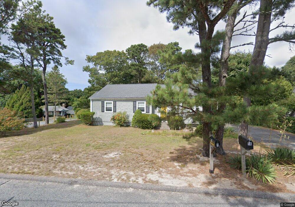
14 Agnes Rd South Dennis, MA 02660
South Dennis NeighborhoodEstimated Value: $524,798 - $545,000
3
Beds
1
Bath
1,001
Sq Ft
$534/Sq Ft
Est. Value
About This Home
This home is located at 14 Agnes Rd, South Dennis, MA 02660 and is currently estimated at $534,950, approximately $534 per square foot. 14 Agnes Rd is a home located in Barnstable County with nearby schools including Dennis-Yarmouth Regional High School.
Ownership History
Date
Name
Owned For
Owner Type
Purchase Details
Closed on
Mar 4, 2016
Sold by
Murthy Meena and Lepler James
Bought by
Judith J Gordon Irt and Murthy Meena A
Current Estimated Value
Purchase Details
Closed on
Nov 3, 2011
Sold by
Gordon Thomas and Gordon Judith
Bought by
Judith J Gordon Irt and Murthy Meena A
Purchase Details
Closed on
May 6, 2002
Sold by
Lemoine Beverly M
Bought by
Lepler James and Gordon Thomas
Purchase Details
Closed on
May 2, 2001
Sold by
Brennan Patricia J
Bought by
Lemoine Beverly M
Home Financials for this Owner
Home Financials are based on the most recent Mortgage that was taken out on this home.
Original Mortgage
$140,780
Interest Rate
6.85%
Mortgage Type
Purchase Money Mortgage
Create a Home Valuation Report for This Property
The Home Valuation Report is an in-depth analysis detailing your home's value as well as a comparison with similar homes in the area
Home Values in the Area
Average Home Value in this Area
Purchase History
| Date | Buyer | Sale Price | Title Company |
|---|---|---|---|
| Judith J Gordon Irt | $107,500 | -- | |
| Judith J Gordon Irt | -- | -- | |
| Lepler James | $190,000 | -- | |
| Lemoine Beverly M | $146,000 | -- |
Source: Public Records
Mortgage History
| Date | Status | Borrower | Loan Amount |
|---|---|---|---|
| Previous Owner | Lemoine Beverly M | $140,780 |
Source: Public Records
Tax History Compared to Growth
Tax History
| Year | Tax Paid | Tax Assessment Tax Assessment Total Assessment is a certain percentage of the fair market value that is determined by local assessors to be the total taxable value of land and additions on the property. | Land | Improvement |
|---|---|---|---|---|
| 2025 | $1,993 | $460,200 | $131,100 | $329,100 |
| 2024 | $1,844 | $420,100 | $126,100 | $294,000 |
| 2023 | $1,783 | $381,900 | $114,600 | $267,300 |
| 2022 | $1,754 | $313,200 | $114,700 | $198,500 |
| 2021 | $1,662 | $275,700 | $112,500 | $163,200 |
| 2020 | $1,590 | $260,600 | $112,500 | $148,100 |
| 2019 | $1,562 | $253,200 | $121,300 | $131,900 |
| 2018 | $1,416 | $223,400 | $105,000 | $118,400 |
| 2017 | $1,351 | $219,700 | $105,000 | $114,700 |
| 2016 | $1,337 | $204,700 | $110,200 | $94,500 |
| 2015 | $1,310 | $204,700 | $110,200 | $94,500 |
| 2014 | $1,225 | $192,900 | $94,500 | $98,400 |
Source: Public Records
Map
Nearby Homes
- 153 Bayridge Dr
- 4 Ebb Rd
- 11 Uncle Stanleys Way
- 15 Captain Jud Rd
- 17 Margate Ln
- 13 Covey Dr
- 118 Driftwood Ln
- 17 Fairmount Rd
- 129 Driftwood Ln
- 17 Fairmount Rd
- 111 Merchant Ave
- 10 Joanne Dr
- 7 Vinland Dr
- 25 Skerry Rd
- 6 Nimble Hill Dr
- 1 Norseman Dr
- 4 Old Colony Way
- 62 Old Fish House Rd
- 32 Captain Walsh Dr
- 59 Main St Unit 19-2