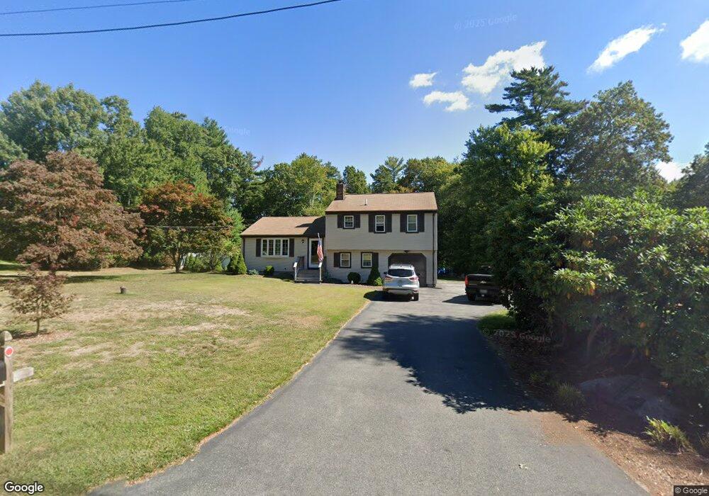
14 Algonquin Way East Freetown, MA 02717
Estimated Value: $555,000 - $660,000
3
Beds
2
Baths
1,694
Sq Ft
$358/Sq Ft
Est. Value
About This Home
This home is located at 14 Algonquin Way, East Freetown, MA 02717 and is currently estimated at $606,992, approximately $358 per square foot. 14 Algonquin Way is a home located in Bristol County with nearby schools including Freetown Elementary School, George R Austin Intermediate School, and Freetown-Lakeville Middle School.
Ownership History
Date
Name
Owned For
Owner Type
Purchase Details
Closed on
Mar 10, 2020
Sold by
Weiner Jerry A and Weiner Carol M
Bought by
Weiner Lt
Current Estimated Value
Purchase Details
Closed on
Jun 20, 1983
Bought by
Weiner Jerry A and Weiner Carol M
Create a Home Valuation Report for This Property
The Home Valuation Report is an in-depth analysis detailing your home's value as well as a comparison with similar homes in the area
Home Values in the Area
Average Home Value in this Area
Purchase History
| Date | Buyer | Sale Price | Title Company |
|---|---|---|---|
| Weiner Lt | -- | None Available | |
| Weiner Jerry A | $63,000 | -- |
Source: Public Records
Mortgage History
| Date | Status | Borrower | Loan Amount |
|---|---|---|---|
| Previous Owner | Weiner Jerry A | $50,000 | |
| Previous Owner | Weiner Jerry A | $50,000 |
Source: Public Records
Tax History Compared to Growth
Tax History
| Year | Tax Paid | Tax Assessment Tax Assessment Total Assessment is a certain percentage of the fair market value that is determined by local assessors to be the total taxable value of land and additions on the property. | Land | Improvement |
|---|---|---|---|---|
| 2025 | $4,602 | $464,400 | $180,500 | $283,900 |
| 2024 | $4,608 | $441,800 | $170,300 | $271,500 |
| 2023 | $4,466 | $417,000 | $153,300 | $263,700 |
| 2022 | $4,254 | $352,700 | $129,900 | $222,800 |
| 2021 | $4,110 | $323,600 | $118,100 | $205,500 |
| 2020 | $3,940 | $302,600 | $113,600 | $189,000 |
| 2019 | $3,723 | $283,100 | $108,200 | $174,900 |
| 2018 | $3,548 | $266,600 | $108,200 | $158,400 |
| 2017 | $3,453 | $259,200 | $108,200 | $151,000 |
| 2016 | $3,320 | $253,600 | $105,100 | $148,500 |
| 2015 | $3,259 | $252,600 | $105,100 | $147,500 |
| 2014 | $3,142 | $249,200 | $102,900 | $146,300 |
Source: Public Records
Map
Nearby Homes
- 144 Chace Rd
- 150 Quanapoag Rd
- Lot 2/3 Quanapoag Rd
- 0 Costa Dr
- 599 Quanapoag Rd
- 195 Slab Bridge Rd
- 1475 Braley Rd Unit 17
- 264 Collins Corner Rd
- 13 Luscomb Ln
- 16 Swallow St
- 4597 Acushnet Ave
- 1069 Cherokee St
- 353 Upland St
- 64 Blaze Rd
- 319 Northwest St
- 300 High Hill Rd
- 210 Heritage Dr
- 34 Poplar Rd
- 145 Heritage Dr
- 24 Bells Brook Rd
- 12 Algonquin Way
- 16 Algonquin Way
- 13 Algonquin Way
- 11 Algonquin Way
- 15 Algonquin Way
- 10 Algonquin Way
- 18 Algonquin Way
- 9 Algonquin Way
- 4 Wamsutta Way
- 8 Algonquin Way
- 137 Bullock Rd
- 7 Algonquin Way
- 135 Bullock Rd
- 139 Bullock Rd
- 133 Bullock Rd
- 5 Wamsutta Way
- 152 Chipaway Rd
- 6 Algonquin Way
- 3 Fall Brook Ln
- 5 Fall Brook Ln