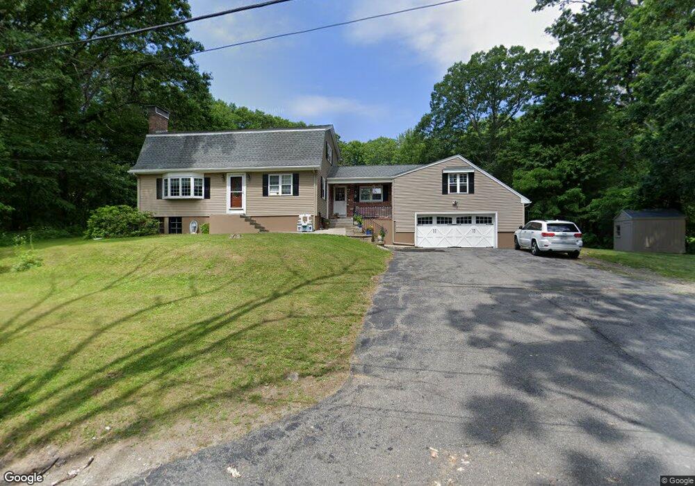
14 Alstead Path Millbury, MA 01527
Estimated Value: $538,435 - $660,000
3
Beds
2
Baths
2,067
Sq Ft
$294/Sq Ft
Est. Value
About This Home
This home is located at 14 Alstead Path, Millbury, MA 01527 and is currently estimated at $607,609, approximately $293 per square foot. 14 Alstead Path is a home located in Worcester County with nearby schools including Elmwood Street Elementary School, Raymond E. Shaw Elementary School, and Millbury Junior/Senior High School.
Create a Home Valuation Report for This Property
The Home Valuation Report is an in-depth analysis detailing your home's value as well as a comparison with similar homes in the area
Home Values in the Area
Average Home Value in this Area
Tax History
| Year | Tax Paid | Tax Assessment Tax Assessment Total Assessment is a certain percentage of the fair market value that is determined by local assessors to be the total taxable value of land and additions on the property. | Land | Improvement |
|---|---|---|---|---|
| 2025 | $6,778 | $506,200 | $128,400 | $377,800 |
| 2024 | $6,214 | $469,700 | $118,900 | $350,800 |
| 2023 | $5,455 | $377,500 | $83,200 | $294,300 |
| 2022 | $4,947 | $329,800 | $83,200 | $246,600 |
| 2021 | $526 | $316,800 | $83,200 | $233,600 |
| 2020 | $113 | $312,400 | $83,200 | $229,200 |
| 2019 | $4,390 | $277,000 | $75,500 | $201,500 |
| 2018 | $2,477 | $267,000 | $75,500 | $191,500 |
| 2017 | $4,567 | $249,000 | $75,500 | $173,500 |
| 2016 | $100 | $232,000 | $75,500 | $156,500 |
| 2015 | $3,773 | $229,200 | $80,200 | $149,000 |
| 2014 | $3,875 | $226,600 | $80,200 | $146,400 |
Source: Public Records
Map
Nearby Homes
- 25 Upton St
- 2 Wilson Rd Unit B
- 2 Wilson Rd Unit A
- 2 Diane St
- 10 Logan's Run Unit 10
- 12 Irene Ct
- 38 Garnet St
- 457 Granite St
- 405 Granite St
- 2 Riverlin Pkwy
- 18 Lincoln Ave
- 1459 Grafton Rd
- 3 Julien Ave
- 17 Lincoln Ave
- 11 Maplewood Rd
- 464-466 Granite St
- 460-462 Granite St
- 460-466 Granite St
- 75 Main St
- 1260 Grafton St
Your Personal Tour Guide
Ask me questions while you tour the home.