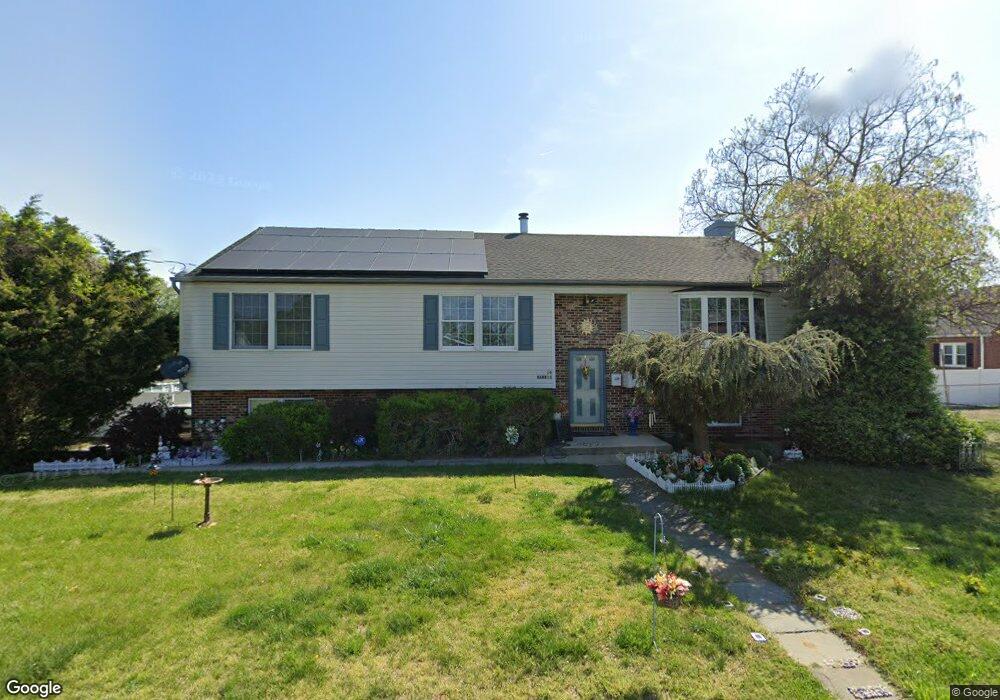
14 Bailey Ln Gibbstown, NJ 08027
Estimated Value: $476,259
3
Beds
3
Baths
2,116
Sq Ft
$225/Sq Ft
Est. Value
About This Home
This home is located at 14 Bailey Ln, Gibbstown, NJ 08027 and is currently estimated at $476,259, approximately $225 per square foot. 14 Bailey Ln is a home located in Gloucester County with nearby schools including Nehaunsey Middle School and Guardian Angels Regional School.
Ownership History
Date
Name
Owned For
Owner Type
Purchase Details
Closed on
Feb 10, 2022
Sold by
Harris Willie M
Bought by
Harris Willie M and Harris Irmgard
Current Estimated Value
Purchase Details
Closed on
Jan 7, 2011
Sold by
Desalvo Joseph A and Desalvo Lori L
Bought by
Harris Willie M
Home Financials for this Owner
Home Financials are based on the most recent Mortgage that was taken out on this home.
Original Mortgage
$231,000
Interest Rate
3.75%
Mortgage Type
VA
Purchase Details
Closed on
Mar 23, 2009
Sold by
Desalvo Joseph A
Bought by
Desalvo Joseph A and Desalvo Lori L
Home Financials for this Owner
Home Financials are based on the most recent Mortgage that was taken out on this home.
Original Mortgage
$140,000
Interest Rate
4.93%
Mortgage Type
New Conventional
Create a Home Valuation Report for This Property
The Home Valuation Report is an in-depth analysis detailing your home's value as well as a comparison with similar homes in the area
Home Values in the Area
Average Home Value in this Area
Purchase History
| Date | Buyer | Sale Price | Title Company |
|---|---|---|---|
| Harris Willie M | -- | Gaglione Marla D | |
| Harris Willie M | $238,000 | None Available | |
| Desalvo Joseph A | -- | Hunter Title Agency Inc |
Source: Public Records
Mortgage History
| Date | Status | Borrower | Loan Amount |
|---|---|---|---|
| Previous Owner | Harris Willie M | $231,000 | |
| Previous Owner | Desalvo Joseph A | $140,000 |
Source: Public Records
Tax History
| Year | Tax Paid | Tax Assessment Tax Assessment Total Assessment is a certain percentage of the fair market value that is determined by local assessors to be the total taxable value of land and additions on the property. | Land | Improvement |
|---|---|---|---|---|
| 2025 | -- | $197,800 | $32,100 | $165,700 |
| 2024 | -- | $197,800 | $32,100 | $165,700 |
| 2023 | -- | $197,800 | $32,100 | $165,700 |
| 2022 | -- | $197,800 | $32,100 | $165,700 |
| 2021 | $6,298 | $197,800 | $32,100 | $165,700 |
| 2020 | $0 | $197,800 | $32,100 | $165,700 |
| 2019 | $6,482 | $197,800 | $32,100 | $165,700 |
| 2018 | $6,298 | $197,800 | $32,100 | $165,700 |
| 2017 | $6,146 | $197,800 | $32,100 | $165,700 |
| 2016 | $6,078 | $197,800 | $32,100 | $165,700 |
| 2015 | $5,883 | $197,800 | $32,100 | $165,700 |
| 2014 | $5,629 | $197,800 | $32,100 | $165,700 |
Source: Public Records
Map
Nearby Homes
- 37 Harmony Rd
- 354 Memorial Ave
- 361 Democrat Rd
- 433 Jefferson St
- 622 W Broad St
- 312 Croce Ave
- 765 Willow Dr
- 318 W Buck St
- 403 W Broad St
- L18 20 W Broad St
- 255 Elizabeth Ave
- 311 Morton Ave
- 1003 Hoffman Ave
- 227 W Washington St
- 227 W Buck St
- 205 W Adams St
- 53-55 Roosevelt St
- 1224 Heddon Ave
- 122 W Washington St
- 1221 Walter Ave
- 143 E Broad St
- 149 E Broad St
- 153 E Broad St
- 127 E Vine St
- 133 E Broad St
- 122 E Vine St
- 161 E Broad St
- 129 E Broad St
- 123 E Vine St
- 119 E Broad St
- 146 E Broad St
- 136 E Broad St
- 150 E Broad St
- 201 E Broad St
- 126 E Broad St Unit 128
- 154 E Broad St
- 101 E Vine St
- 917 Billingsport Rd Unit 3
- 917 Billingsport Rd
- 917 Billingsport Rd Unit 2
Your Personal Tour Guide
Ask me questions while you tour the home.