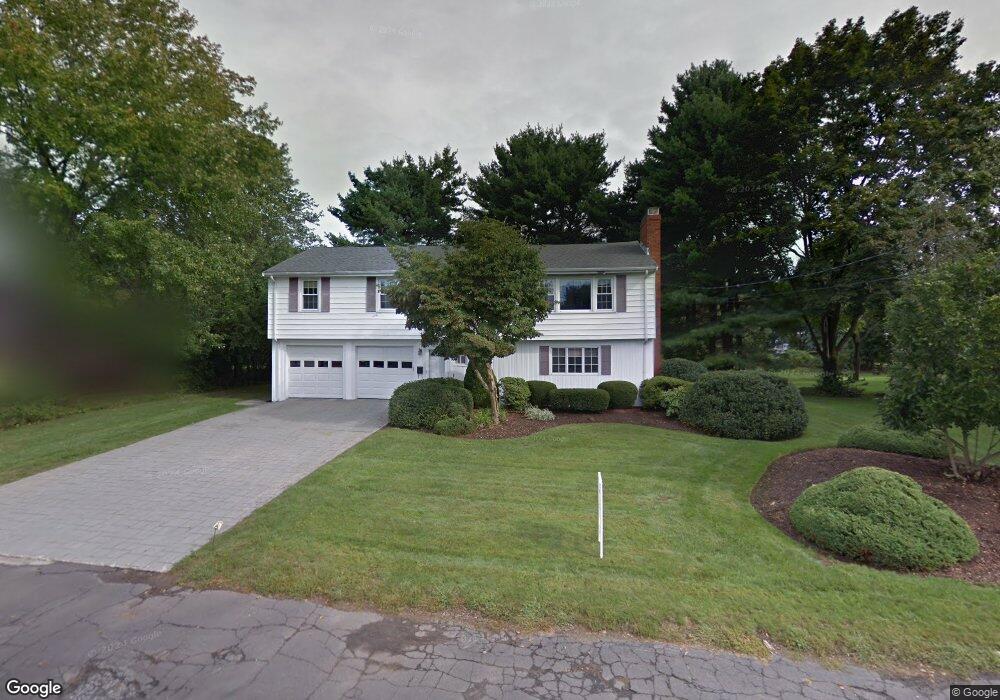
14 Bellwood Way Unit 14 Framingham, MA 01701
Estimated Value: $814,000 - $888,245
5
Beds
3
Baths
3,500
Sq Ft
$244/Sq Ft
Est. Value
About This Home
This home is located at 14 Bellwood Way Unit 14, Framingham, MA 01701 and is currently estimated at $854,811, approximately $244 per square foot. 14 Bellwood Way Unit 14 is a home located in Middlesex County with nearby schools including Framingham High School, Summit Montessori School, and Sudbury Valley School.
Ownership History
Date
Name
Owned For
Owner Type
Purchase Details
Closed on
Aug 16, 2013
Sold by
Abushanab Daniel N and Abushanab Heather L
Bought by
Kalajian Michael S and Kalajian Michelle M
Current Estimated Value
Home Financials for this Owner
Home Financials are based on the most recent Mortgage that was taken out on this home.
Original Mortgage
$424,175
Outstanding Balance
$314,434
Interest Rate
4.31%
Mortgage Type
New Conventional
Estimated Equity
$540,377
Purchase Details
Closed on
Jan 27, 1999
Sold by
Levy Elliot S and Olasky-Levy Joanne
Bought by
Abushanab Daniel N and Abushanab Heather L
Purchase Details
Closed on
Dec 18, 1992
Sold by
Soto Enrique A and Soto Donna M
Bought by
Levy Elliot S and Olasky-Levy Jaonne
Create a Home Valuation Report for This Property
The Home Valuation Report is an in-depth analysis detailing your home's value as well as a comparison with similar homes in the area
Home Values in the Area
Average Home Value in this Area
Purchase History
| Date | Buyer | Sale Price | Title Company |
|---|---|---|---|
| Kalajian Michael S | $432,000 | -- | |
| Kalajian Michael S | $432,000 | -- | |
| Abushanab Daniel N | $280,000 | -- | |
| Levy Elliot S | $216,000 | -- | |
| Levy Elliot S | $216,000 | -- |
Source: Public Records
Mortgage History
| Date | Status | Borrower | Loan Amount |
|---|---|---|---|
| Open | Kalajian Michael S | $424,175 | |
| Closed | Levy Elliot S | $424,175 | |
| Previous Owner | Levy Elliot S | $311,250 |
Source: Public Records
Tax History Compared to Growth
Tax History
| Year | Tax Paid | Tax Assessment Tax Assessment Total Assessment is a certain percentage of the fair market value that is determined by local assessors to be the total taxable value of land and additions on the property. | Land | Improvement |
|---|---|---|---|---|
| 2025 | $8,904 | $745,700 | $318,500 | $427,200 |
| 2024 | $8,842 | $709,600 | $283,800 | $425,800 |
| 2023 | $8,459 | $646,200 | $261,500 | $384,700 |
| 2022 | $8,085 | $588,400 | $237,600 | $350,800 |
| 2021 | $8,066 | $574,100 | $228,200 | $345,900 |
| 2020 | $8,106 | $541,100 | $207,600 | $333,500 |
| 2019 | $7,542 | $490,400 | $184,000 | $306,400 |
| 2018 | $7,476 | $458,100 | $180,400 | $277,700 |
| 2017 | $7,204 | $431,100 | $175,100 | $256,000 |
| 2016 | $7,117 | $409,500 | $176,800 | $232,700 |
| 2015 | $7,096 | $398,200 | $176,800 | $221,400 |
Source: Public Records
Map
Nearby Homes
- 26 Knight Rd
- 401 Belknap Rd
- 15 Clearview Dr
- 10 Millwood St
- 10 Millwood Cir
- 341 Pleasant St
- 576 Grove St
- 11 Cavatorta Dr
- 616 Grove St
- 27 Flanagan Dr
- 10 Kings Row Ln
- 37 Westgate Rd
- 18 Eagle Ln Unit 21
- 641 Grove St
- 1327 Old Worcester Rd
- 13 Hawk Ln Unit 13
- 4 Callahan Dr Unit 4
- 5 Pioneer Rd Unit 5
- 9 Pleasantview Terrace
- 7 Pioneer Rd Unit 7