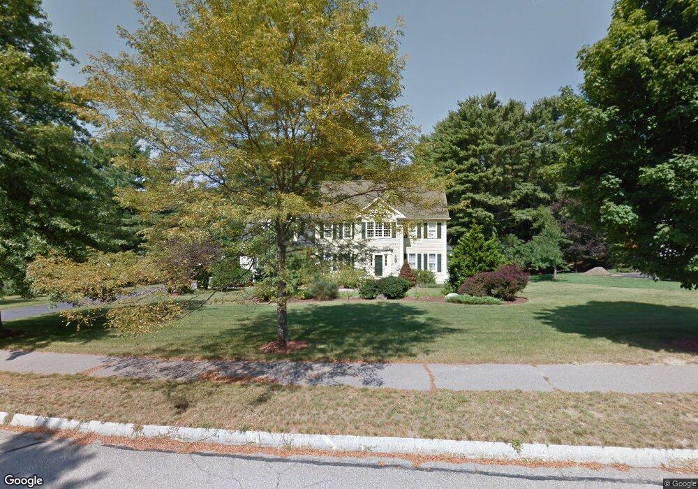
14 Berkshire St Norfolk, MA 02056
Estimated Value: $923,476 - $1,083,000
4
Beds
3
Baths
2,620
Sq Ft
$375/Sq Ft
Est. Value
About This Home
This home is located at 14 Berkshire St, Norfolk, MA 02056 and is currently estimated at $982,619, approximately $375 per square foot. 14 Berkshire St is a home located in Norfolk County with nearby schools including H. Olive Day School, Freeman-Kennedy School, and Woodside Montessori Academy.
Ownership History
Date
Name
Owned For
Owner Type
Purchase Details
Closed on
May 1, 1997
Sold by
Colwell Tr Calvin W and Colwell Tr Scott W
Bought by
Mccarthy Robert J and Mccarthy Elaine G
Current Estimated Value
Home Financials for this Owner
Home Financials are based on the most recent Mortgage that was taken out on this home.
Original Mortgage
$272,000
Interest Rate
7.85%
Mortgage Type
Purchase Money Mortgage
Create a Home Valuation Report for This Property
The Home Valuation Report is an in-depth analysis detailing your home's value as well as a comparison with similar homes in the area
Home Values in the Area
Average Home Value in this Area
Purchase History
| Date | Buyer | Sale Price | Title Company |
|---|---|---|---|
| Mccarthy Robert J | $345,000 | -- | |
| Mccarthy Robert J | $345,000 | -- |
Source: Public Records
Mortgage History
| Date | Status | Borrower | Loan Amount |
|---|---|---|---|
| Open | Mccarthy Robert J | $293,000 | |
| Closed | Mccarthy Robert J | $270,000 | |
| Closed | Mccarthy Robert J | $272,000 |
Source: Public Records
Tax History Compared to Growth
Tax History
| Year | Tax Paid | Tax Assessment Tax Assessment Total Assessment is a certain percentage of the fair market value that is determined by local assessors to be the total taxable value of land and additions on the property. | Land | Improvement |
|---|---|---|---|---|
| 2025 | $12,760 | $799,000 | $191,100 | $607,900 |
| 2024 | $12,003 | $770,900 | $192,300 | $578,600 |
| 2023 | $11,705 | $713,300 | $192,300 | $521,000 |
| 2022 | $10,771 | $591,800 | $180,800 | $411,000 |
| 2021 | $10,413 | $578,800 | $186,700 | $392,100 |
| 2020 | $10,817 | $580,300 | $187,400 | $392,900 |
| 2019 | $10,402 | $568,700 | $187,400 | $381,300 |
| 2018 | $10,109 | $542,900 | $196,500 | $346,400 |
| 2017 | $9,966 | $547,000 | $196,500 | $350,500 |
| 2016 | $9,781 | $541,000 | $201,800 | $339,200 |
| 2015 | $9,455 | $535,400 | $192,300 | $343,100 |
| 2014 | $9,262 | $531,400 | $192,300 | $339,100 |
Source: Public Records
Map
Nearby Homes
- 14 Essex St
- 45 Joshua Rd
- 8 Analore Cir
- 20 Waites Crossing
- 13 Waites Crossing
- 19 Waites Crossing
- 9 Waites Crossing
- 8 Waites Crossing
- 11 Waites Crossing
- 32 Waites Crossing
- 23 Fredrickson Rd
- 14 Robin Rd
- 26 Ridge Rd
- 12 Waites Crossing Way
- 50 Reed Fulton Ave Unit Lot 61
- 38 Robin Rd
- 3 Pheasanthill Rd
- 246 Forest Grove Ave
- 6 Trailside Way
- 6 Forest Grove Ave