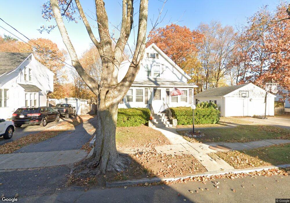
14 Brackett Ave Stoneham, MA 02180
Colonial Park NeighborhoodEstimated Value: $657,000 - $741,000
2
Beds
2
Baths
1,370
Sq Ft
$508/Sq Ft
Est. Value
About This Home
This home is located at 14 Brackett Ave, Stoneham, MA 02180 and is currently estimated at $695,711, approximately $507 per square foot. 14 Brackett Ave is a home located in Middlesex County with nearby schools including Stoneham High School, St Joseph School, and St. Patrick Elementary School.
Ownership History
Date
Name
Owned For
Owner Type
Purchase Details
Closed on
Nov 16, 2022
Sold by
Pluckett Maria C
Bought by
Biscotti Realty Llc
Current Estimated Value
Purchase Details
Closed on
Sep 23, 2022
Sold by
Scalelle Irt
Bought by
Plunkett Maria C
Purchase Details
Closed on
Oct 4, 2007
Sold by
Int Venturo
Bought by
Scalelle Irt
Purchase Details
Closed on
Oct 16, 2003
Sold by
Venturo Antonio and Venturo Esterina
Bought by
Investt Venturo
Create a Home Valuation Report for This Property
The Home Valuation Report is an in-depth analysis detailing your home's value as well as a comparison with similar homes in the area
Home Values in the Area
Average Home Value in this Area
Purchase History
| Date | Buyer | Sale Price | Title Company |
|---|---|---|---|
| Biscotti Realty Llc | -- | None Available | |
| Plunkett Maria C | -- | None Available | |
| Scalelle Irt | -- | -- | |
| Investt Venturo | -- | -- |
Source: Public Records
Tax History Compared to Growth
Tax History
| Year | Tax Paid | Tax Assessment Tax Assessment Total Assessment is a certain percentage of the fair market value that is determined by local assessors to be the total taxable value of land and additions on the property. | Land | Improvement |
|---|---|---|---|---|
| 2025 | $5,830 | $569,900 | $365,700 | $204,200 |
| 2024 | $5,574 | $526,300 | $336,900 | $189,400 |
| 2023 | $5,407 | $487,100 | $308,000 | $179,100 |
| 2022 | $4,663 | $447,900 | $279,100 | $168,800 |
| 2021 | $4,714 | $435,700 | $269,500 | $166,200 |
| 2020 | $4,551 | $421,800 | $257,900 | $163,900 |
| 2019 | $4,448 | $396,400 | $242,500 | $153,900 |
| 2018 | $4,394 | $375,200 | $219,700 | $155,500 |
| 2017 | $4,661 | $376,200 | $206,800 | $169,400 |
| 2016 | $4,262 | $335,600 | $206,800 | $128,800 |
| 2015 | $4,146 | $319,900 | $197,400 | $122,500 |
| 2014 | $4,448 | $329,700 | $188,000 | $141,700 |
Source: Public Records
Map
Nearby Homes
- 32 Garden Rd
- 34 Duncklee Ave
- 59 Norval Ave
- 4 Vernon Ave
- 25 Penny Ln
- 106 Elm St
- 20 Myrtle St
- 13 Washington Ave
- 21 Tremont St Unit A
- 43 Pomeworth St Unit 44
- 1 Tremont St
- 62 High St Unit 4
- 62 High St Unit 3
- 62 High St Unit Lot 12
- 62 High St Unit Lot 2
- 62 High St Unit Lot 7
- 62 High St Unit Lot 9
- 8 Steele St
- 97 Macarthur Rd
- 4 Gavin Cir
- 12 Brackett Ave
- 16 Brackett Ave
- 10 Brackett Ave
- 23 Stonecroft Ave
- 13 Brackett Ave
- 15 Brackett Ave
- 11 Brackett Ave
- 22 Garden Rd
- 20 Brackett Ave
- 8 Brackett Ave
- 19 Brackett Ave
- 7 Brackett Ave
- 20 Stonecroft Ave
- 6 Brackett Ave
- 34 Norval Ave
- 30 Norval Ave
- 38 Norval Ave
- 17 Garden Rd
- 15 Garden Rd
- 3 Brackett Ave