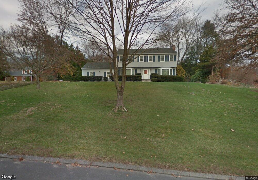
14 Brenner Rd Norwalk, CT 06851
Cranbury NeighborhoodEstimated Value: $830,000 - $1,053,000
4
Beds
3
Baths
2,324
Sq Ft
$411/Sq Ft
Est. Value
About This Home
This home is located at 14 Brenner Rd, Norwalk, CT 06851 and is currently estimated at $955,781, approximately $411 per square foot. 14 Brenner Rd is a home located in Fairfield County with nearby schools including Cranbury Elementary School, West Rocks Middle School, and Norwalk High School.
Ownership History
Date
Name
Owned For
Owner Type
Purchase Details
Closed on
Oct 17, 1989
Sold by
Craig Philip
Bought by
Tarantino Patrick
Current Estimated Value
Home Financials for this Owner
Home Financials are based on the most recent Mortgage that was taken out on this home.
Original Mortgage
$120,000
Interest Rate
10.13%
Mortgage Type
Purchase Money Mortgage
Create a Home Valuation Report for This Property
The Home Valuation Report is an in-depth analysis detailing your home's value as well as a comparison with similar homes in the area
Home Values in the Area
Average Home Value in this Area
Purchase History
| Date | Buyer | Sale Price | Title Company |
|---|---|---|---|
| Tarantino Patrick | $346,500 | -- |
Source: Public Records
Mortgage History
| Date | Status | Borrower | Loan Amount |
|---|---|---|---|
| Open | Tarantino Patrick | $63,000 | |
| Closed | Tarantino Patrick | $82,000 | |
| Closed | Tarantino Patrick | $112,000 | |
| Closed | Tarantino Patrick | $120,000 |
Source: Public Records
Tax History
| Year | Tax Paid | Tax Assessment Tax Assessment Total Assessment is a certain percentage of the fair market value that is determined by local assessors to be the total taxable value of land and additions on the property. | Land | Improvement |
|---|---|---|---|---|
| 2025 | $12,691 | $534,570 | $242,660 | $291,910 |
| 2024 | $12,496 | $534,570 | $242,660 | $291,910 |
| 2023 | $10,689 | $428,150 | $194,130 | $234,020 |
| 2022 | $10,521 | $428,150 | $194,130 | $234,020 |
| 2021 | $8,953 | $428,150 | $194,130 | $234,020 |
| 2020 | $10,107 | $428,150 | $194,130 | $234,020 |
| 2019 | $9,761 | $428,150 | $194,130 | $234,020 |
| 2018 | $10,160 | $391,820 | $209,220 | $182,600 |
| 2017 | $9,805 | $391,820 | $209,220 | $182,600 |
| 2016 | $9,968 | $391,820 | $209,220 | $182,600 |
| 2015 | $8,953 | $391,820 | $209,220 | $182,600 |
| 2014 | $9,811 | $391,820 | $209,220 | $182,600 |
Source: Public Records
Map
Nearby Homes
Your Personal Tour Guide
Ask me questions while you tour the home.