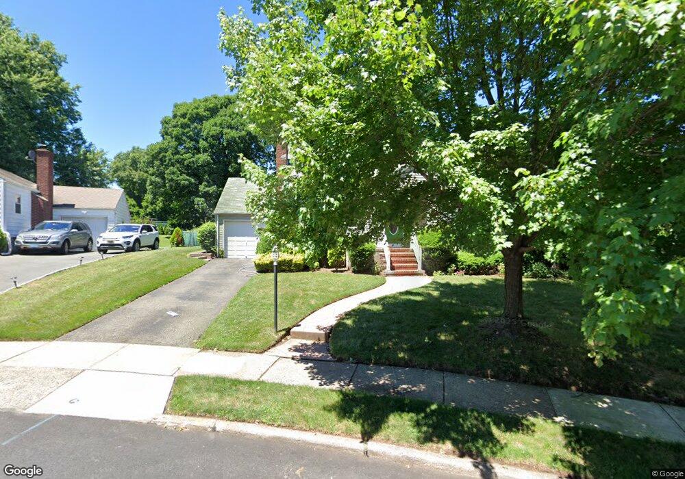
14 Broadale Ave Clifton, NJ 07013
Montclair Heights NeighborhoodEstimated Value: $618,000 - $1,222,000
--
Bed
--
Bath
3,873
Sq Ft
$241/Sq Ft
Est. Value
About This Home
This home is located at 14 Broadale Ave, Clifton, NJ 07013 and is currently estimated at $934,478, approximately $241 per square foot. 14 Broadale Ave is a home located in Passaic County with nearby schools including Clifton High School, Saint Philip the Apostle Preparatory School, and The Magical Palace of Knowledge.
Ownership History
Date
Name
Owned For
Owner Type
Purchase Details
Closed on
Jun 22, 2018
Sold by
Patel Ketankumar and Patel Taukumar K
Bought by
Patel Ketankumar and Patel Rinkuben
Current Estimated Value
Purchase Details
Closed on
May 24, 2012
Sold by
Patel Ketankumar
Bought by
Patel Ketankumar
Home Financials for this Owner
Home Financials are based on the most recent Mortgage that was taken out on this home.
Original Mortgage
$307,292
Outstanding Balance
$216,369
Interest Rate
4.25%
Mortgage Type
FHA
Estimated Equity
$718,109
Purchase Details
Closed on
Oct 15, 2009
Sold by
Stys Susan E and Boscia Nicholas L
Bought by
Patel Ketankumar and Patel Tarukumar K
Home Financials for this Owner
Home Financials are based on the most recent Mortgage that was taken out on this home.
Original Mortgage
$313,390
Interest Rate
4.86%
Mortgage Type
FHA
Create a Home Valuation Report for This Property
The Home Valuation Report is an in-depth analysis detailing your home's value as well as a comparison with similar homes in the area
Home Values in the Area
Average Home Value in this Area
Purchase History
| Date | Buyer | Sale Price | Title Company |
|---|---|---|---|
| Patel Ketankumar | -- | None Available | |
| Patel Ketankumar | -- | None Available | |
| Patel Ketankumar | $405,000 | -- |
Source: Public Records
Mortgage History
| Date | Status | Borrower | Loan Amount |
|---|---|---|---|
| Open | Patel Ketankumar | $307,292 | |
| Previous Owner | Patel Ketankumar | $313,390 |
Source: Public Records
Tax History Compared to Growth
Tax History
| Year | Tax Paid | Tax Assessment Tax Assessment Total Assessment is a certain percentage of the fair market value that is determined by local assessors to be the total taxable value of land and additions on the property. | Land | Improvement |
|---|---|---|---|---|
| 2025 | $21,714 | $365,800 | $106,500 | $259,300 |
| 2024 | $21,194 | $365,800 | $106,500 | $259,300 |
| 2022 | $20,713 | $365,800 | $106,500 | $259,300 |
| 2021 | $11,640 | $212,600 | $106,500 | $106,100 |
| 2020 | $11,678 | $212,600 | $106,500 | $106,100 |
| 2019 | $11,595 | $212,600 | $106,500 | $106,100 |
| 2018 | $11,529 | $212,600 | $106,500 | $106,100 |
| 2017 | $11,404 | $212,600 | $106,500 | $106,100 |
| 2016 | $11,183 | $212,600 | $106,500 | $106,100 |
| 2015 | $11,074 | $212,600 | $106,500 | $106,100 |
| 2014 | $10,847 | $212,600 | $106,500 | $106,100 |
Source: Public Records
Map
Nearby Homes
- 29 Lennon Place
- 33 Graydon Terrace
- 43 Graydon Terrace
- 479 Grove St
- 30 Notch Rd
- 119 Highview Dr
- 565 Grove St Unit B12
- 15 Scott Terrace
- 68 Doherty Dr
- 54 Doherty Dr
- 605 Grove St Unit 4
- 605 Grove St Unit 11
- 148 Urma Ave
- 77 Huemmer Terrace
- 65 Macarthur Dr
- 83 Larkspur Ln
- 69 Larkspur Ln
- 36 Independence Ct
- 32 Greendale Rd
- 124 Thanksgiving Ln