Estimated Value: $1,322,000 - $1,567,000
4
Beds
4
Baths
3,400
Sq Ft
$412/Sq Ft
Est. Value
About This Home
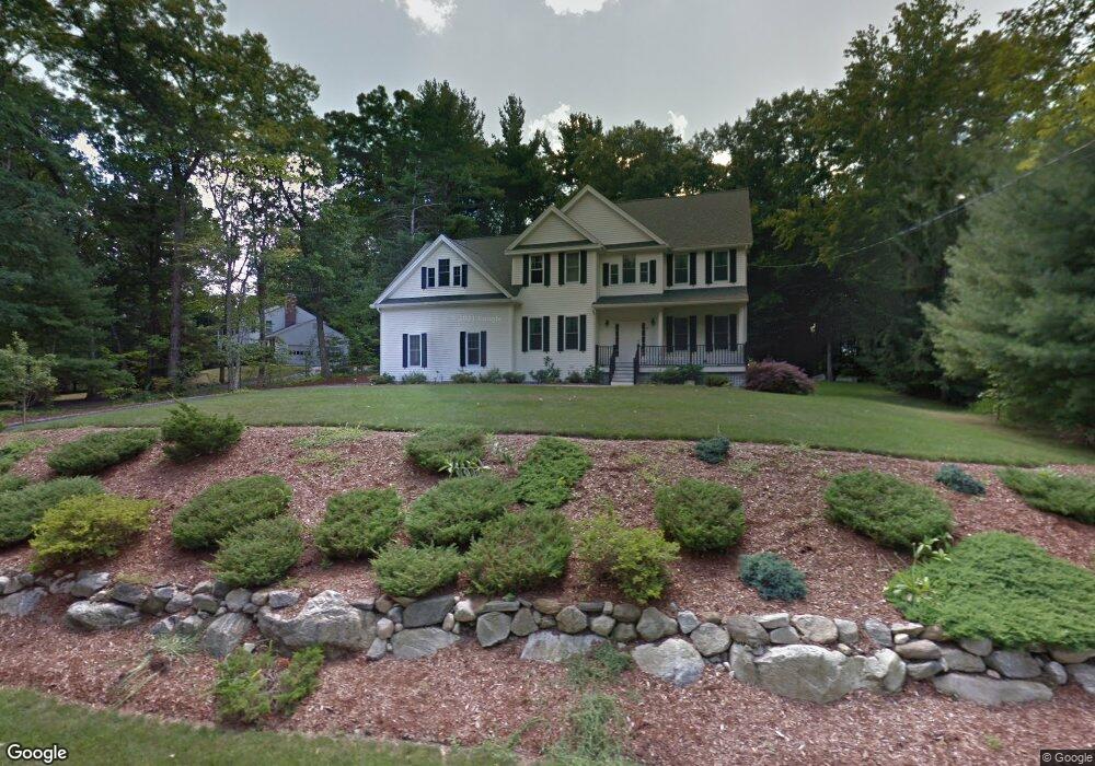
This home is located at 14 Captain Forbush Ln, Acton, MA 01720 and is currently estimated at $1,399,752, approximately $411 per square foot. 14 Captain Forbush Ln is a home located in Middlesex County with nearby schools including Acton-Boxborough Regional High School and The Imago School.
Ownership History
Date
Name
Owned For
Owner Type
Purchase Details
Closed on
Feb 16, 2010
Sold by
Centennial Lane Llc
Bought by
Nanda Nihar K and Kar Sushree
Current Estimated Value
Home Financials for this Owner
Home Financials are based on the most recent Mortgage that was taken out on this home.
Original Mortgage
$523,750
Outstanding Balance
$345,457
Interest Rate
5.12%
Mortgage Type
Purchase Money Mortgage
Estimated Equity
$1,054,295
Purchase Details
Closed on
Aug 11, 2009
Sold by
Est Reedy George P and Reynolds Colleen
Bought by
Centennial Lane Llc
Home Financials for this Owner
Home Financials are based on the most recent Mortgage that was taken out on this home.
Original Mortgage
$511,750
Interest Rate
5.47%
Mortgage Type
Purchase Money Mortgage
Create a Home Valuation Report for This Property
The Home Valuation Report is an in-depth analysis detailing your home's value as well as a comparison with similar homes in the area
Home Values in the Area
Average Home Value in this Area
Purchase History
| Date | Buyer | Sale Price | Title Company |
|---|---|---|---|
| Nanda Nihar K | $799,888 | -- | |
| Nanda Nihar K | $799,888 | -- | |
| Centennial Lane Llc | $305,000 | -- |
Source: Public Records
Mortgage History
| Date | Status | Borrower | Loan Amount |
|---|---|---|---|
| Open | Nanda Nihar K | $523,750 | |
| Closed | Nanda Nihar K | $523,750 | |
| Previous Owner | Centennial Lane Llc | $511,750 |
Source: Public Records
Tax History Compared to Growth
Tax History
| Year | Tax Paid | Tax Assessment Tax Assessment Total Assessment is a certain percentage of the fair market value that is determined by local assessors to be the total taxable value of land and additions on the property. | Land | Improvement |
|---|---|---|---|---|
| 2025 | $19,450 | $1,134,100 | $368,100 | $766,000 |
| 2024 | $18,230 | $1,093,600 | $368,100 | $725,500 |
| 2023 | $17,818 | $1,014,700 | $334,600 | $680,100 |
| 2022 | $16,822 | $864,900 | $290,700 | $574,200 |
| 2021 | $16,453 | $813,300 | $269,300 | $544,000 |
| 2020 | $15,619 | $811,800 | $269,300 | $542,500 |
| 2019 | $15,122 | $780,700 | $269,300 | $511,400 |
| 2018 | $15,029 | $775,500 | $269,300 | $506,200 |
| 2017 | $15,564 | $816,600 | $269,300 | $547,300 |
| 2016 | $15,290 | $795,100 | $269,300 | $525,800 |
| 2015 | $15,078 | $791,500 | $269,300 | $522,200 |
| 2014 | $13,975 | $718,500 | $269,300 | $449,200 |
Source: Public Records
Map
Nearby Homes
- 285 Central St Unit 285
- 9 Elm St Unit 1
- 5 Elm St Unit 1
- 31 Mohawk Dr
- 89 Windsor Ave
- 4,7,8 Crestwood Ln
- 4 Huron Rd
- 92 Willow St Unit 3
- 92 Willow St Unit 2
- 90 Willow St Unit 1
- 169 Main St
- 23 John Swift Rd
- 19 Railroad St Unit C2
- 129 Main St Unit 129
- 129 Main St
- 131 Main St
- 68 Macintosh Ln
- 5 Oakwood Rd
- 134 Russet Ln
- 8 Laurel Ct
- 16 Captain Forbush Ln
- 12 Captain Forbush Ln
- 13 Captain Forbush Ln
- 11 Captain Forbush Ln
- 15 Captain Forbush Ln
- 21 Deacon Hunt Dr
- 19 Deacon Hunt Dr
- 17 Joseph Reed Ln
- 10 Captain Forbush Ln
- 9 Captain Forbush Ln
- 23 Deacon Hunt Dr
- 17 Captain Forbush Ln
- 20 Captain Browns Ln
- 20 Captain Brown's Ln
- 17 Deacon Hunt Dr
- 24 Captain Browns Ln
- 21 Joseph Reed Ln
- 8 Capt Forbush La
- 26 Captain Browns Ln
- 20 Deacon Hunt Dr