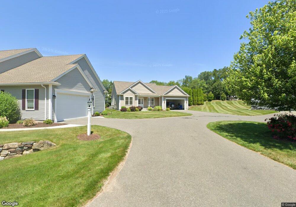
14 Cedar Ridge Dr Wilbraham, MA 01095
Estimated Value: $530,000 - $600,000
3
Beds
2
Baths
1,737
Sq Ft
$328/Sq Ft
Est. Value
About This Home
This home is located at 14 Cedar Ridge Dr, Wilbraham, MA 01095 and is currently estimated at $569,895, approximately $328 per square foot. 14 Cedar Ridge Dr is a home located in Hampden County with nearby schools including Minnechaug Regional High School, St. John the Baptist School, and Wilbraham & Monson Academy.
Ownership History
Date
Name
Owned For
Owner Type
Purchase Details
Closed on
Jul 11, 2016
Sold by
Mile Oak Land Holdings
Bought by
Burke Mark F
Current Estimated Value
Home Financials for this Owner
Home Financials are based on the most recent Mortgage that was taken out on this home.
Original Mortgage
$287,920
Outstanding Balance
$181,397
Interest Rate
3.64%
Mortgage Type
New Conventional
Estimated Equity
$388,498
Create a Home Valuation Report for This Property
The Home Valuation Report is an in-depth analysis detailing your home's value as well as a comparison with similar homes in the area
Home Values in the Area
Average Home Value in this Area
Purchase History
| Date | Buyer | Sale Price | Title Company |
|---|---|---|---|
| Burke Mark F | $359,900 | -- |
Source: Public Records
Mortgage History
| Date | Status | Borrower | Loan Amount |
|---|---|---|---|
| Open | Burke Mark F | $287,920 |
Source: Public Records
Tax History Compared to Growth
Tax History
| Year | Tax Paid | Tax Assessment Tax Assessment Total Assessment is a certain percentage of the fair market value that is determined by local assessors to be the total taxable value of land and additions on the property. | Land | Improvement |
|---|---|---|---|---|
| 2025 | $9,215 | $515,400 | $0 | $515,400 |
| 2024 | $8,301 | $448,700 | $0 | $448,700 |
| 2023 | $8,233 | $399,900 | $0 | $399,900 |
| 2022 | $8,233 | $401,800 | $0 | $401,800 |
| 2021 | $8,142 | $354,600 | $0 | $354,600 |
| 2020 | $7,936 | $354,600 | $0 | $354,600 |
| 2019 | $7,730 | $354,600 | $0 | $354,600 |
| 2018 | $7,770 | $343,200 | $0 | $343,200 |
| 2017 | $7,528 | $342,200 | $0 | $342,200 |
| 2016 | $5,759 | $266,600 | $0 | $266,600 |
| 2015 | $6,928 | $331,800 | $0 | $331,800 |
Source: Public Records
Map
Nearby Homes
- 15 Sandalwood Dr Unit site 00
- 26 Sandalwood Dr
- 111 Sandalwood Dr Unit site 00
- 57 Sandalwood Dr Unit site 61
- 11 Hickory Hill Dr
- 344 Stony Hill Rd
- 103 Sandalwood Dr Unit site 00
- 99 Sandalwood Dr Unit site 00
- 10 Forest Glade Dr
- 6V Melikian Dr
- 92 Sandalwood Dr
- 8 Glenn Dr
- 4 Lance Ln
- 11 Wellfleet Dr
- 34 Blacksmith Rd
- 32 Lodge Ln Unit 32
- 24 Lodge Ln Unit 24
- 116 Cherry Dr Unit 116
- 19 Linwood Dr
- 2205 Boston Rd Unit I 82
- 14 Cedar Ridge Dr Unit 14
- 15 Oaks Farm Ln
- 15 Oaks Farm Ln Unit 15
- 15 Oaks Farm Ln Unit 15300
- 17 Oaks Farm Ln
- 11 Cedar Ridge Dr
- 22 Oaks Farm Rd
- 7 Oaks Farm Ln
- 7 Oaks Farm Ln Unit 7
- 19 Oaks Farm Ln
- 19 Oaks Farm Ln Unit 19
- 15 Cedar Ridge Dr Unit 15
- 12 Oaks Farm Ln
- 12 Oaks Farm Ln Unit 12
- 8 Oaks Farm Ln
- 8 Oaks Farm Ln
- 8 Oaks Farm Ln
- 8 Oaks Farm Ln Unit 8
- 4 Woodsley Rd
- 28 Oaks Farm Ln