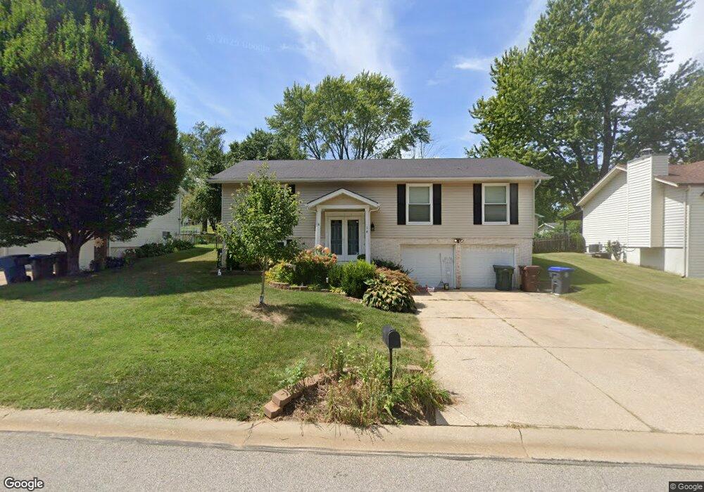
14 Christine Dr Saint Peters, MO 63376
Estimated Value: $291,446 - $308,000
3
Beds
2
Baths
1,196
Sq Ft
$251/Sq Ft
Est. Value
About This Home
This home is located at 14 Christine Dr, Saint Peters, MO 63376 and is currently estimated at $299,612, approximately $250 per square foot. 14 Christine Dr is a home located in St. Charles County with nearby schools including Lewis & Clark Elementary School, Dr. Bernard J. Dubray Middle School, and Fort Zumwalt East High School.
Ownership History
Date
Name
Owned For
Owner Type
Purchase Details
Closed on
Jun 27, 2008
Sold by
Bauman Thomas M and Thomas M Bauman Revocable Trus
Bought by
Wulff Sarah A
Current Estimated Value
Home Financials for this Owner
Home Financials are based on the most recent Mortgage that was taken out on this home.
Original Mortgage
$135,000
Outstanding Balance
$87,004
Interest Rate
6.05%
Mortgage Type
Purchase Money Mortgage
Estimated Equity
$212,608
Purchase Details
Closed on
Jul 29, 2005
Sold by
Bauman Thomas M and Bauman Karen S
Bought by
Bauman Thomas M and The Thomas M Bauman Revocable
Create a Home Valuation Report for This Property
The Home Valuation Report is an in-depth analysis detailing your home's value as well as a comparison with similar homes in the area
Home Values in the Area
Average Home Value in this Area
Purchase History
| Date | Buyer | Sale Price | Title Company |
|---|---|---|---|
| Wulff Sarah A | $150,000 | Inv | |
| Bauman Thomas M | -- | -- |
Source: Public Records
Mortgage History
| Date | Status | Borrower | Loan Amount |
|---|---|---|---|
| Open | Wulff Sarah A | $135,000 |
Source: Public Records
Tax History Compared to Growth
Tax History
| Year | Tax Paid | Tax Assessment Tax Assessment Total Assessment is a certain percentage of the fair market value that is determined by local assessors to be the total taxable value of land and additions on the property. | Land | Improvement |
|---|---|---|---|---|
| 2025 | $3,079 | $47,606 | -- | -- |
| 2023 | $3,077 | $43,076 | $0 | $0 |
| 2022 | $2,672 | $35,010 | $0 | $0 |
| 2021 | $2,668 | $35,010 | $0 | $0 |
| 2020 | $2,549 | $32,404 | $0 | $0 |
| 2019 | $2,543 | $32,404 | $0 | $0 |
| 2018 | $2,130 | $26,008 | $0 | $0 |
| 2017 | $2,120 | $26,008 | $0 | $0 |
| 2016 | $1,931 | $23,610 | $0 | $0 |
| 2015 | $1,809 | $23,610 | $0 | $0 |
| 2014 | $1,904 | $24,402 | $0 | $0 |
Source: Public Records
Map
Nearby Homes
- 537 Ryehill Dr
- 533 Ryehill Dr
- 26 Jane Dr
- 1196 Colby Ct
- 22 Shadow Creek Dr
- 5 Victoria Square
- 31 Carriage Way W
- 114 Long And Winding Rd
- 404 Kaliedoscope Ln
- 17 Forrel Tree Ct
- 212 Agamemnon Ct
- Winslow Plan at Ryehill Manor
- Carver Plan at Ryehill Manor
- Stratton Plan at Ryehill Manor
- Lansford Plan at Ryehill Manor
- Brookmont Plan at Ryehill Manor
- Parker Plan at Ryehill Manor
- Waverly Plan at Ryehill Manor
- Whitehall Plan at Ryehill Manor
- 38 Amberly Dr