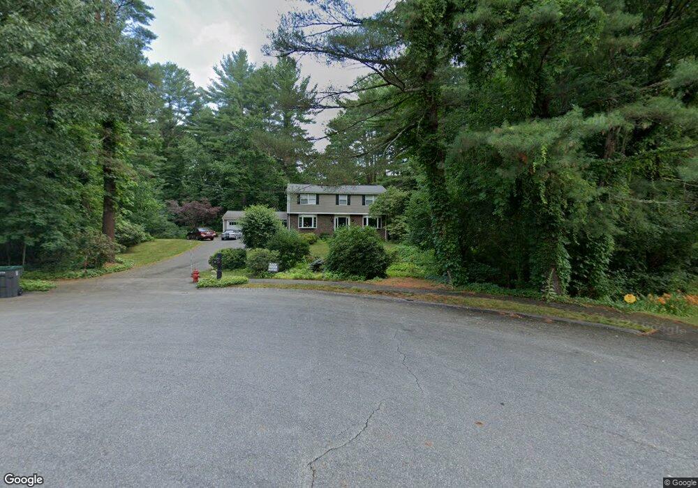
14 Countryside Rd Natick, MA 01760
Estimated Value: $1,263,737 - $1,430,000
4
Beds
3
Baths
2,980
Sq Ft
$455/Sq Ft
Est. Value
About This Home
This home is located at 14 Countryside Rd, Natick, MA 01760 and is currently estimated at $1,357,184, approximately $455 per square foot. 14 Countryside Rd is a home located in Middlesex County with nearby schools including Natick High School, Memorial Elementary School, and J F Kennedy Middle School.
Ownership History
Date
Name
Owned For
Owner Type
Purchase Details
Closed on
Mar 18, 2022
Sold by
Hurwitz Sandra Est
Bought by
Sandra F Hurwitz 1990 Ret
Current Estimated Value
Purchase Details
Closed on
Mar 15, 2022
Sold by
Sandra F Hurwitz 1990 Ret
Bought by
Hurwitz Ann E and Carey Michael T
Purchase Details
Closed on
Dec 27, 2021
Sold by
Joseph Hurwitz 1990 Ret
Bought by
Hurwitz Ann E and Carey Michael T
Purchase Details
Closed on
Mar 3, 2021
Sold by
Hurwitz Joseph
Bought by
Joseph Hurwitz 1990 Ret
Purchase Details
Closed on
Dec 17, 2012
Sold by
Hurwitz Joseph and Hurwitz Sandra F
Bought by
Hurwitz Joseph and Hurwitz Sandra F
Purchase Details
Closed on
Jun 19, 1968
Bought by
Hurwitz Joseph and Hurwitz Sandra F
Create a Home Valuation Report for This Property
The Home Valuation Report is an in-depth analysis detailing your home's value as well as a comparison with similar homes in the area
Home Values in the Area
Average Home Value in this Area
Purchase History
We collect this data history from publicly available records. To have your information removed, we recommend requesting removal directly through your county’s website.
| Date | Buyer | Sale Price | Title Company |
|---|---|---|---|
| Sandra F Hurwitz 1990 Ret | -- | None Available | |
| Hurwitz Ann E | -- | None Available | |
| Hurwitz Ann E | $500,000 | None Available | |
| Joseph Hurwitz 1990 Ret | -- | None Available | |
| Hurwitz Joseph | -- | -- | |
| Hurwitz Joseph | -- | -- |
Source: Public Records
Mortgage History
We collect this data history from publicly available records. To have your information removed, we recommend requesting removal directly through your county’s website.
| Date | Status | Borrower | Loan Amount |
|---|---|---|---|
| Previous Owner | Hurwitz Joseph | $100,000 | |
| Previous Owner | Hurwitz Joseph | $100,000 | |
| Previous Owner | Hurwitz Joseph | $100,000 |
Source: Public Records
Tax History
| Year | Tax Paid | Tax Assessment Tax Assessment Total Assessment is a certain percentage of the fair market value that is determined by local assessors to be the total taxable value of land and additions on the property. | Land | Improvement |
|---|---|---|---|---|
| 2025 | $12,448 | $1,040,800 | $523,600 | $517,200 |
| 2024 | $11,974 | $976,700 | $494,700 | $482,000 |
| 2023 | $11,572 | $915,500 | $458,900 | $456,600 |
| 2022 | $11,139 | $835,000 | $412,800 | $422,200 |
| 2021 | $10,670 | $784,000 | $390,200 | $393,800 |
| 2020 | $10,439 | $767,000 | $373,200 | $393,800 |
| 2019 | $9,749 | $767,000 | $373,200 | $393,800 |
| 2018 | $9,735 | $746,000 | $356,200 | $389,800 |
| 2017 | $9,819 | $727,900 | $345,200 | $382,700 |
| 2016 | $9,827 | $724,200 | $345,200 | $379,000 |
| 2015 | $8,977 | $649,600 | $345,200 | $304,400 |
Source: Public Records
Map
Nearby Homes
Your Personal Tour Guide
Ask me questions while you tour the home.