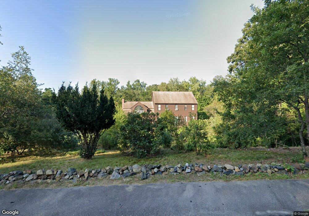
14 Crestview Dr Mendon, MA 01756
Estimated Value: $714,000 - $812,000
4
Beds
3
Baths
2,400
Sq Ft
$317/Sq Ft
Est. Value
About This Home
This home is located at 14 Crestview Dr, Mendon, MA 01756 and is currently estimated at $759,895, approximately $316 per square foot. 14 Crestview Dr is a home located in Worcester County with nearby schools including Nipmuc Regional High School, Bethany Christian Academy, and Mendon Mennonite School.
Ownership History
Date
Name
Owned For
Owner Type
Purchase Details
Closed on
Apr 29, 2020
Sold by
Scott Lawrence S and Scott Catherine O
Bought by
Scott Lawrence S and Scott Nerida E
Current Estimated Value
Home Financials for this Owner
Home Financials are based on the most recent Mortgage that was taken out on this home.
Original Mortgage
$383,100
Outstanding Balance
$337,989
Interest Rate
3.3%
Mortgage Type
New Conventional
Estimated Equity
$421,906
Purchase Details
Closed on
Apr 1, 1993
Sold by
Wgb Constr Co
Bought by
Scott Lawrence S and Scott Catherine
Create a Home Valuation Report for This Property
The Home Valuation Report is an in-depth analysis detailing your home's value as well as a comparison with similar homes in the area
Home Values in the Area
Average Home Value in this Area
Purchase History
| Date | Buyer | Sale Price | Title Company |
|---|---|---|---|
| Scott Lawrence S | -- | None Available | |
| Scott Lawrence S | $224,900 | -- |
Source: Public Records
Mortgage History
| Date | Status | Borrower | Loan Amount |
|---|---|---|---|
| Open | Scott Lawrence S | $383,100 | |
| Previous Owner | Scott Lawrence S | $373,673 | |
| Previous Owner | Scott Lawrence S | $21,734 |
Source: Public Records
Tax History
| Year | Tax Paid | Tax Assessment Tax Assessment Total Assessment is a certain percentage of the fair market value that is determined by local assessors to be the total taxable value of land and additions on the property. | Land | Improvement |
|---|---|---|---|---|
| 2025 | $8,631 | $644,600 | $197,200 | $447,400 |
| 2024 | $8,780 | $640,400 | $189,600 | $450,800 |
| 2023 | $8,480 | $580,800 | $169,200 | $411,600 |
| 2022 | $8,287 | $537,800 | $169,000 | $368,800 |
| 2021 | $8,029 | $478,200 | $164,000 | $314,200 |
| 2020 | $7,576 | $452,300 | $157,300 | $295,000 |
| 2019 | $7,284 | $435,100 | $146,300 | $288,800 |
| 2018 | $7,164 | $422,400 | $146,300 | $276,100 |
| 2017 | $7,153 | $403,000 | $146,300 | $256,700 |
| 2016 | $6,974 | $404,300 | $148,200 | $256,100 |
| 2015 | $6,340 | $396,000 | $148,200 | $247,800 |
| 2014 | $6,197 | $386,800 | $150,200 | $236,600 |
Source: Public Records
Map
Nearby Homes
Your Personal Tour Guide
Ask me questions while you tour the home.