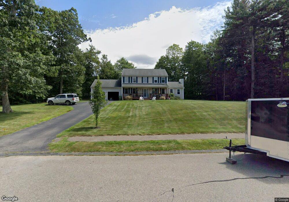
14 Debbie Dr Spencer, MA 01562
Estimated Value: $502,000 - $603,000
3
Beds
3
Baths
2,124
Sq Ft
$265/Sq Ft
Est. Value
About This Home
This home is located at 14 Debbie Dr, Spencer, MA 01562 and is currently estimated at $561,935, approximately $264 per square foot. 14 Debbie Dr is a home located in Worcester County with nearby schools including David Prouty High School.
Ownership History
Date
Name
Owned For
Owner Type
Purchase Details
Closed on
Oct 29, 2003
Sold by
Laureldale Woods Llc
Bought by
Soter Robert T and Soter Sandra
Current Estimated Value
Home Financials for this Owner
Home Financials are based on the most recent Mortgage that was taken out on this home.
Original Mortgage
$200,000
Outstanding Balance
$93,043
Interest Rate
6.05%
Mortgage Type
Purchase Money Mortgage
Estimated Equity
$468,892
Create a Home Valuation Report for This Property
The Home Valuation Report is an in-depth analysis detailing your home's value as well as a comparison with similar homes in the area
Home Values in the Area
Average Home Value in this Area
Purchase History
| Date | Buyer | Sale Price | Title Company |
|---|---|---|---|
| Soter Robert T | $300,390 | -- |
Source: Public Records
Mortgage History
| Date | Status | Borrower | Loan Amount |
|---|---|---|---|
| Open | Soter Robert T | $200,000 |
Source: Public Records
Tax History Compared to Growth
Tax History
| Year | Tax Paid | Tax Assessment Tax Assessment Total Assessment is a certain percentage of the fair market value that is determined by local assessors to be the total taxable value of land and additions on the property. | Land | Improvement |
|---|---|---|---|---|
| 2025 | $59 | $498,900 | $54,500 | $444,400 |
| 2024 | $5,703 | $498,500 | $54,500 | $444,000 |
| 2023 | $5,344 | $443,100 | $54,500 | $388,600 |
| 2022 | $5,118 | $388,900 | $49,500 | $339,400 |
| 2021 | $4,932 | $351,300 | $49,500 | $301,800 |
| 2020 | $4,411 | $312,400 | $49,500 | $262,900 |
| 2019 | $4,231 | $305,300 | $45,000 | $260,300 |
| 2018 | $3,964 | $295,400 | $52,200 | $243,200 |
| 2017 | $3,963 | $283,500 | $49,500 | $234,000 |
| 2016 | $3,914 | $273,900 | $49,500 | $224,400 |
| 2015 | $3,754 | $274,600 | $54,900 | $219,700 |
| 2014 | $3,611 | $274,600 | $54,900 | $219,700 |
Source: Public Records
Map
Nearby Homes