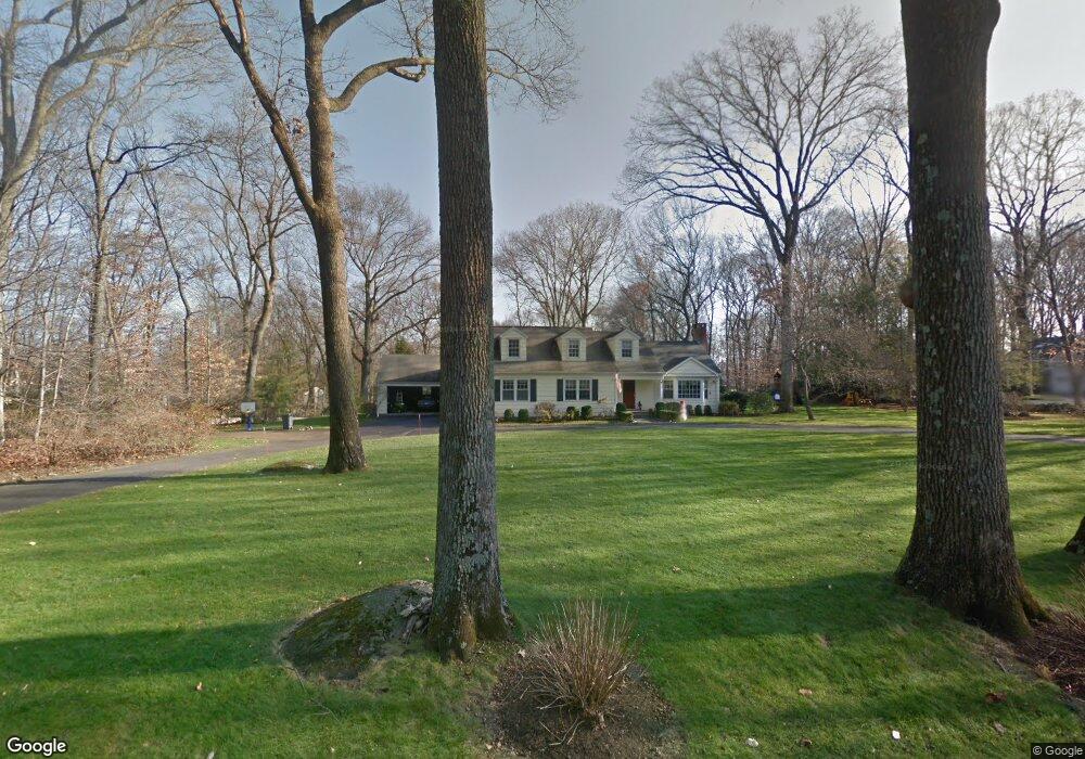
14 Dellwood Rd Norwalk, CT 06850
West Norwalk NeighborhoodEstimated Value: $1,034,000 - $1,402,393
4
Beds
3
Baths
3,200
Sq Ft
$393/Sq Ft
Est. Value
About This Home
This home is located at 14 Dellwood Rd, Norwalk, CT 06850 and is currently estimated at $1,258,348, approximately $393 per square foot. 14 Dellwood Rd is a home located in Fairfield County with nearby schools including Fox Run Elementary School, Ponus Ridge Middle School, and Brien Mcmahon High School.
Ownership History
Date
Name
Owned For
Owner Type
Purchase Details
Closed on
Oct 9, 2009
Sold by
Baker Andrew D and Baker Kelly J
Bought by
Ruckman Scott M and Mcgrath Maureen E
Current Estimated Value
Home Financials for this Owner
Home Financials are based on the most recent Mortgage that was taken out on this home.
Original Mortgage
$706,000
Interest Rate
5.14%
Purchase Details
Closed on
Apr 8, 1998
Sold by
Nilsson Euphemia J Est
Bought by
Baker Andrew D and Baker Kelly J
Create a Home Valuation Report for This Property
The Home Valuation Report is an in-depth analysis detailing your home's value as well as a comparison with similar homes in the area
Home Values in the Area
Average Home Value in this Area
Purchase History
| Date | Buyer | Sale Price | Title Company |
|---|---|---|---|
| Ruckman Scott M | $882,500 | -- | |
| Ruckman Scott M | $882,500 | -- | |
| Baker Andrew D | $325,000 | -- | |
| Baker Andrew D | $325,000 | -- |
Source: Public Records
Mortgage History
| Date | Status | Borrower | Loan Amount |
|---|---|---|---|
| Open | Baker Andrew D | $641,600 | |
| Closed | Baker Andrew D | $641,600 | |
| Closed | Baker Andrew D | $706,000 |
Source: Public Records
Tax History Compared to Growth
Tax History
| Year | Tax Paid | Tax Assessment Tax Assessment Total Assessment is a certain percentage of the fair market value that is determined by local assessors to be the total taxable value of land and additions on the property. | Land | Improvement |
|---|---|---|---|---|
| 2025 | $16,482 | $694,260 | $239,400 | $454,860 |
| 2024 | $16,228 | $694,260 | $239,400 | $454,860 |
| 2023 | $13,421 | $537,580 | $182,880 | $354,700 |
| 2022 | $13,210 | $537,580 | $182,880 | $354,700 |
| 2021 | $11,241 | $537,580 | $182,880 | $354,700 |
| 2020 | $12,690 | $537,580 | $182,880 | $354,700 |
| 2019 | $12,256 | $537,580 | $182,880 | $354,700 |
| 2018 | $12,312 | $474,800 | $208,480 | $266,320 |
| 2017 | $11,881 | $474,800 | $208,480 | $266,320 |
| 2016 | $12,079 | $474,800 | $208,480 | $266,320 |
| 2015 | $10,849 | $474,800 | $208,480 | $266,320 |
| 2014 | $11,889 | $474,800 | $208,480 | $266,320 |
Source: Public Records
Map
Nearby Homes
- 97 Richards Ave Unit B10
- 97 Richards Ave Unit E12
- 105 Richards Ave Unit 2305
- 7 Morehouse Ln
- 5 Wakeman Rd
- 29 Priscilla Rd
- 175 W Norwalk Rd
- 6 Orlando Rd
- 7 Tommys Ln
- 13 Joemar Rd
- 20 Marianne Rd
- 39 Chatham Dr
- 146 Gillies Ln Unit 146
- 10 Pine Brook Ln
- 201 W Norwalk Rd
- 17 Pine Brook Ln Unit 17
- 10 Prospect Ave
- 19 Woodchuck Ct
- 5 Betmarlea Rd
- 9 Hollow Spring Rd
- 12 Dellwood Rd
- 33 Powder Horn Rd
- 32 Powder Horn Rd
- 29 Powder Horn Rd
- 15 Dellwood Rd
- 67 W Norwalk Rd
- 75 W Norwalk Rd
- 30 Powder Horn Rd
- 65 W Norwalk Rd
- 11 Dellwood Rd
- 77 W Norwalk Rd
- 27 Powder Horn Rd
- 89 W Norwalk Rd
- 91 W Norwalk Rd
- 25 Powder Horn Rd
- 49 W Norwalk Rd
- 10 Dellwood Rd
- 97 W Norwalk Rd Unit 9
- 97 W Norwalk Rd Unit 8
- 97 W Norwalk Rd Unit 7