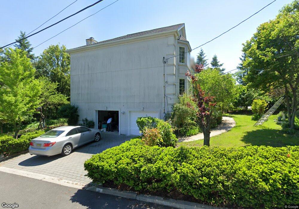
14 Demarest Ave Englewood Cliffs, NJ 07632
Estimated Value: $1,799,032 - $2,080,000
--
Bed
--
Bath
3,390
Sq Ft
$570/Sq Ft
Est. Value
About This Home
This home is located at 14 Demarest Ave, Englewood Cliffs, NJ 07632 and is currently estimated at $1,933,508, approximately $570 per square foot. 14 Demarest Ave is a home located in Bergen County with nearby schools including North Cliff Elementary School, Upper School Elementary School, and Englewood on the Palisades Charter School.
Ownership History
Date
Name
Owned For
Owner Type
Purchase Details
Closed on
Oct 1, 2021
Sold by
Oh Sun Woong
Bought by
Oh Sun Woong
Current Estimated Value
Purchase Details
Closed on
Feb 27, 2001
Sold by
Ferolie Realty Assoc Llc
Bought by
Oh Sun W and Oh Janet J
Home Financials for this Owner
Home Financials are based on the most recent Mortgage that was taken out on this home.
Original Mortgage
$500,000
Outstanding Balance
$181,928
Interest Rate
7.01%
Estimated Equity
$1,751,580
Create a Home Valuation Report for This Property
The Home Valuation Report is an in-depth analysis detailing your home's value as well as a comparison with similar homes in the area
Home Values in the Area
Average Home Value in this Area
Purchase History
| Date | Buyer | Sale Price | Title Company |
|---|---|---|---|
| Oh Sun Woong | -- | None Available | |
| Oh Sun W | $696,000 | -- | |
| -- | $697,000 | -- |
Source: Public Records
Mortgage History
| Date | Status | Borrower | Loan Amount |
|---|---|---|---|
| Open | -- | $500,000 |
Source: Public Records
Tax History Compared to Growth
Tax History
| Year | Tax Paid | Tax Assessment Tax Assessment Total Assessment is a certain percentage of the fair market value that is determined by local assessors to be the total taxable value of land and additions on the property. | Land | Improvement |
|---|---|---|---|---|
| 2025 | $15,015 | $1,300,000 | $641,300 | $658,700 |
| 2024 | $14,833 | $1,300,000 | $641,300 | $658,700 |
| 2023 | $14,599 | $1,300,000 | $641,300 | $658,700 |
| 2022 | $14,599 | $1,300,000 | $641,300 | $658,700 |
| 2021 | $14,612 | $1,300,000 | $641,300 | $658,700 |
| 2020 | $14,963 | $1,300,000 | $641,300 | $658,700 |
| 2019 | $14,053 | $1,300,000 | $641,300 | $658,700 |
| 2018 | $13,559 | $1,300,000 | $641,300 | $658,700 |
| 2017 | $12,974 | $1,300,000 | $641,300 | $658,700 |
| 2016 | $12,727 | $1,300,000 | $641,300 | $658,700 |
| 2015 | $12,090 | $1,300,000 | $641,300 | $658,700 |
| 2014 | $11,310 | $1,300,000 | $641,300 | $658,700 |
Source: Public Records
Map
Nearby Homes
- 45 Marjorie Terrace
- 577 Floyd St
- 148 Demarest Ave
- 519 E Palisade Ave
- 30 Reiner Place
- 645 Summit St
- 2 Maple St
- 12 Kira Ln
- 379 Mauro Rd
- 48 Cambridge Place
- 244 Fairview Ave
- 48 S Woodland St
- 231 N Woodland St
- 316 Bolz St
- 312 Bolz St
- 320 Mountain Rd
- 14 Allison Dr
- 2 Connor Dr
- 26 Sara Hill Ln
- 277 Walnut St
- 33 Clifton Terrace
- 550 Sylvan Ave Unit LL2
- 550 Sylvan Ave Unit 200
- 550 Sylvan Ave Unit 205
- 550 Sylvan Ave Unit 203
- 550 Sylvan Ave Unit 207
- 550 Sylvan Ave Unit 112
- 550 Sylvan Ave Unit 208
- 550 Sylvan Ave Unit 111
- 550 Sylvan Ave Unit 206
- 550 Sylvan Ave Unit 100
- 550 Sylvan Ave Unit 103
- 550 Sylvan Ave
- 31 Clifton Terrace
- 20 Demarest Ave
- 48 Clifton Terrace
- 23 Demarest Ave
- 29 Clifton Terrace
- 46 Clifton Terrace
- 557 Floyd St