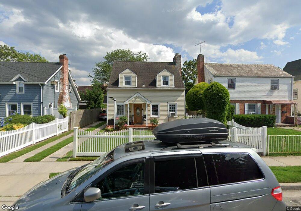
14 Devon Rd Hempstead, NY 11550
Estimated Value: $504,000 - $627,405
Studio
2
Baths
1,292
Sq Ft
$438/Sq Ft
Est. Value
About This Home
This home is located at 14 Devon Rd, Hempstead, NY 11550 and is currently estimated at $565,703, approximately $437 per square foot. 14 Devon Rd is a home located in Nassau County with nearby schools including St Martin De Porres Marianist School and Hebrew Academy of Nassau County Middle School and Brookdale High School.
Ownership History
Date
Name
Owned For
Owner Type
Purchase Details
Closed on
Apr 21, 2010
Sold by
Morales Walter E
Bought by
Lazo Rosa E and Lazo Beatriz David
Current Estimated Value
Home Financials for this Owner
Home Financials are based on the most recent Mortgage that was taken out on this home.
Original Mortgage
$220,900
Outstanding Balance
$150,724
Interest Rate
5.5%
Mortgage Type
FHA
Estimated Equity
$414,979
Purchase Details
Closed on
Nov 2, 2006
Sold by
Maldonado Santos
Purchase Details
Closed on
Jun 13, 2000
Sold by
Birmingham Herbert
Bought by
Hernandez Nery
Purchase Details
Closed on
May 1, 1995
Sold by
Johnson Janet Est
Bought by
Birmingham Herbert
Create a Home Valuation Report for This Property
The Home Valuation Report is an in-depth analysis detailing your home's value as well as a comparison with similar homes in the area
Home Values in the Area
Average Home Value in this Area
Purchase History
| Date | Buyer | Sale Price | Title Company |
|---|---|---|---|
| Lazo Rosa E | $225,000 | -- | |
| -- | -- | -- | |
| Hernandez Nery | $164,300 | William D Friedman | |
| Birmingham Herbert | $100,000 | -- |
Source: Public Records
Mortgage History
| Date | Status | Borrower | Loan Amount |
|---|---|---|---|
| Open | Lazo Rosa E | $220,900 |
Source: Public Records
Tax History
| Year | Tax Paid | Tax Assessment Tax Assessment Total Assessment is a certain percentage of the fair market value that is determined by local assessors to be the total taxable value of land and additions on the property. | Land | Improvement |
|---|---|---|---|---|
| 2025 | $7,394 | $336 | $103 | $233 |
| 2024 | $894 | $336 | $103 | $233 |
Source: Public Records
Map
Nearby Homes
- 27 Elizabeth Ct
- 63 Devon Rd
- 676 Front St Unit F
- 16 Hendrickson Ave
- 59 Kernochan Ave
- 678 Front St Unit E
- 104 Phoenix St
- 51 Phoenix St
- 22 Fairview Blvd
- 41 Perry St
- 43 Macdonald St
- 49 Fairview Blvd
- 119 Broadfield Rd
- 64 Fairview Blvd
- 25 Crowell St
- 17 Hope St
- 811 Front St
- 95 Rhodes Ave
- 122 Hamilton Rd
- 126 Fairview Blvd
Your Personal Tour Guide
Ask me questions while you tour the home.