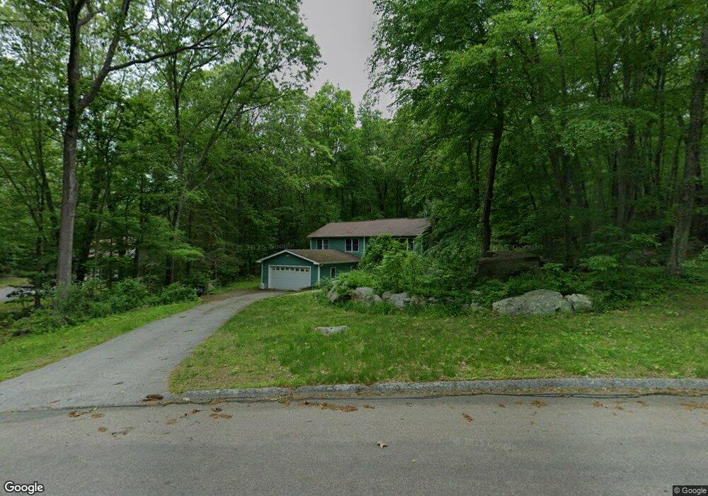
14 Devonshire Dr Gales Ferry, CT 06335
Estimated Value: $358,000 - $460,622
3
Beds
3
Baths
1,110
Sq Ft
$362/Sq Ft
Est. Value
About This Home
This home is located at 14 Devonshire Dr, Gales Ferry, CT 06335 and is currently estimated at $401,656, approximately $361 per square foot. 14 Devonshire Dr is a home located in New London County with nearby schools including Ledyard Middle School, Ledyard High School, and Academy Of St Therese.
Ownership History
Date
Name
Owned For
Owner Type
Purchase Details
Closed on
Mar 2, 2010
Sold by
Wilson Sheri Ann
Bought by
Sheri Ann Wilson Ret
Current Estimated Value
Purchase Details
Closed on
Oct 27, 1986
Bought by
Bailey Kenneth P and Bailey Louise G
Create a Home Valuation Report for This Property
The Home Valuation Report is an in-depth analysis detailing your home's value as well as a comparison with similar homes in the area
Home Values in the Area
Average Home Value in this Area
Purchase History
| Date | Buyer | Sale Price | Title Company |
|---|---|---|---|
| Sheri Ann Wilson Ret | -- | -- | |
| Bailey Kenneth P | -- | -- |
Source: Public Records
Mortgage History
| Date | Status | Borrower | Loan Amount |
|---|---|---|---|
| Open | Bailey Kenneth P | $100,000 | |
| Open | Bailey Kenneth P | $168,000 | |
| Previous Owner | Bailey Kenneth P | $8,000 | |
| Previous Owner | Bailey Kenneth P | $85,000 |
Source: Public Records
Tax History Compared to Growth
Tax History
| Year | Tax Paid | Tax Assessment Tax Assessment Total Assessment is a certain percentage of the fair market value that is determined by local assessors to be the total taxable value of land and additions on the property. | Land | Improvement |
|---|---|---|---|---|
| 2025 | $6,840 | $184,170 | $52,920 | $131,250 |
| 2024 | $6,462 | $183,540 | $52,920 | $130,620 |
| 2023 | $6,343 | $183,540 | $52,920 | $130,620 |
| 2022 | $6,207 | $183,540 | $52,920 | $130,620 |
| 2021 | $6,167 | $183,540 | $52,920 | $130,620 |
| 2020 | $5,995 | $171,430 | $55,440 | $115,990 |
| 2019 | $6,010 | $171,430 | $55,440 | $115,990 |
| 2018 | $5,878 | $171,430 | $55,440 | $115,990 |
| 2017 | $5,578 | $171,430 | $55,440 | $115,990 |
| 2016 | $5,469 | $171,430 | $55,440 | $115,990 |
| 2015 | $5,211 | $171,430 | $55,440 | $115,990 |
| 2014 | $5,226 | $174,790 | $55,440 | $119,350 |
Source: Public Records
Map
Nearby Homes
- 0 Clarks Falls Unit 24089817
- 21 Oakridge Dr
- 1637 Connecticut 12
- 48 N Glenwoods Rd
- 50 N Glenwoods Rd
- 52 N Glenwoods Rd
- 1918 Route 12
- 16 Marty's Way
- 48 Bittersweet Dr
- 18 Marty's Way
- 25 Marty's Way
- 16 Marlene Dr
- 82 Christy Hill Rd
- 6 Sunset Rd
- 7 Partridge Hollow Rd
- 131 Derry Hill Rd
- 3 Holdsworth Rd
- 165 Massapeag Rd
- 14 Bluff Rd
- 7 Harvard Rd
- 13 Devonshire Dr
- 4 Ravenwood Row
- 12 Devonshire Dr
- 19 Devonshire Dr
- 22 Devonshire Dr
- 7 Devonshire Dr
- 23 Devonshire Dr
- 10 Devonshire Dr
- 6 Ravenwood Row
- 27 Devonshire Dr
- 8 Devonshire Dr
- 24 Devonshire Dr
- 6 Devonshire Dr
- 5 Devonshire Dr
- 168 Whalehead Rd
- 7 Ravenwood Row
- 4 Devonshire Dr
- 29 Devonshire Dr
- 26 Devonshire Dr
- 28 Devonshire Dr