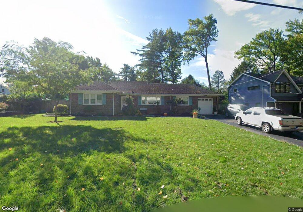
14 Dewey Dr New Brunswick, NJ 08901
Estimated Value: $621,000 - $690,000
4
Beds
3
Baths
1,989
Sq Ft
$330/Sq Ft
Est. Value
About This Home
This home is located at 14 Dewey Dr, New Brunswick, NJ 08901 and is currently estimated at $656,769, approximately $330 per square foot. 14 Dewey Dr is a home located in Middlesex County with nearby schools including New Brunswick High School and St. Mary of Mount Virgin School.
Ownership History
Date
Name
Owned For
Owner Type
Purchase Details
Closed on
Nov 14, 2018
Sold by
Dekka Croce Matthew M and Cronk Lauren J
Bought by
Franks Susan and Franks Colin
Current Estimated Value
Home Financials for this Owner
Home Financials are based on the most recent Mortgage that was taken out on this home.
Original Mortgage
$319,600
Outstanding Balance
$281,024
Interest Rate
4.8%
Mortgage Type
New Conventional
Estimated Equity
$375,745
Purchase Details
Closed on
Apr 27, 2015
Sold by
Comollo Catherine
Bought by
Della-Croce Matthew
Create a Home Valuation Report for This Property
The Home Valuation Report is an in-depth analysis detailing your home's value as well as a comparison with similar homes in the area
Home Values in the Area
Average Home Value in this Area
Purchase History
| Date | Buyer | Sale Price | Title Company |
|---|---|---|---|
| Franks Susan | $381,000 | Chicago Title Insurance Co | |
| Della-Croce Matthew | $252,000 | -- |
Source: Public Records
Mortgage History
| Date | Status | Borrower | Loan Amount |
|---|---|---|---|
| Open | Franks Susan | $319,600 |
Source: Public Records
Tax History Compared to Growth
Tax History
| Year | Tax Paid | Tax Assessment Tax Assessment Total Assessment is a certain percentage of the fair market value that is determined by local assessors to be the total taxable value of land and additions on the property. | Land | Improvement |
|---|---|---|---|---|
| 2025 | $9,064 | $346,100 | $168,300 | $177,800 |
| 2024 | $9,064 | $346,100 | $168,300 | $177,800 |
| 2023 | $8,801 | $346,100 | $168,300 | $177,800 |
| 2022 | $8,614 | $346,100 | $168,300 | $177,800 |
| 2021 | $6,391 | $346,100 | $168,300 | $177,800 |
| 2020 | $7,141 | $289,100 | $168,300 | $120,800 |
| 2019 | $7,005 | $289,100 | $168,300 | $120,800 |
| 2018 | $6,846 | $289,100 | $168,300 | $120,800 |
| 2017 | $6,574 | $289,100 | $168,300 | $120,800 |
| 2016 | $10,324 | $176,000 | $57,400 | $118,600 |
| 2015 | $10,078 | $176,000 | $57,400 | $118,600 |
| 2014 | $9,898 | $176,000 | $57,400 | $118,600 |
Source: Public Records
Map
Nearby Homes
- 11 Cotter Dr
- 40 Phelps Ave
- 628 Sadie Cir
- 228 Jessie Place
- 220 Jessie Place
- 602 Sadie Cir
- Union Plan at Scarlet Place
- Greenwich Plan at Scarlet Place
- Murray Hill Plan at Scarlet Place
- Bowery Plan at Scarlet Place
- 202 Jessie Place
- 216 Lyla Ln
- 521 Sadie Cir
- 513 Sadie Cir
- 509 Sadie Cir
- 116 Graham St
- 525 S 2nd Ave
- 414 Graham St
- 53 Patton Dr
- 328 Becker St