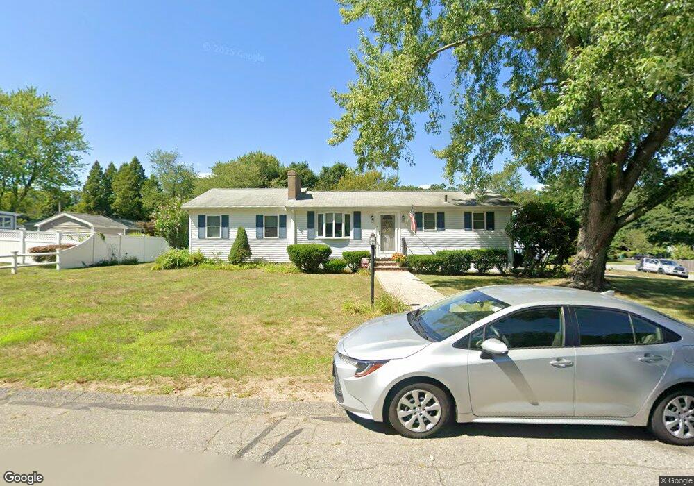
14 Donald Tennant Cir North Attleboro, MA 02760
North Attleboro NeighborhoodEstimated Value: $546,000 - $604,000
3
Beds
2
Baths
1,373
Sq Ft
$418/Sq Ft
Est. Value
About This Home
This home is located at 14 Donald Tennant Cir, North Attleboro, MA 02760 and is currently estimated at $573,541, approximately $417 per square foot. 14 Donald Tennant Cir is a home located in Bristol County with nearby schools including North Attleboro High School, Cadence Academy Preschool - North Attleborough, and Bishop Feehan High School.
Ownership History
Date
Name
Owned For
Owner Type
Purchase Details
Closed on
Apr 27, 2000
Sold by
Reinbold Thomas A and Reinbold Kimberly J
Bought by
Bithoney Noelle C and Bithonye Maryann C
Current Estimated Value
Home Financials for this Owner
Home Financials are based on the most recent Mortgage that was taken out on this home.
Original Mortgage
$161,500
Interest Rate
8.23%
Mortgage Type
Purchase Money Mortgage
Purchase Details
Closed on
Oct 23, 1992
Sold by
Restino Jerry J and Restino Lena E
Bought by
Reinbold Thomas A and Reinbold Kimberly
Create a Home Valuation Report for This Property
The Home Valuation Report is an in-depth analysis detailing your home's value as well as a comparison with similar homes in the area
Home Values in the Area
Average Home Value in this Area
Purchase History
| Date | Buyer | Sale Price | Title Company |
|---|---|---|---|
| Bithoney Noelle C | $170,000 | -- | |
| Reinbold Thomas A | $123,000 | -- |
Source: Public Records
Mortgage History
| Date | Status | Borrower | Loan Amount |
|---|---|---|---|
| Open | Reinbold Thomas A | $223,100 | |
| Closed | Reinbold Thomas A | $164,000 | |
| Closed | Reinbold Thomas A | $161,500 | |
| Previous Owner | Reinbold Thomas A | $101,000 |
Source: Public Records
Tax History Compared to Growth
Tax History
| Year | Tax Paid | Tax Assessment Tax Assessment Total Assessment is a certain percentage of the fair market value that is determined by local assessors to be the total taxable value of land and additions on the property. | Land | Improvement |
|---|---|---|---|---|
| 2025 | $6,157 | $522,200 | $123,300 | $398,900 |
| 2024 | $5,808 | $503,300 | $123,300 | $380,000 |
| 2023 | $5,607 | $438,400 | $123,300 | $315,100 |
| 2022 | $5,058 | $363,100 | $123,300 | $239,800 |
| 2021 | $5,301 | $371,500 | $123,300 | $248,200 |
| 2019 | $4,375 | $307,200 | $112,100 | $195,100 |
| 2018 | $3,827 | $286,900 | $112,100 | $174,800 |
| 2017 | $3,680 | $278,400 | $112,100 | $166,300 |
| 2016 | $3,511 | $265,600 | $124,600 | $141,000 |
| 2015 | $3,415 | $259,900 | $130,800 | $129,100 |
| 2014 | $3,301 | $249,300 | $120,900 | $128,400 |
Source: Public Records
Map
Nearby Homes
- 196 Donald Tennant Cir
- 115 Westfield Dr
- 11 Landry Ave
- 57 Vine St
- 11 Buckthorn Ln
- Lot 2 Jeffrey Dr
- Lot 5 Jeffrey Dr
- 5 Old Wood Rd
- 116 George St
- 255 Mckeon Dr
- 12 Houde St
- 40 Natalie Dr
- 150 Gilbert St
- 835 Mt Hope St Unit 39
- 20 Sperry Ln
- 24 Maverick Dr
- 21 Shady Ln
- 28 Messenger St
- 9 Sunnyside Dr Unit 9
- 711 Mount Hope St Unit 13
- 215 Donald Tennant Cir
- 6 Donald Tennant Cir
- 26 Donald Tennant Cir
- 321 Kelley Blvd
- 19 Donald Tennant Cir
- 209 Donald Tennant Cir
- 5 Donald Tennant Cir
- 206 Donald Tennant Cir
- 206 Donald Tennant Cir
- 323 Kelley Blvd
- 27 Donald Tennant Cir
- 325 Kelley Blvd
- 34 Donald Tennant Cir
- 205 Donald Tennant Cir
- 312 Kelley Blvd
- 33 Donald Tennant Cir
- 20 High Rock Rd
- 306 Kelley Blvd
- 329 Kelley Blvd
- 199 Donald Tennant Cir