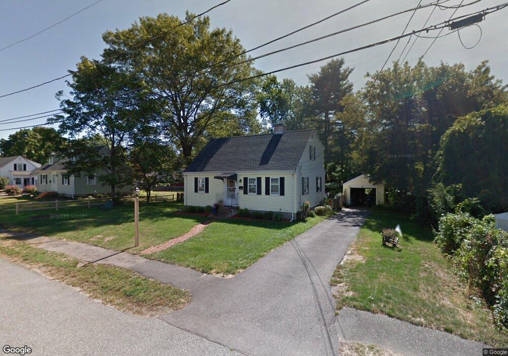
14 Draper St Natick, MA 01760
Estimated Value: $692,000 - $791,000
3
Beds
1
Bath
1,416
Sq Ft
$527/Sq Ft
Est. Value
About This Home
This home is located at 14 Draper St, Natick, MA 01760 and is currently estimated at $746,659, approximately $527 per square foot. 14 Draper St is a home located in Middlesex County with nearby schools including Natick High School, J F Kennedy Middle School, and Johnson Elementary School.
Ownership History
Date
Name
Owned For
Owner Type
Purchase Details
Closed on
Oct 25, 2025
Sold by
Pilla Enrico A and Pilla Justina T
Bought by
Marcus Gift Irt and Borges
Current Estimated Value
Purchase Details
Closed on
Jun 29, 1971
Bought by
Pilla Enrico A and Pilla Justina T
Create a Home Valuation Report for This Property
The Home Valuation Report is an in-depth analysis detailing your home's value as well as a comparison with similar homes in the area
Home Values in the Area
Average Home Value in this Area
Purchase History
| Date | Buyer | Sale Price | Title Company |
|---|---|---|---|
| Marcus Gift Irt | -- | -- | |
| Pilla Enrico A | -- | -- |
Source: Public Records
Mortgage History
| Date | Status | Borrower | Loan Amount |
|---|---|---|---|
| Previous Owner | Pilla Enrico A | $100,000 | |
| Previous Owner | Pilla Enrico A | $60,000 | |
| Previous Owner | Pilla Enrico A | $45,000 | |
| Previous Owner | Pilla Enrico A | $30,000 |
Source: Public Records
Tax History
| Year | Tax Paid | Tax Assessment Tax Assessment Total Assessment is a certain percentage of the fair market value that is determined by local assessors to be the total taxable value of land and additions on the property. | Land | Improvement |
|---|---|---|---|---|
| 2025 | $7,288 | $609,400 | $428,200 | $181,200 |
| 2024 | $7,084 | $577,800 | $403,000 | $174,800 |
| 2023 | $7,086 | $560,600 | $387,600 | $173,000 |
| 2022 | $6,891 | $516,600 | $352,100 | $164,500 |
| 2021 | $6,625 | $486,800 | $332,000 | $154,800 |
| 2020 | $4,827 | $471,700 | $316,900 | $154,800 |
| 2019 | $5,995 | $471,700 | $316,900 | $154,800 |
| 2018 | $4,439 | $423,400 | $301,800 | $121,600 |
| 2017 | $4,585 | $372,700 | $257,300 | $115,400 |
| 2016 | $4,756 | $350,500 | $236,300 | $114,200 |
| 2015 | $4,714 | $341,100 | $236,300 | $104,800 |
Source: Public Records
Map
Nearby Homes
- 79 Speen St
- 28 Sylvester Rd
- 1 Fern St
- 16 West St
- 46 Silver Hill Ln Unit 1
- 5 Lanes End
- 36 Silver Hill Ln Unit 21
- 26 Wellesley Ave Unit B
- 3 Silver Hill Ln Unit 6
- 62 Oakland St
- 1 Post Oak Ln Unit 19
- 89 W Central St
- 25 Forest Ave
- 34 Walden Dr Unit 5
- 8 Walden Dr Unit 13
- 21 Kelsey Rd
- 216-218 S Main St
- 58 W Central St
- 50 Village Brook Ln Unit 4
- 57 Village Brook Ln Unit 5
Your Personal Tour Guide
Ask me questions while you tour the home.